With everything from hidden caves to slot canyons and hot springs in the middle of the desert, Arizona is full of natural wonders. We put together this guide to the best hikes in Arizona, including trail stats, to help you do some epic hiking.
The best hikes in Arizona are all over the map, both literally and figuratively. You’ll find trails in every corner of the state, at every difficulty level, and with just about every imaginable feature.
From national parks and one of the most bucket list-worthy waterfall hikes in the world to desert hot springs, slot canyons, and so much more, you’ll quickly learn that Arizona is far more diverse than many people realize.
Hiking in Arizona often means traveling to extremely isolated areas or securing hard-to-get permits. Keep reading to plan your Arizona trail bucket list!
Arizona Hiking Guide
We’ve included some extra info for planning your hiking trip to Arizona. Jump to the following sections (or just keep scrolling to see it all!).

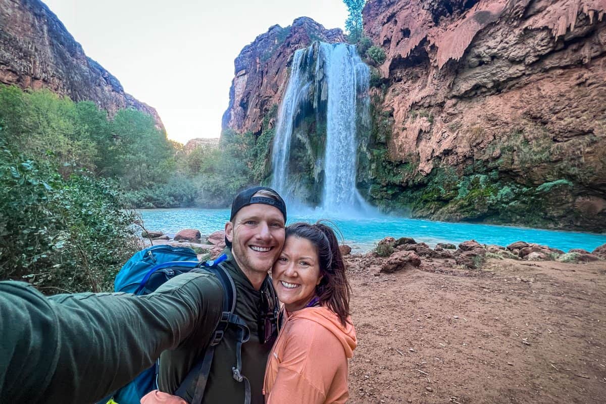
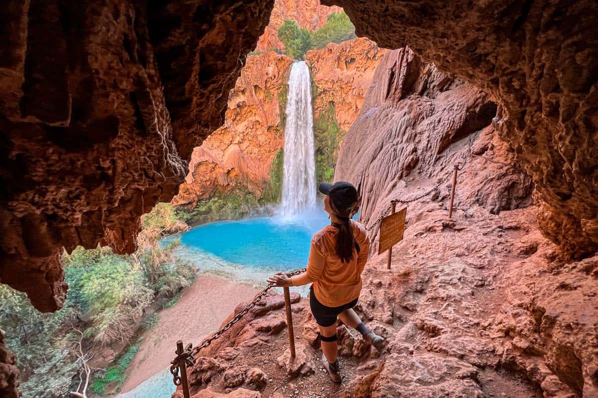
1. Havasu Falls Hike
- Location: Havasupai Indian Reservation
- Distance: ~20-miles*, out-and-back
- Elevation gain: 2,400 ft
- Difficulty rating: moderate
- View the trail guide
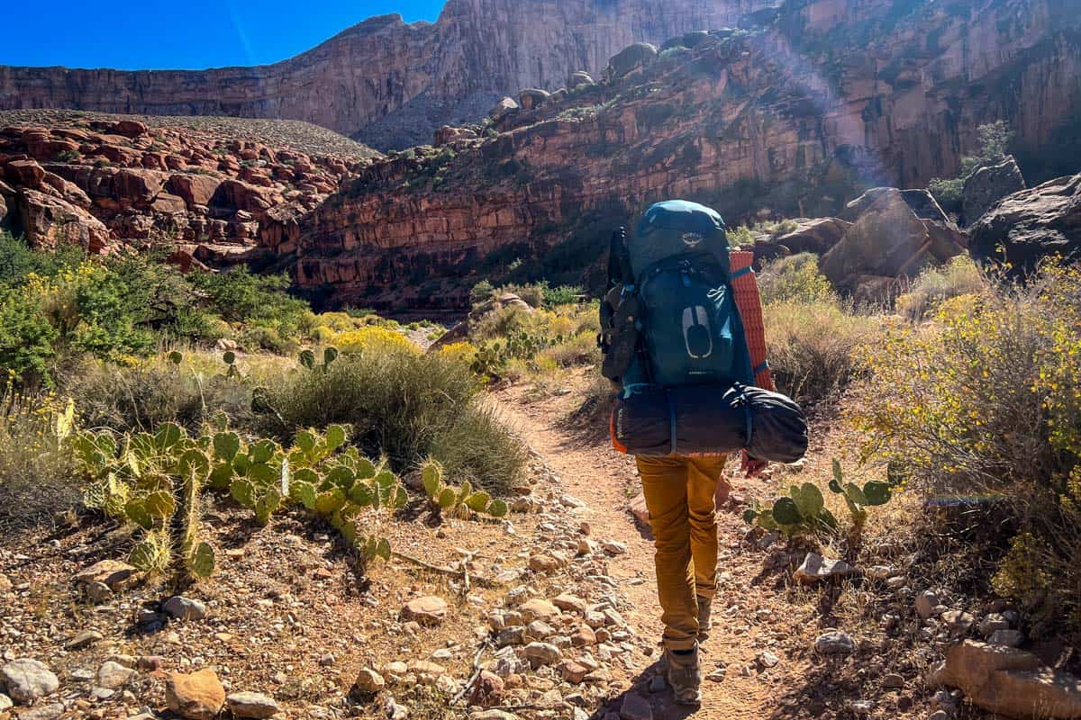
With multiple milky, bright blue waterfalls and an ultra remote location, Havasu Falls is one of the best hikes in Arizona. It’s truly epic, and worth all the hype.
It’s hard to cram even the basics about Havasu Falls into a few paragraphs, but here are the most important things to know.
This isn’t a day hike; it’s (at minimum) an overnight backpacking trip. Many people spend two or three nights on the trail. With the shortest route about 20 miles and moderately challenging, there’s a lot to cover.
You also need extremely hard-to-get permits, because the falls are on the Havasupai Indian Reservation. Permits become available on February 1 for the following year, and the hiking season is open February through November.
*A note on total distance: Though the trail indicates 10 miles of hiking, one way, I can assure you that you’ll be covering much more than 20 miles in total during this backpacking adventure.
Determining the exact total distance can be challenging, and will depend on where you camp, how many waterfalls you visit and if you plan to attempt the additional Confluence Hike within the reservation.
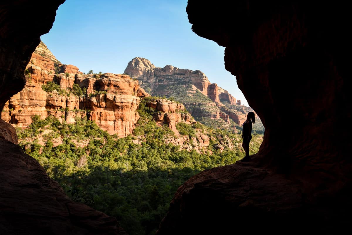
2. Boynton Canyon Trail & Subway Cave
- Location: Sedona
- Distance: 7.2 miles out and back
- Elevation gain: 964 feet
- Difficulty rating: Moderate
- View the trail guide
The Subway Cave, named for its tunnel-like shape, is one of the most popular hikes in Sedona. The fairly easy-going 7-mile trail takes you past a mystical energy vortex and leads to the cave, which is completely hidden from view.
Finding the cave is the most challenging thing about this hike, although as its popularity grows, it’s getting easier.
Keep your eyes open for the huge, distinctive alligator juniper tree two miles in, then take a slight right. The Subway Cave is 0.4 miles farther along this spur trail.
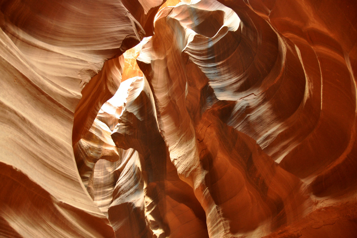
3. Upper Antelope Canyon
- Location: Page
- Distance: 6.5 miles out and back
- Elevation gain: 252 feet
- Difficulty rating: Easy
- View the trail guide
One of the most photographed sites in the world is also one of the best hikes in Arizona.
Upper Antelope Canyon is an easy hike, but it’s on the Navajo Nation, so the only way to see it is on a guided tour. Five outfitters operate year-round, all with similar offerings. Learn more on the Navajo Nation Parks website.
The Navajo Nation observes Daylight Savings Time, even though Arizona does not. Most tours depart from Page and follow Arizona time, but some use Navajo Nation time, which is one hour ahead from March-November.
Clarify the correct time with your tour company, and know whether or not it’s the same at your lodging.
4. The Rim Trail
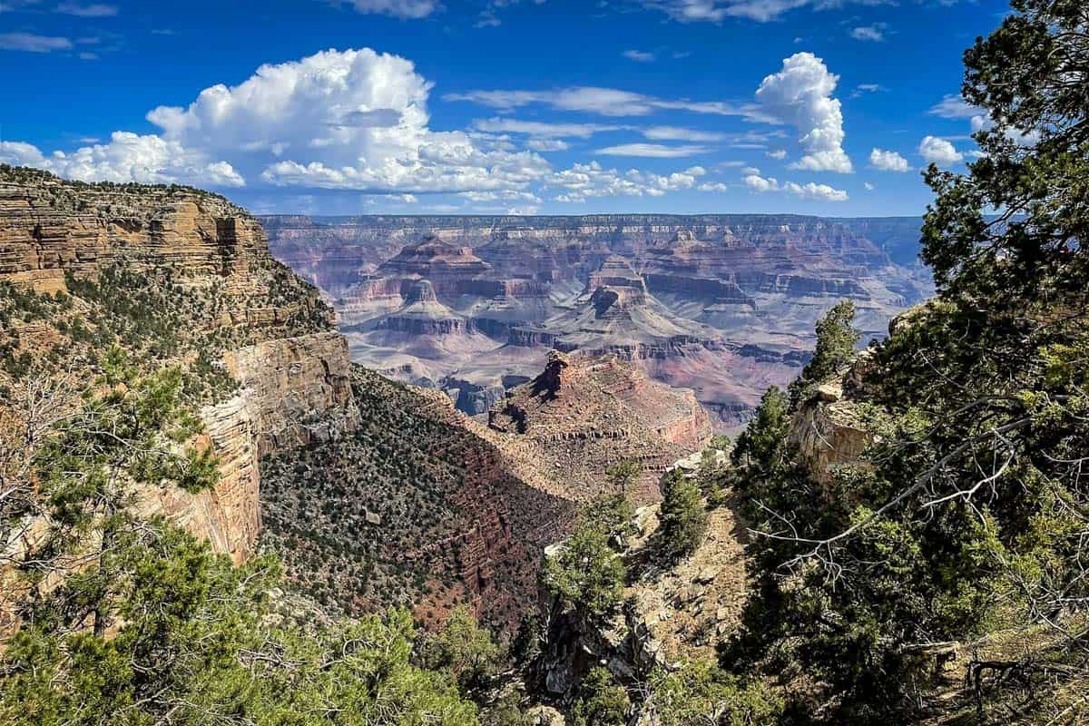
- Location: Grand Canyon National Park
- Distance: 12.7 miles point-to-point
- Elevation gain: 583 feet
- Difficulty rating: Moderate
- View the trail notes
It’s no surprise that one of the best hikes in Arizona follows the rim of the Grand Canyon. This trail offers an up-close overview of the canyon, one of the 7 Natural Wonders, providing a great alternative to the massive, strenuous Rim-to-Rim hike.
Despite being over 12 miles one way, the Rim Trail is fairly easy. It’s mostly wide and paved, and dozens of viewpoints and other interesting stops, like bustling Grand Canyon Village, break it up.
Between March and November, the South Rim Shuttle runs along the entire trail. You can hike the full length and take the shuttle back, or hike just a section.
5. Camelback Mountain
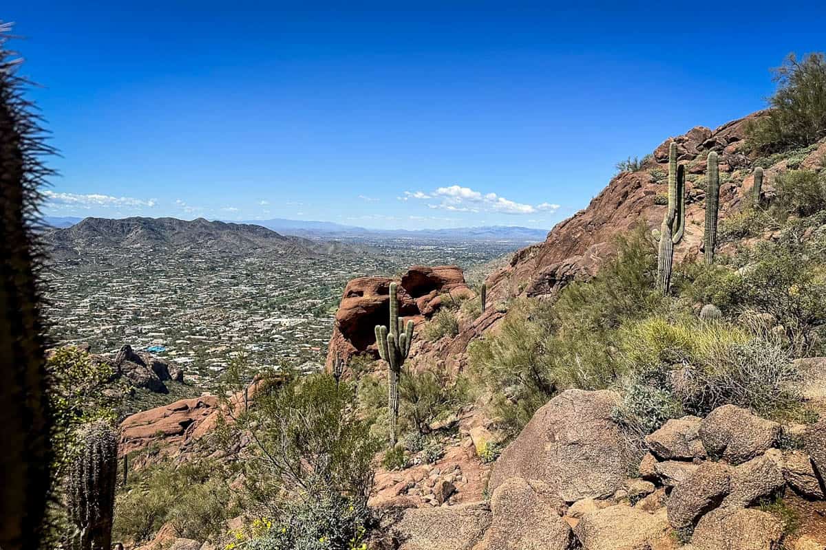
- Location: Scottsdale
- Distance: 2.6 miles out and back
- Elevation gain: 1,522 feet
- Difficulty rating: Challenging
- View the trail notes
Camelback Mountain alone largely contributes to Phoenix’s reputation for having some of the best urban hiking in the US. This short but VERY challenging trail makes it hard to believe you’re in the middle of a major city.
In just over one mile, you’ll gain a staggering 1,500 feet in elevation. During the last stretch, it’s steep enough that you’ll have to do some scrambling. We normally recommend trekking poles for a hike like this, but you’ll want your hands free!
6. Cathedral Rock Trail
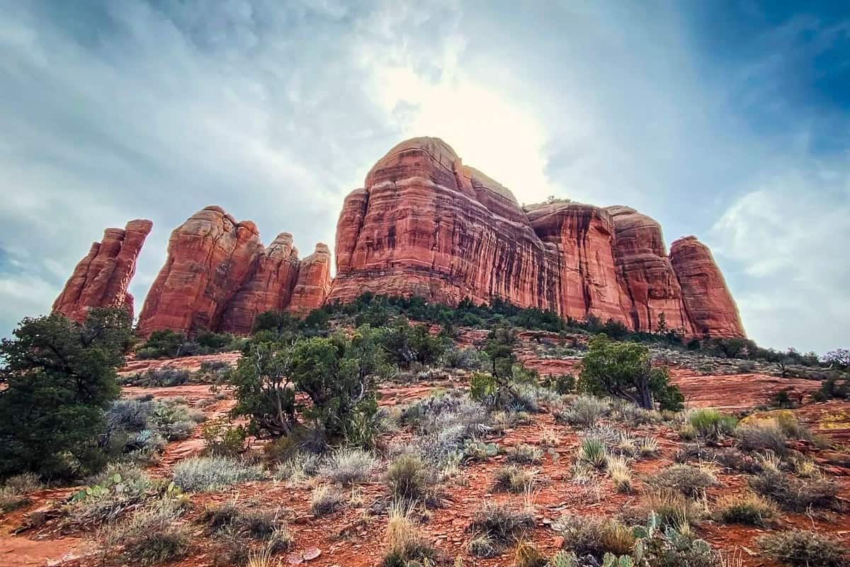
- Location: Sedona
- Distance: 1.2 miles out and back
- Elevation gain: 741 feet
- Difficulty rating: Moderate
- View the trail notes
Cathedral Rock isn’t quite as steep as Camelback Mountain, but don’t underestimate it. You’ll climb over 700 feet in half a mile, and we do mean climb. The near-vertical ascent resembles rock climbing more than hiking at several points.
Other than some rock steps, the first half of the trail is moderate. Once you reach a distinct crevasse, or crack, in the rock, things get significantly more difficult. You’ll often have to scramble on all fours, looking for natural hand- and footholds.
Thankfully, Cathedral Trail is busy enough that you can watch other hikers first.
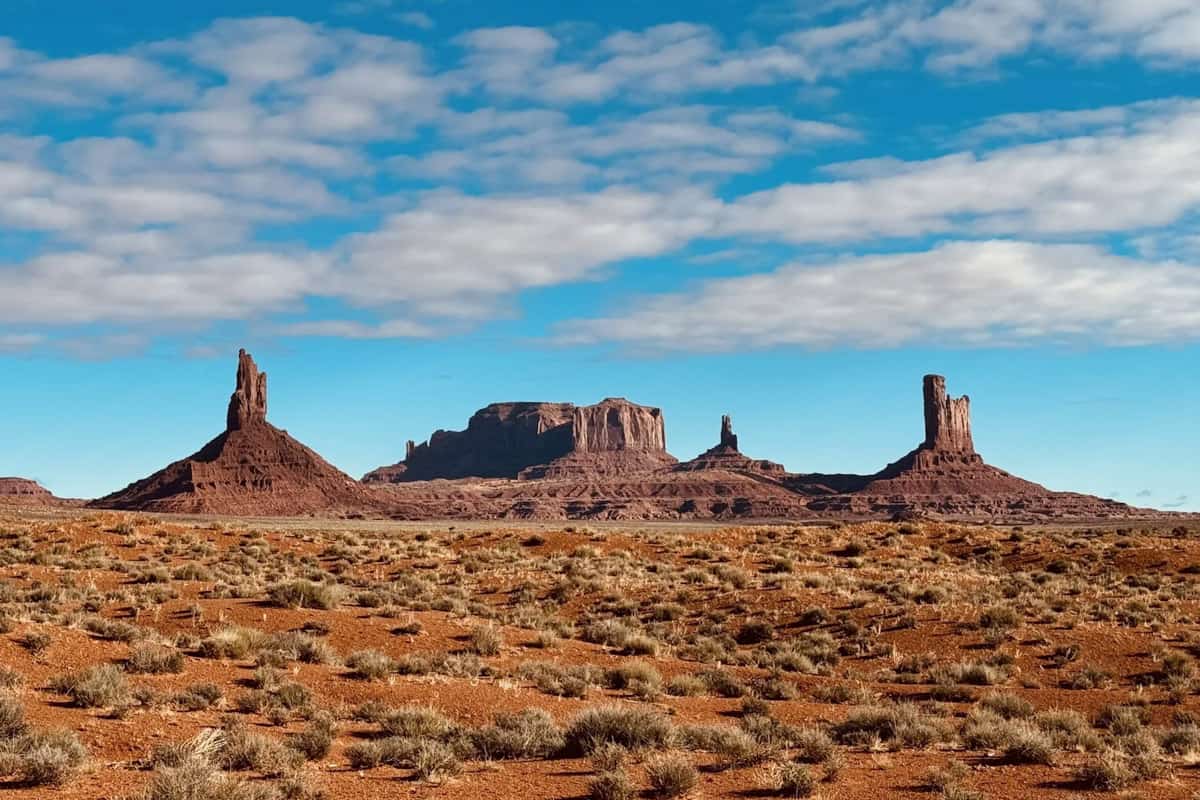
7. Wildcat Trail
- Location: Monument Valley
- Distance: 3.9-mile loop
- Elevation gain: 390 feet
- Difficulty rating: Moderate
- View the trail notes
In order to legally hike without a guide in Monument Valley, there’s only one option: the Wildcat Trail.
Despite being an iconic photo spot, Monument Valley isn’t a major hiking destination. This may be due to the remote location or the fact that the land is privately owned by the Navajo Nation.
Regardless, the Wildcat Trail is fantastic, taking you around the monument’s famous rock formations on a lollipop loop. The hike is easy, but the trail is loose sand, so it’s slow-going. There’s also zero shade, so bring plenty of water and sun protection.
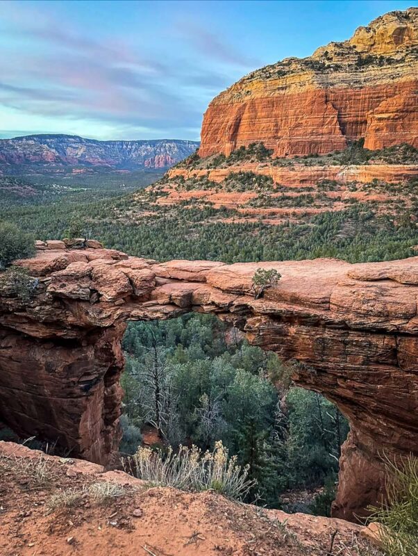
8. Devil’s Bridge Trail
- Location: Sedona
- Distance: 3.9 miles out and back
- Elevation gain: 521 feet
- Difficulty rating: Moderate
- View the trail notes
One of the most unique and best hikes in Arizona, Devil’s Bridge tops many bucket lists.
The trail leads to Sedona’s largest stone arch, where you can walk across the top. It’s wider than it looks from a distance (honest!), so even people with a serious fear of heights should be fine. The thrill and incredible view is well worth it!
Unless you have a high-clearance, four-wheel-drive vehicle, you can’t park at the trailhead. Instead, you have to take the Sedona shuttle or park at the nearby Mescal Trailhead or Dry Creek Road and walk.
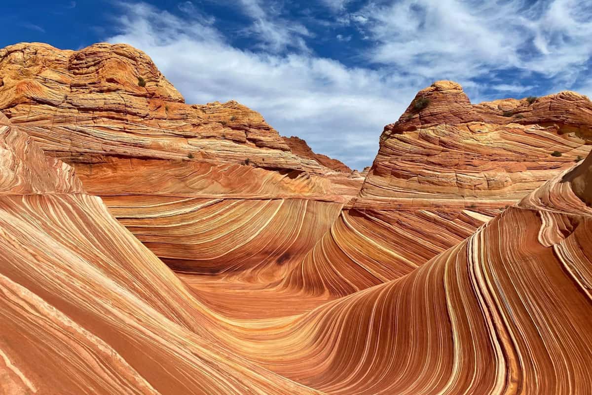
9. The Wave Trail
- Location: Coyote Buttes North
- Distance: 6.7 miles out and back
- Elevation gain: 1,204 feet
- Difficulty rating: Moderate
- View the trail notes
A once-unknown trail in an extremely remote part of the state, The Wave is now one of the best hikes in Arizona, and arguably the most famous.
Before you can even attempt it, you have to win a hard-to-get permit. Only 64 people total, per day, are allowed on the trail.
The Wave is just one formation within Coyote Buttes North, and the entire area is stunning. The otherworldly landscape feels like another planet, and the lack of other people adds to this sense.
Coyote Buttes is a primitive wilderness area, so there is no discernible trail or trail markers. There are also countless spur trails, making it easy to lose your way.
10. Seven Falls Trail
- Location: Tucson
- Distance: 8.4 miles out and back
- Elevation gain: 1,069 feet
- Difficulty rating: Moderate
- View the trail notes
Tucson’s Sabino Canyon Recreation Area is home to one of the best hikes in Arizona, Seven Falls.
Start on Bear Canyon Trail, and just before Seven Falls itself (which, yes, has seven waterfalls), fork away from it and descend into the canyon. When you arrive, you’ll be at the pool below the lowest waterfall.
You’ll cross Sabino Creek several times (how many depends on recent rainfall) and hike through Bear Canyon, bursting with wildflowers and wildlife. The falls dry up in the summer, and the trail is completely exposed. Hike this one in late winter or spring.
If you’re short on time or not up for an 8-mile hike, ride the Sabino Canyon shuttle. It shaves off about four miles and eliminates walking along the paved road. You can also take it one way.
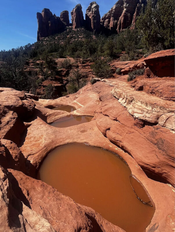
11. Seven Sacred Pools via Soldier Pass Trail
- Location: Sedona
- Distance: 1.1 miles out and back
- Elevation gain: 95 feet
- Difficulty rating: Easy
- View the trail notes
Despite being very short and very easy, Seven Sacred Pools is one of the best hikes in Arizona.
In just half a mile each way, you’ll get a great intro to Sedona’s stunning red rock scenery. On the way to the pools, you’ll pass the huge Devil’s Kitchen sinkhole, which you can walk right up to the edge of.
The pools don’t always have water in them, so if you can, time your hike for after recent rain. Either way, you can also continue on to Soldier Pass Cave, another of Sedona’s elusive hidden caves.
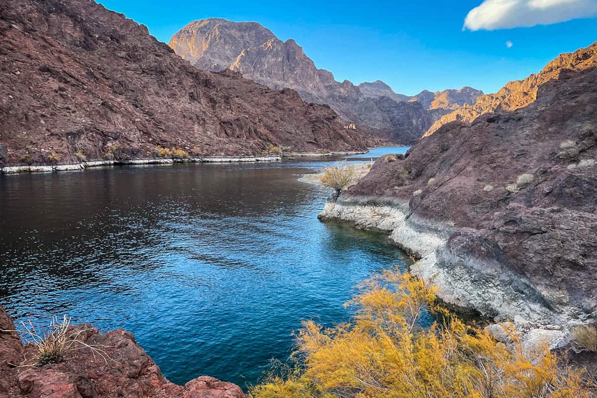
12. Arizona Hot Springs Trail
- Location: Lake Mead
- Distance: 5.9-mile loop
- Elevation gain: 1,223 feet
- Difficulty rating: Moderate to challenging
- View the trail notes
Arizona Hot Springs, also called Ringbolt Hot Springs, are a literal oasis in the desert. Reaching them requires driving to the middle of nowhere, and a somewhat grueling hike across a remote desert, through slot canyons and sandy washes.
Even occasional hikers will likely find this more moderate than difficult. The hardest aspects are the unforgiving sun and slogging through the sand.
The trail can also be tricky to follow, particularly along the river. AllTrails calls it a loop, but you can do this as an out-and-back, avoiding the confusing river stretch.
Slipping into one of the four hot springs at the end is well worth the trek. They sit just above the Colorado River, and each pool is a slightly different temperature.
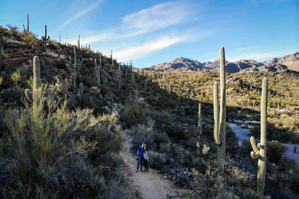
13. King Canyon Trail
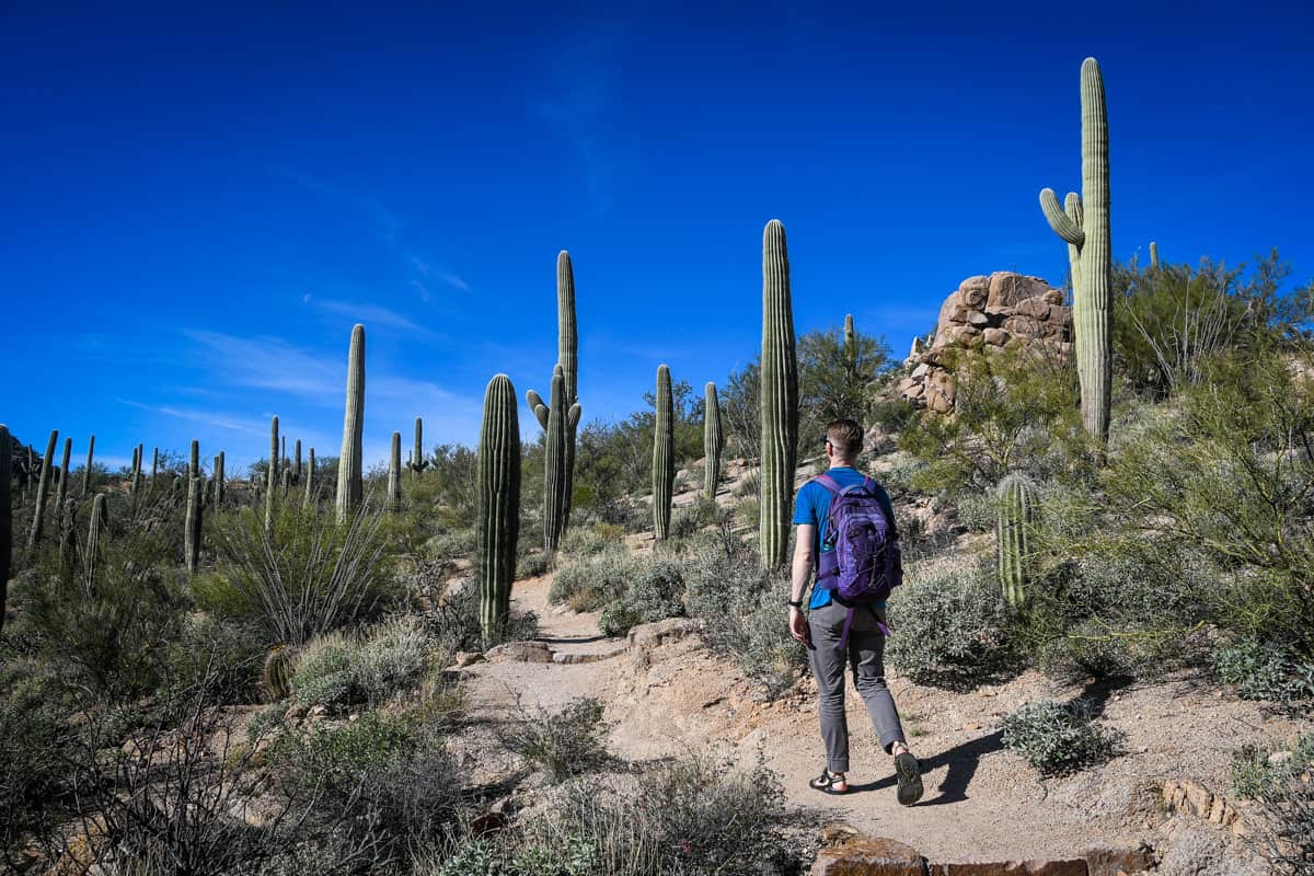
- Location: Seguaro National Park, Tucson
- Distance: 6.9 miles out and back
- Elevation gain: 1,824 feet
- Difficulty rating: Moderate to challenging
- View the trail notes
Looking for one of the best hikes in Arizona that isn’t social media famous? Like Saguaro National Park itself, the King Canyon Trail is rarely busy. Don’t let that deter you—it’s fantastic, with mountains, majestic saguaro cacti, and wildflowers.
King Canyon is the shortest, easiest (not ‘easy’) trail to the top of 4,687-foot Wasson Peak. Although you trudge uphill almost the entire way, the last mile involves a brutal, near-vertical climb to the summit.
Saguaro National Park is uniquely split into two areas, East and West. The King Canyon Trail is in the Tucson Mountains District (West), but if you want to visit the other part of the park, you’ll have to drive 30 miles east to the Rincon Mountain District.
14. Shoshone Point
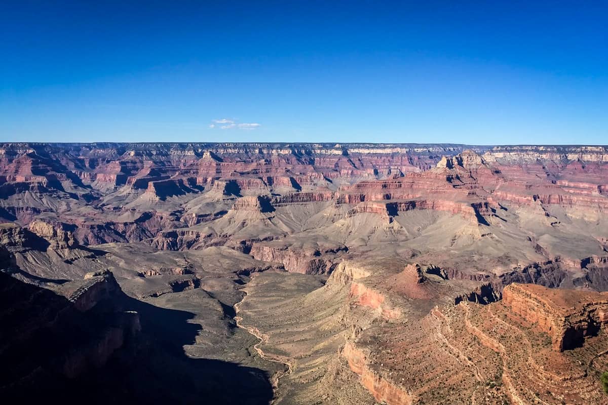
- Location: Grand Canyon National Park
- Distance: 2.1 miles out and back
- Elevation gain: 154 feet
- Difficulty rating: Easy
- View the trail notes
Not only is Shoshone Point a genuinely easy hike, but it’s shockingly uncrowded. Each of those things alone is extremely unusual in a national park, never mind both!
Hikers experience the wild diversity of Arizona’s terrain on this trail. Start out in pines, then head to Shoshone Point, a rock peninsula with 360-degree views overlooking the Grand Canyon’s vastness. It’s spectacular at sunrise and sunset.
Just before Shoshone Point, you’ll come to a picnic area. This is the only reservable event space in the entire park, popular for weddings and family reunions. If there’s an event going on when you walk through, be respectful. That’s a tough permit to get!
15. Horseshoe Bend

- Location: Page
- Distance: 1.5 miles out and back
- Elevation gain: 137 feet
- Difficulty rating: Easy
- View the trail notes
Unlike many of the other best hikes in Arizona, Horseshoe Bend is very easily accessible. From the parking lot, it’s a straightforward walk to the overlook at a slight uphill angle. The trail is even accessible, suitable for wheelchairs and strollers.
Bucket list-worthy Horseshoe Bend is, unsurprisingly, always extremely crowded. It lives up to the hype, though, so it’s worth seeing at least once—especially at sunset. Luckily, the overlook is huge and turnover is pretty fast, so if you’re patient, you’ll get plenty of epic photo ops.
Psst! If you are a newbie to hiking and not sure where to start. Our friend Parker helped us put together a list of beginner hiking tips and essential info that has everything you need to know to feel comfortable hitting the trails!
Best time to go hiking in Arizona

The best times to hike in Arizona are mid- to late fall and spring (October-November and February-May). You can hike here for most of the year, but you should avoid summer.
Aside from feeling insanely hot, Arizona’s sun actually burns hotter. The sun hits the surface in Arizona at a certain angle, traveling through less atmosphere and resulting in (much) higher than average UV exposure.
Even in mild temperatures, that high UV index and lack of cloud cover often cause heat-related illnesses and sunburn. Do not underestimate Arizona sunshine! If you absolutely must hike on hot days, start as early as possible and stay well-hydrated.
Arizona’s terrain and climate also varies significantly throughout the state. Phoenix and Page are nothing like Flagstaff or the White Mountains, with elevations exceeding 11,000 feet.
Where to camp in Arizona

The Dyrt is our favorite campsite locating app with the largest database of campgrounds (44,000+ campsites and counting!) and over 1 million user-submitted reviews. Plus, it’s super user-friendly, and has some pretty cool features, like outdoor gear contests and forums to connect and seek advice from fellow campers, that you won’t find on any other camping app.
Try their Pro Membership for FREE for 30 days and gain access to the offline version of the app, utilize their trip planning feature AND get exclusive discounts on campsites and gear!
What to pack for hiking in Arizona
- Navigation*: we recommend using Alltrails+ to download the offline trail map
- Get your first week of using Alltrails+ for FREE when you sign up using our link!
- Permit**
- Hiking daypack or hiking backpack
- Water bottles and/or bladder for your Camelbak
- Way to purify your water (we love our Grayl water bottles, and before them we always brought along our Steripen)
- Dry bag (we always carry one with us for our valuables in case of rain)
- Bug repellant
- Sun protection: sunscreen, hat, sun glasses
- Headlamp
- Camera/tripod (this one’s our favorite for hiking)
- Lots of layers (here is a great resource if you’re wondering what to wear hiking)
- Rain jacket
- Comfortable hiking boots or shoes
- Hiking poles (optional)
- Battery pack (if you are relying on your phone)
- Bear spray (just in case)
- Bear canister (to properly store your food)
- Multi-tool
- Lightweight tent: find out the best 2-person tents for camping and backpacking
- Sleeping bag
- Sleeping pad
- Toilet kit: toilet paper, small shovel, bag for packing out TP, hand sanitizer
- Bag for your trash
- Camp stove/fuel (we love our Jetboil!)
- Mess kit
- Biodegradable soap and towel
- Plenty of snacks: check out our favorite hiking snacks here!
*If you choose to us your phone for navigation, be sure to bring a reliable battery pack to charge your phone
**Don’t forget to pack your permit!
Be sure to download our FREE hiking packing list before your next trip and never leave another essential behind again!

Round up of the best hikes in Arizona
Here’s a roundup of all the best hikes in Arizona so you can see everything in one place.
- Havasu Falls Hike (Havasupai Indian Reservation)
- Boynton Canyon Trail & Subway Cave (Sedona)
- Upper Antelope Canyon (Page)
- The Rim Trail (Grand Canyon National Park)
- Camelback Mountain (Echo Canyon Park)
- Cathedral Rock Trail (Sedona)
- Wildcat Trail (Monument Valley)
- Devil’s Bridge Trail (Sedona)
- The Wave Trail (Coyote Buttes North)
- Seven Falls Trail (Tucson)
- Seven Sacred Pools via Soldiers Pass Trail (Sedona)
- Arizona Hot Springs Trail (Lake Mead)
- King Canyon Trail (Saguaro National Park)
- Shoshone Point (Grand Canyon National Park)
- Horseshoe Bend (Page)
You may also like…
- Best Hikes in Sedona, Arizona for All Levels
- Beginner Hiking Tips: Essential Info & Preparedness
- What to Wear Hiking in Every Season
- Best Hiking Snacks: Healthy & Delicious Trekking Food
Save this article on Pinterest for later!


We want to hear from you!
Have you done any of the best hikes in Arizona on this list? What was your experience like? Are you planning a trip to Arizona for hiking and want more advice? Comment below and let us know!