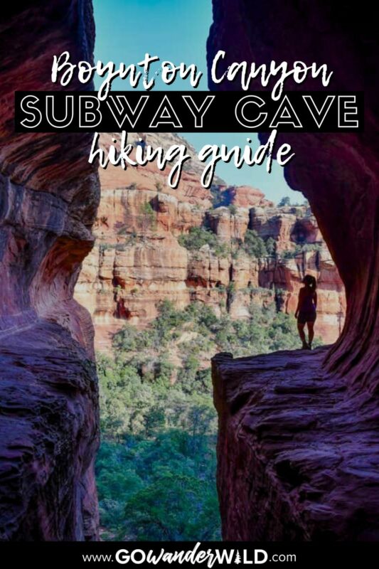
Home to the famous ‘secret’ Subway Cave and an especially unique energy vortex, it’s no surprise the Boynton Canyon Trail is one of the most popular hikes in Sedona. We put together this trail guide with everything you need to know, including how to find the hidden cave.
A locals-only secret just a few years ago, the Subway Cave in Sedona is now ultra famous and one of the most sought-after photo ops in the Southwest. Rightfully so, as this ‘hidden’ keyhole-shaped cave just off the Boynton Canyon trail packs a tremendous punch.
In a relatively short, easy hike, you have the opportunity to not only explore the Subway Cave, but also experience one of Sedona’s revered energy vortexes and see ancient cliff dwellings.
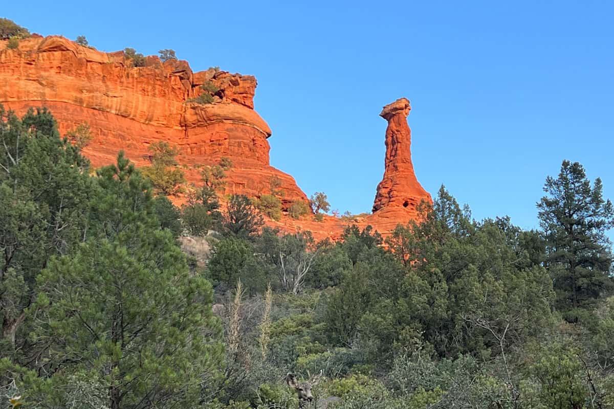
Along the way, of course, you’ll also enjoy plenty of that iconic red rock scenery!
Boynton Canyon Trail Guide
- Boynton Canyon Trail stats
- Hike overview
- Know before you go
- The route to Subway Cave
- Tips for hiking Boynton Canyon Trail
- Where to camp nearby
- What to pack

Boynton Canyon Trail stats
- Location: West Sedona
- Distance: 7.2 miles out and back
- Elevation gain: 964 feet
- Difficulty rating: Moderate
- Timing: 3-4 hours
- Pets: Leashed dogs welcome
- Permits: None required, but you do need a Red Rock Pass ($5 per day) or America the Beautiful Pass to park
- View the trail notes
Boynton Canyon & Subway Cave hike overview
Before we get into the details of the Subway Cave hike, let’s address something. Because of trail overcrowding and unfortunate damage to the Sinaguan ruins near the cave, this hike has recently become extremely controversial.
The reality is that the Subway Cave is no longer a secret, and anyone can easily find information on how to get there. We’re sharing especially detailed info in the hopes that you won’t need or be tempted to go off trail, and we can all continue to enjoy this special place.
With that out of the way…
Although you won’t find an official ‘Subway Cave’ trail, it’s considered part of the Boynton Canyon trail. Many people think getting to it is the most difficult aspect of the hike, but it’s just a matter of knowing what to look for (and exactly where).
The cave is certainly a worthwhile destination, but don’t overlook Boynton Canyon’s beautiful finale, or the Boynton energy vortex. It’s unique in that it has both masculine and feminine energy, whereas most are one or the other.
Psst! Boynton Canyon is one just one of the best hikes in Sedona, Arizona we’d recommend checking out if you’re in the area!
Things to know before you go
The Boynton Canyon trail is pretty straightforward, but finding and hiking to the Subway Cave isn’t, necessarily. Here are some important things to know and consider before hitting the trail.
Best time of year for the Subway Cave hike
If we have to choose one best time to hike the Subway Cave, we’d say early spring or late fall. Both seasons bring pleasant, mild weather with little chance of rain and plenty of seasonal scenery. Fall foliage is surprisingly vibrant in Sedona, and spring means colorful wildflowers.
With that said, however, Sedona is a destination you can hike nearly year-round. Winter is a close runner-up, with sunny days, cool but comfortable temps, and the possibility (rare, but possible!) of seeing a bit of snow in the desert. Crowds are also a bit thinner in the winter.
How long does it take to hike to Subway Cave?
It takes an average of three hours to do the round-trip hike to the Subway Cave Sedona.
However, a variety of factors impact that timeframe, including your own personal hiking pace, whether you hike the complete Boynton Canyon trail, and how much time you spend at the cave.
If you hike fast, you could be done in 2-2.5 hours. If you spend quite a bit of time at the Subway Cave or detour to the energy vortex, plan for closer to four hours.
How difficult is the Subway Cave hike?
The vast majority of Boynton Canyon Trail is easy, but actually getting into (and out of!) the Subway Cave is trickier. If you want to go up into the cave, you’ll have to scramble over steep, slippery slickrock.
It’s manageable for most people with even very limited hiking experience, but it’s definitely not for people with limited mobility.
You’ll also have to make the call on whether or not to bring young children. If they’re good hikers, they’ll likely be fine, but you won’t want—or be able—to carry them at the very end, getting in and out of the cave.
The route to Subway Cave
We broke down the route for hiking Boynton Canyon trail to Subway Cave into parts to give you an idea of what to expect on the route.
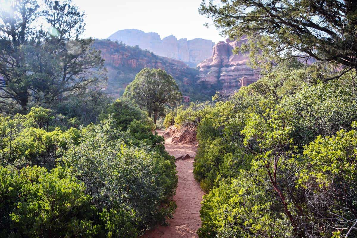
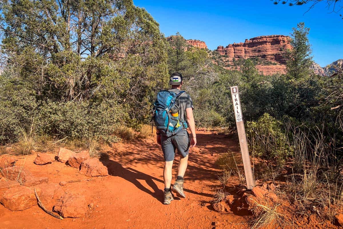
The hike to reach the Subway Cave starts from the Boynton Canyon trail parking lot, near the Enchantment Resort at the end of a paved road. You’ll actually walk along the resort’s perimeter for the first stretch, following the open, flat, red sand trail.
Before starting your hike, make sure you have a Red Rocks Pass or America the Beautiful Pass. You can purchase a daily or weekly pass from the kiosk in the parking lot. The trail’s only pit toilet is also here.
There is no ‘official’ trail to the Subway Cave, so follow the signs for Boynton Canyon trail.
Visiting the Boynton Vortex
If you want to see the Boynton energy vortex, keep your eyes open for the sign to Boynton Vista Trail (labeled simply “Vista”). It’s on your right, after just 0.3 miles.
To get up to the vortex, it’s only about a 10-minute hike, and you can easily re-connect with the main trail afterward. Because you may (or may not!) experience some strange sensations at the vortex, we recommend taking this detour on your way back from the Subway Cave.
Hiking to the Subway Cave
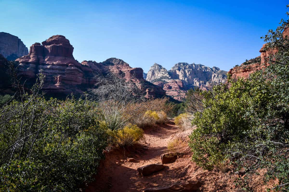
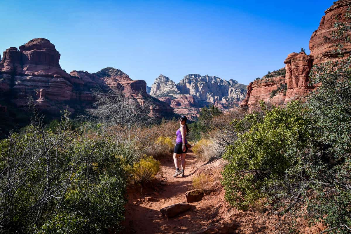
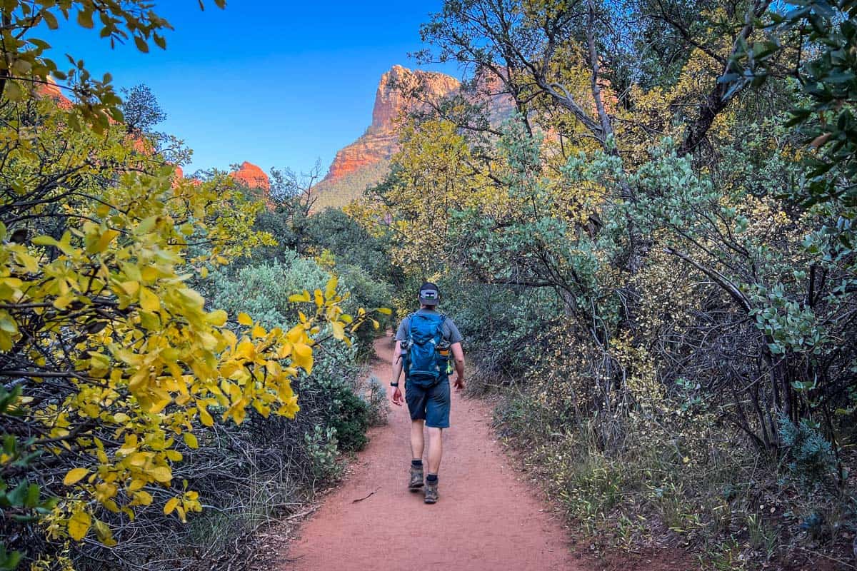
Not long after leaving the trailhead, the trail veers away from the resort and brings you down to the canyon floor. It remains mostly flat and easy for about one mile, and you also have more shade.
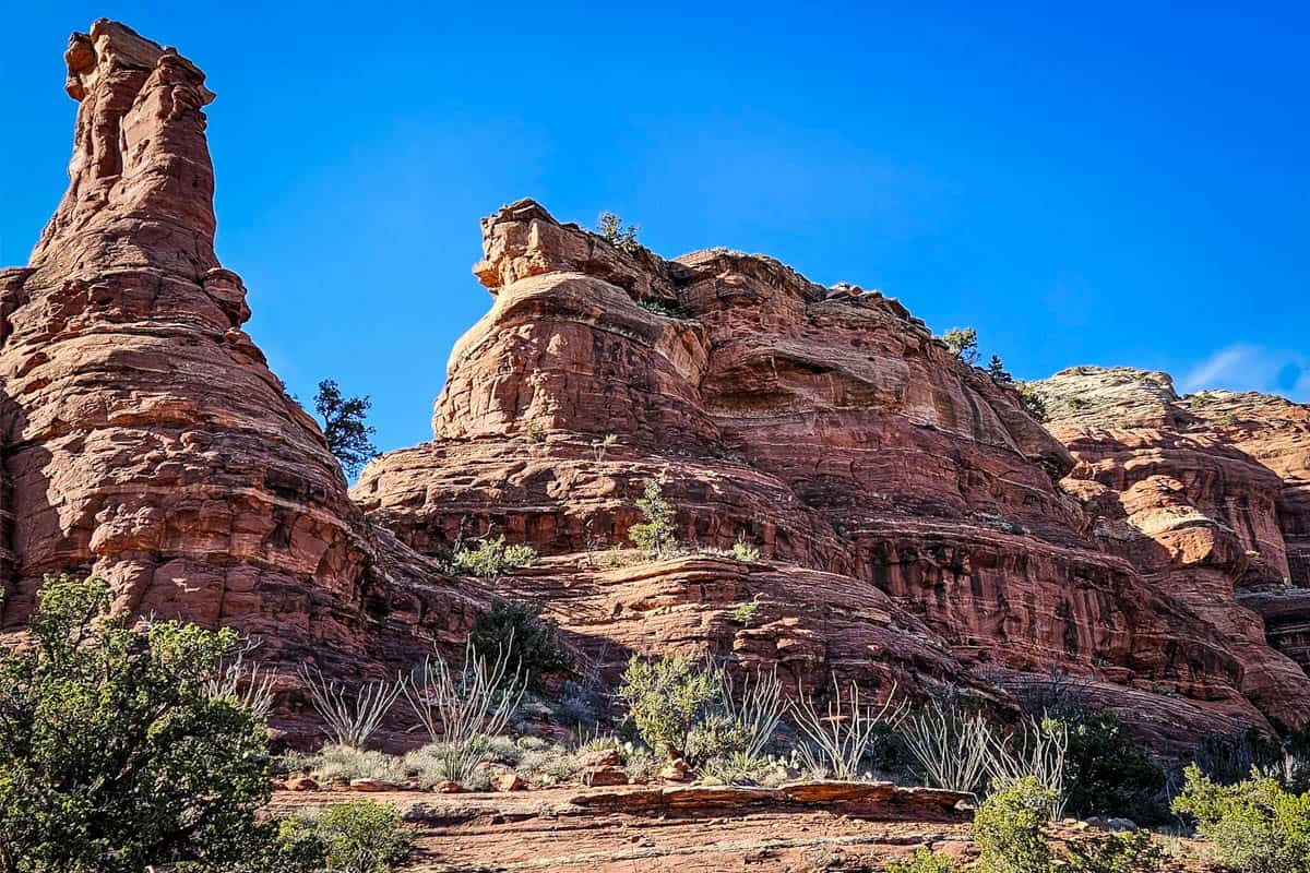
From here on, the scenery is different. Instead of being out in the open, you walk through a narrow canyon with steep walls. It’s well-shaded and cool, so stands of tall ponderosa pines replace Sedona’s typical shrubs, cacti, and junipers.
The turnoff to the Subway Cave is just shy of two miles from the trailhead (note that if you detour to the Boynton energy vortex first, your mileage will be slightly different). It isn’t marked by anything official, but there is a very distinct alligator juniper tree ‘pointing’ the way.
Not only does the tree’s bark look like alligator skin, but it’s also huge—significantly bigger than any other trees around it.
Once you spot the tree on your left, look for the path just past it and to the right, across the trail.
Sometimes, you may see manmade trail markers, like arrows made from rocks, pointing toward the cave. They’re not always there, though (and really, in keeping with Leave No Trace, they shouldn’t be), so don’t rely on finding one. Instead, look for the distinctive juniper tree.
Quick note: the tree and trail to the cave are farther than many people realize. Your mind starts playing tricks on you, convincing you that maybe it’s this tree. We promise, when you see THE tree and path, you’ll know. It’s well traveled and not overgrown.
The Subway Cave is 0.3 miles, maybe 15 minutes, from the alligator juniper. At one point en route, you come to a split in the trail, marked by a broken tree stump and a dry creek bed. Do not cross the creek, but instead take a right, toward the cliffs.
You missed the turn if you’re suddenly surrounded by a proper pine forest.
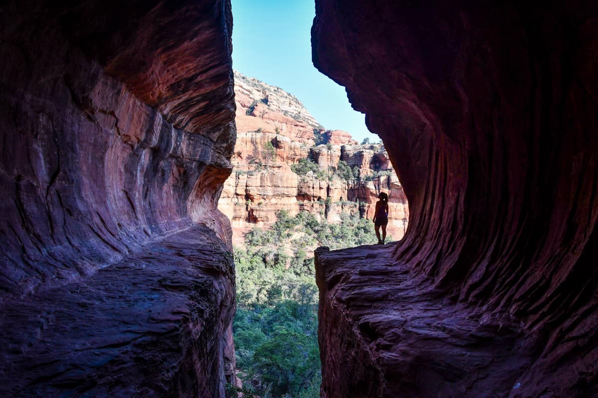
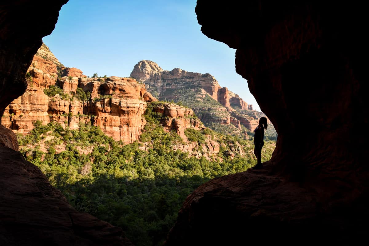
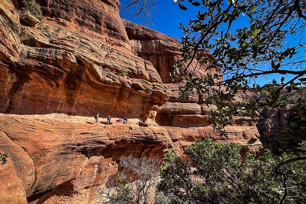
When you reach the cave, you’ll be standing underneath its crevasse-like entrance, facing it. You have two options for getting up inside it: scale the slippery rock ‘slide’ directly in front of you, or walk the trail to the left, along the canyon rim.
Both options are tricky. Some people decide the scramble isn’t worth the view and turn back without going into the Subway Cave. If you take your time and ensure you have solid footing, you’ll be totally fine on either route.
With that said, the trail to the left is shorter and easier overall.
Entering the Subway Cave from below
If you take the more direct route up, start on the left (the lower path, hugging the canyon wall). There are some natural notches in the rocks here that act as hand and footholds. Some are far apart, and you’ll find yourself scrambling and stretching out as far as possible at a few points.
When you emerge in the cave, you’ll be standing at the rear. You can walk out onto either ledge for photos, but be careful, as it’s pretty high up.
To exit the cave, you can go back down the way you came (prepare to slide down on your bottom!). You can also take the narrow ledge from the right side of the cave, which follows the alternate rim path.
At one point, you have to hug the cave’s wall, so it’s not necessarily ‘easier!’ It’s up to you to choose between sliding down or dealing with heights and the narrow ledge.
Taking the rim trail into the Subway Cave
Prefer walking along the canyon rim over scaling the slippery rocks? Take the trail to the left when you’re standing outside the bottom of the cave.
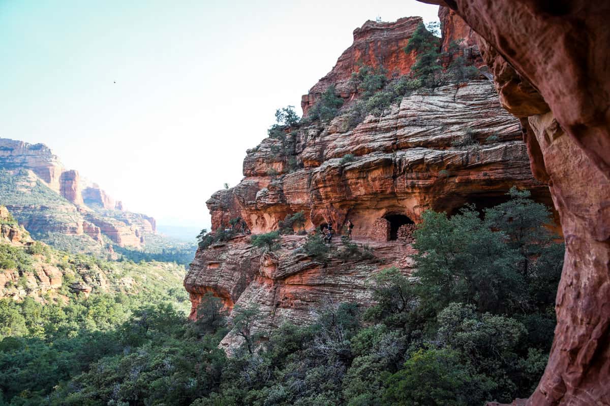
The first part of this trail is straightforward, but it gets fairly steep. Luckily, before long, you’ll come to a cave with ancient Sinaguan ruins. Yes, you can go inside. However, do not sit, stand, or climb on them. This is a sacred, very fragile site!
From the ruins, it’s a short walk to the Subway Cave. The trail gets very narrow closer to the cave entrance. Going in reverse of the exit we explained above, you’ll have to sort of shuffle along the ledge and hug the cave’s exterior around the bend just before entering.
Completing the Bonyton Canyon trail
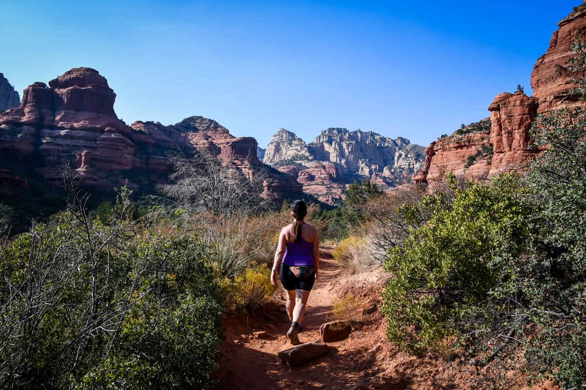
When you get back to the main trail after exploring the Subway Cave, head back to your vehicle (or the energy vortex) or complete the Boynton Canyon hike. The official trail ends at a box canyon with gorgeous views, and sometimes even a small waterfall!
From the alligator juniper, the end of Boynton Canyon trail is about one mile. It gets fairly steep toward the end, as it leads you to the rocky summit above treeline.
Psst! Check out our round up of the best hikes in Arizona for more inspiration for hiking for all levels and abilities!
Tips for hiking to Subway Cave
- You need a parking pass. To park at the Boynton Canyon trailhead, you’ll need either a Red Rocks Pass ($5 daily) or an America the Beautiful annual pass.
- Be respectful and patient at the Subway Cave. Typically, LOTS of people are waiting to get in and/or take photos—just like you. Wait your turn, and then take your photos quickly.
- Practice Leave No Trace. Keep in mind that this entire area is not only delicate, but sacred. Don’t touch or take anything and stay on maintained trails.
- The Boynton Canyon energy vortex is just off the trail. If you want to experience it yourself, head up the short Vista Trail before or after hiking the Boynton Canyon trail.
- Wear sturdy hiking shoes with rugged soles. Due to the slippery rocks and sand along the trail and getting into the Subway Cave, leave the casual sneakers at home. Trust us, you’re going to want a solid grip in several places!
- The Subway Cave is tricky to photograph. There’s really no golden hour inside and depending on the time of year, late morning or afternoon are usually best.
Where to camp nearby
Much of Sedona, and the land surrounding it, sits within the Coconino National Forest. While there’s a ton of public land, there’s actually not a ton of free or dispersed camping—anymore, anyway.
2022 regulations created a LOT of restrictions, so today, there are five main areas where you can legally camp for free in Sedona. They’re all off Forest Road 525, about 10 miles outside of town.
- Nolan Campground (closest to Boynton Canyon)
- Greasy Spoon Campground
- Cockscomb Campground
- Windmill Campground
- Surprise Campground
If you’re willing to drive closer to Flagstaff or Verde Valley, you’ll also find several private campgrounds with varying levels of amenities.
What to pack for hiking Boynton Canyon Trail to Subway Cave
- Navigation*: we recommend using Alltrails+ to download the offline trail map
- Get your first week of using Alltrails+ for FREE when you sign up using our link!
- Hiking daypack
- Water bottles and/or bladder for your Camelbak
- Bug repellant
- Sun protection: sunscreen, hat, sun glasses
- Headlamp (if hiking close to sunrise/sunset)
- Camera/tripod (this one’s our favorite for hiking)
- Lots of layers (here is a great resource if you’re wondering what to wear hiking)
- Comfortable hiking boots or shoes
- Hiking poles (optional)
- Plenty of snacks: check out our favorite hiking snacks here!
Be sure to download our FREE hiking packing list before your next trip and never leave another essential behind again!

You may also like…
- Best Hikes in Sedona, Arizona for All Levels
- Easy Hikes in Sedona, Arizona for Beginners
- What to Wear Hiking in Every Season
- Best Hiking Snacks: Healthy & Delicious Trekking Food
Save this article on Pinterest for later!

We want to hear from you!
Have you hiked the Boynton Canyon Trail to the Subway Cave in Sedona, Arizona? What was your experience like? Are you planning a trip to Sedona and want more advice? Comment below and let us know!