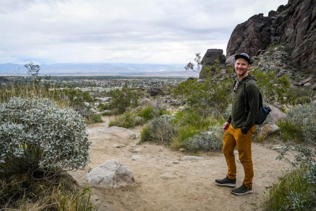
From leisurely nature walks to challenging treks through unforgiving desert, Palm Springs hikes genuinely have a bit of everything. Best of all, most of them are minutes from downtown! In this guide, we detail the best hikes in Palm Springs with plenty of local tips.
Towering mountains, colorful desert wildflowers, waterfalls inside canyons, hidden alpine lakes, wildlife sightings, and enormous rock formations all in one place. We could only be talking about Palm Springs.
To fully experience the area’s stunning, one-of-a-kind beauty, check out Palm Springs hiking. Convenient to town and with comfortable weather most of the year, there’s no reason not to hit the trail.
We put together some amazing options, but in addition to the best hikes in Palm Springs proper, we added some in the greater metro area, including Joshua Tree National Park.
Palm Springs Hiking Guide
We’ve included some extra info for planning your hiking trip to Palm Springs. Jump to the following sections (or just keep scrolling to see it all!).

1. Tahquitz Canyon
- Distance: 2-mile loop
- Elevation gain: 324 feet
- Difficulty rating: Moderate
- View our trail guide
With a 60-foot seasonal waterfall and swimming hole, it comes as no surprise that Tahquitz Canyon is one of the most popular Palm Springs hikes.
Even the trail to the waterfall is interesting, with massive boulders, bridges over the creek, wildflowers, and expansive views over the city at high points.
A few things to note: admission is $15 per person, everyone is required to have at least 32 ounces of water, and Tahquitz Canyon closes temporarily when it reaches capacity. Arrive early!
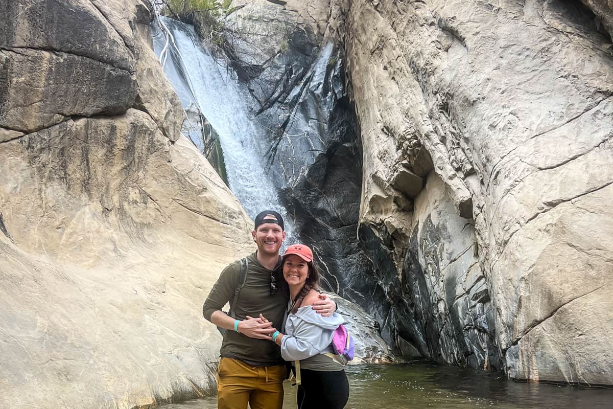
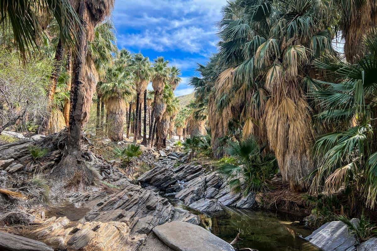
2. Murray Canyon Trail to Seven Falls (Indian Canyons)
- Distance: 3.7 miles out and back
- Elevation gain: 538 feet
- Difficulty rating: Moderate
- View our trail guide
Murray Canyon’s endpoint is Seven Falls, an aptly-named waterfall with seven pools. In this case, the journey really is part of the destination, as you’ll walk right through some of the area’s impressive diversity.
Your hike starts in the open desert, crossing soft sand. Next is a small, shaded palm grove and depending on the time of year, possibly several water crossings.
Many people are surprised that the trail officially ends before Seven Falls. You can still get to it, but it involves a moderate rock scramble just after the ‘end of trail’ sign.
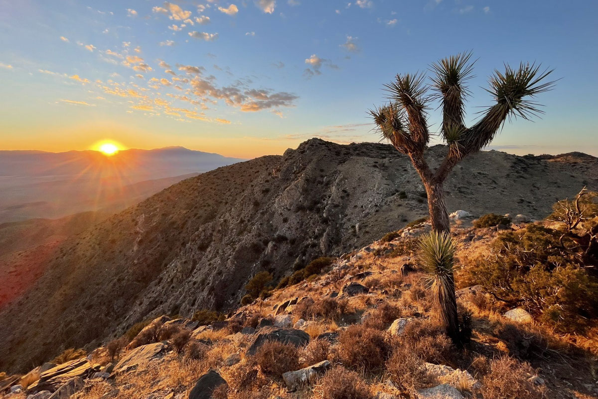
3. San Jacinto Peak
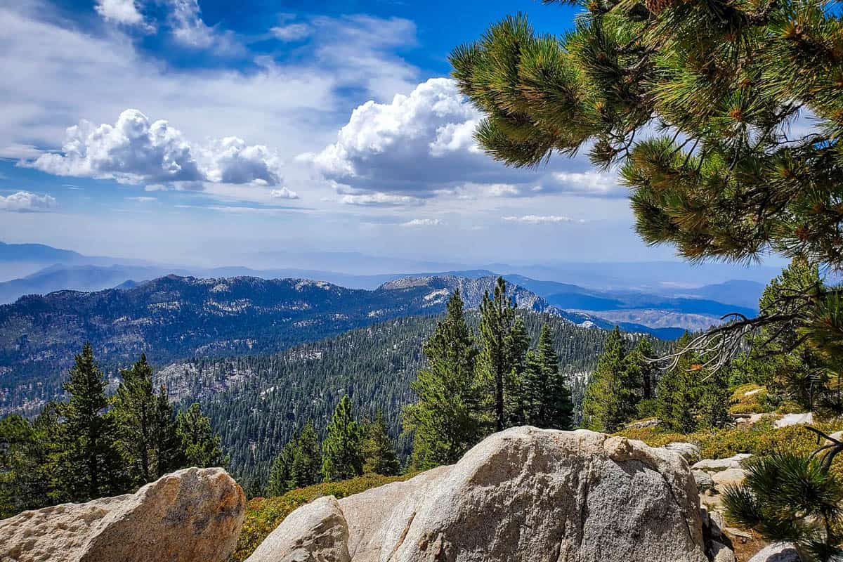
- Distance: 10.1 miles out and back
- Elevation gain: 2,578 feet
- Difficulty rating: Challenging
- View the trail notes
Far and away one of the most unique Palm Springs hikes, San Jacinto Peak involves a tram ride, high elevation, and often, snow—not the usual desert scenery!
You’ll first ride the Palm Springs Aerial Tramway to 8,516 feet. Once at the top, stop at the ranger station to self-register for a Wilderness permit. From there, descend into Long Valley.
The trail levels out at Round Valley, then ascends the steepest section to Wellman Divide. Mercifully, this stretch is only one mile.
Expect to see snow about half the year, from fall through spring. Microspikes or even snowshoes are handy during these times. In heavy snow, even with crampons or snowshoes, you may not be able to pass Wellman Divide.
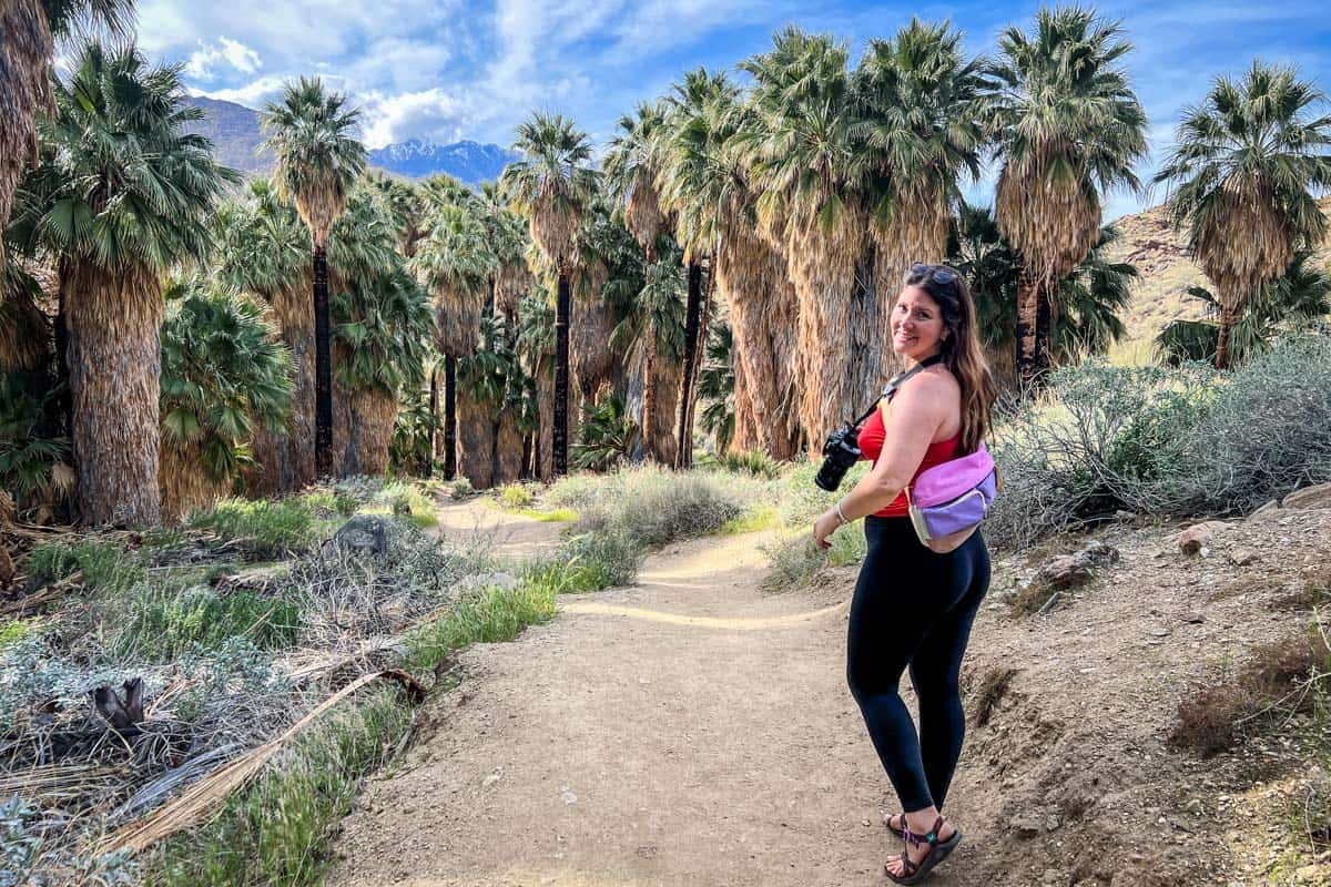
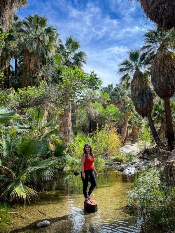
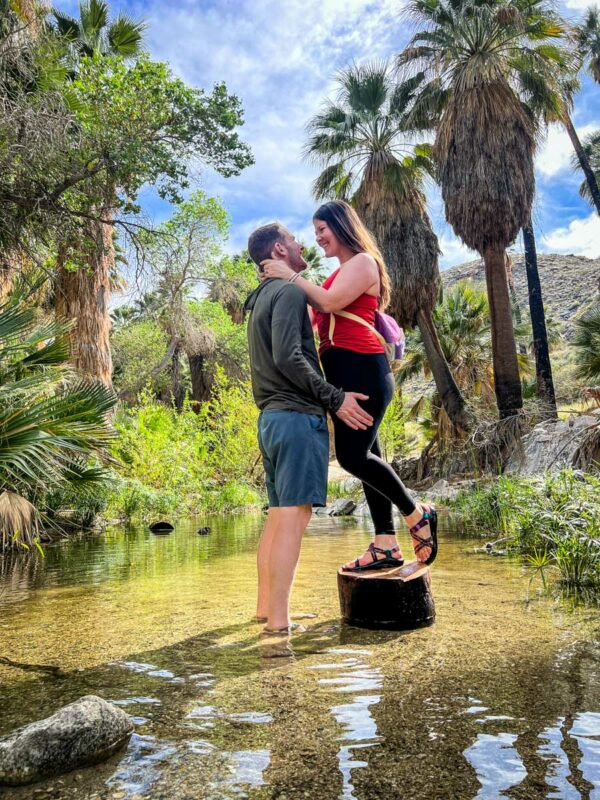
4. Andreas Canyon (Indian Canyons)
- Distance: 1-mile loop
- Elevation gain: 177 feet
- Difficulty rating: Easy
- View the trail notes
Despite being the shortest, easiest hike in Indian Canyons, Andreas Canyon does a wonderful job showcasing a true oasis in the desert.
Hikers loop around Andreas Creek, experiencing up close the bright green vegetation and babbling stream against the sharply-contrasting backdrop of a rugged desert.
The trail has a cultural element, too, with ancient bedrock mortars carved into river rocks. High above the trail, exclusive stone houses built in the 1920s represent more modern history. As if all that weren’t enough, Andreas Canyon also has a beautiful picnic area.
Psst! Check out our complete guide to Indian Canyons!
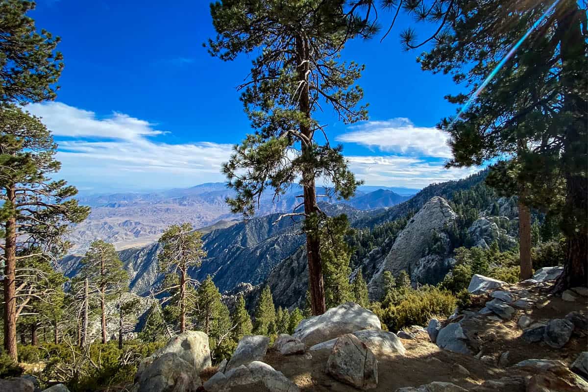
5. Desert View Trail
- Distance: 1.9-mile loop
- Elevation gain: 334 feet
- Difficulty rating: Easy
- View the trail notes
Another trail you access via the aerial tram, this is one of the best hikes Palm Springs has to offer. The easy, mostly flat trail takes you to several scenic overlooks (‘notches’) with panoramic views of the valley.
The beginning of the hike follows the Long Valley Discovery Trail. It’s well-signed and you come to the first ‘notch’ quickly, but the best one (by far!) is Notch 3.
Every website seems to list a different distance—ranging from 1.5-2.5 miles. Plan for just under two and know that regardless, it’s an easy hike. The hardest part is the steep walk back up the ramp to the tram building!
6. Palm Springs Museum and North Lykken Trail
- Distance: 4.3 miles out and back
- Elevation gain: 1,745 feet
- Difficulty rating: Challenging
- View the trail notes
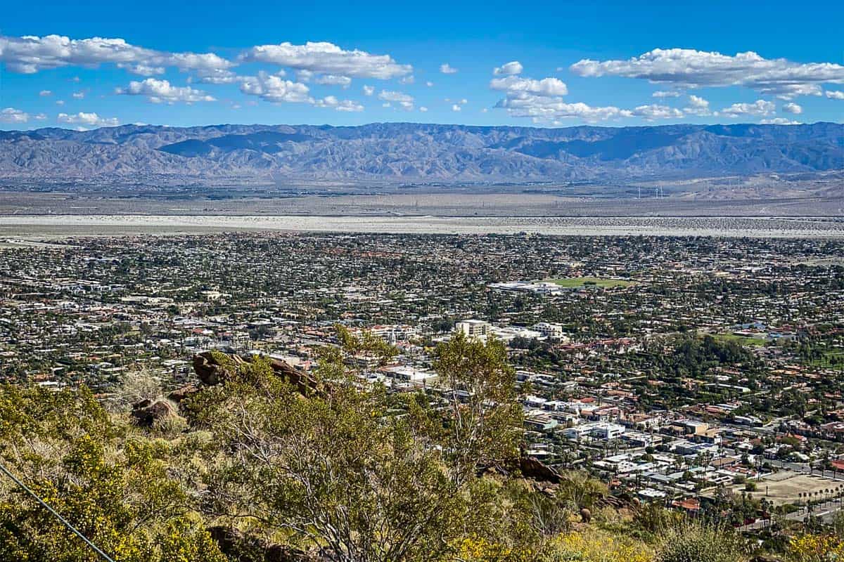
If you’re looking for a thigh-burner right in the city, this is one of the best hikes in Palm Springs. It starts behind the Palm Springs Art Museum and ascends 1,000 feet in one mile. Thankfully, picnic tables with great city views await you at the top!
This is also where you connect to the North Lykken Trail. The trail descends (thankfully not quite as steeply!) into a residential area, ending at Ramon Drive.
You can also do this hike in reverse, starting at Ramon Drive. It’s a more manageable ascent, but a tougher-on-the-knees descent. Alternatively, if you use rideshare, you can also do this as a shorter point-to-point hike.
7. Museum Trail
- Distance: 1.5 miles out and back
- Elevation gain: 900 feet
- Difficulty rating: Challenging
- View the trail notes
The Museum Trail comprises the first segment of the Museum to North Lykken Trail, so although it’s short, it’s anything but ‘sweet.’
Start in the far corner of the museum parking lot, then begin your climb to the picnic area. Unless you’re continuing onto North Lykken Trail or doing Cactus to Clouds (reportedly one of the toughest hikes in the US!), retrace your steps back to the museum.
Don’t park in the lot where the hike starts—unless you’re paying to go into the museum, of course. Instead, use the FREE covered garage right across N. Museum Drive.
8. Victor Loop (Indian Canyons)
- Distance: 2.6-mile loop
- Elevation gain: 354 feet
- Difficulty rating: Moderate
- View the trail notes
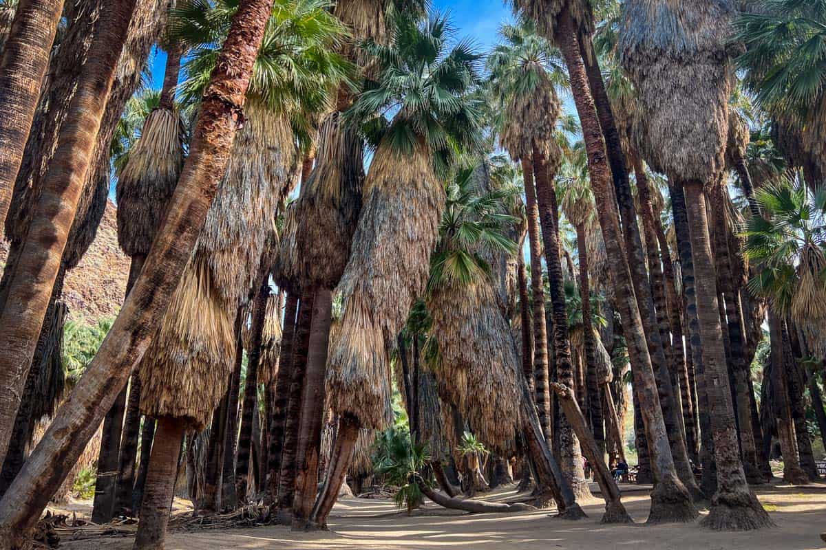
Victor Loop is widely considered one of the most scenic trails in Indian Canyons. With thousands of tremendous palms, wildflowers, and a picturesque creek, it’s easy to see why!
Start out on Palm Canyon Trail, deservedly among the most popular Palm Springs hikes. It leads to the largest, oldest natural grove of palm trees in the world!
After one mile, connect to the Victor Trail via a sharp switchback. It takes hikers back toward the trading post, this time following a high ridge with great views over Palm Canyon.
The lower section of the trail is quite easy, while the ridge portion involves the moderate climb. Because it’s a loop, you can hike in either direction.
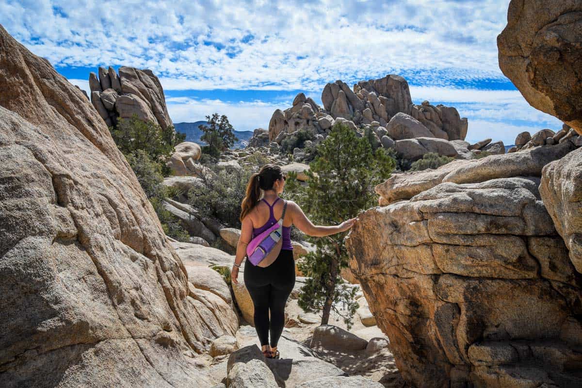
9. Hidden Valley Trail (Joshua Tree National Park)
- Distance: 1-mile loop
- Elevation gain: 118 feet
- Difficulty rating: Easy
- View the trail notes
Although not technically Palm Springs hiking, Joshua Tree National Park is close enough that it’s practically part of the metro area.
Hidden Valley Trail is just over one hour from downtown Palm Springs, and this easy loop is one of the most popular in the park.
The hike offers a perfect intro to Joshua Tree, with those iconic huge boulders—and plenty of opportunities to scramble up and over them! Legend holds that cattle rustlers once used the towering walls of the rock ‘valley’ to hide, adding a fun historical element.
10. South Lykken Trail

- Distance: 8.9 miles out and back
- Elevation gain: 2,200 feet
- Difficulty rating: Moderate
- View the trail notes
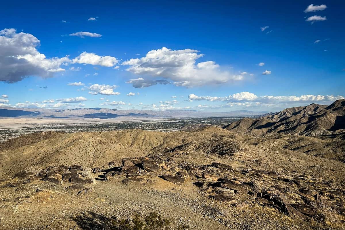
With wildflowers blooming half the year, frequent bighorn sightings, and a birds-eye perspective of Tahquitz Falls, it’s no surprise this is considered one of the best hikes in Palm Springs.
The trail quickly climbs 1,000 feet to a picnic area overlooking the city. Along the ridgeline, look down to see Tahquitz Falls flowing in the winter and spring.
Beyond the initial ascent, this hike isn’t at all technical. Its logistics, however, are slightly trickier.
You can do the trail as an 8.9-mile out-and-back hike, turn it into a loop (and shave off some distance!) by hiking back to the trailhead along the road, or do a point-to-point hike and get a ride back to your vehicle.
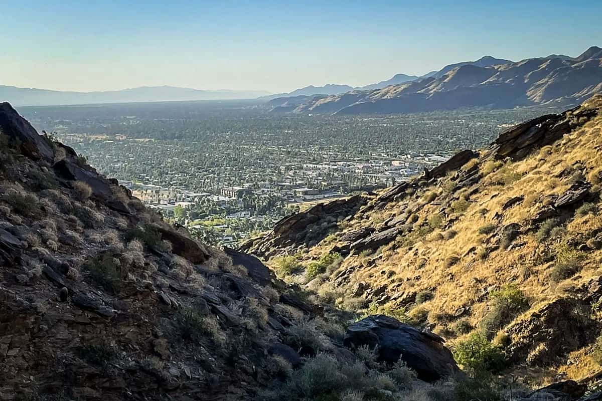
11. Cahuilla Peak via Araby Trail
- Distance: 5 miles out and back
- Elevation gain: 1,519 feet
- Difficulty rating: Challenging
- View the trail notes
Despite starting at the edge of a mobile home park, the Araby Trail to Cahuilla Peak is one of the best hikes in Palm Springs.
The entire way up to the peak is, well, up, but the climb is mostly moderate. 1.7 miles in, hop on the Berns Trail, where the ascent gets steeper.
Near here, you’ll see iconic Palm Springs mansions, including Bob Hope’s former home and one featured in a James Bond movie.
After one mile and several switchbacks on the Berns Trail, you’ll reach the Cahuilla Peak summit. Take in the views, then head back the way you came. Both directions, avoid the spur trails that lead into various residential neighborhoods.
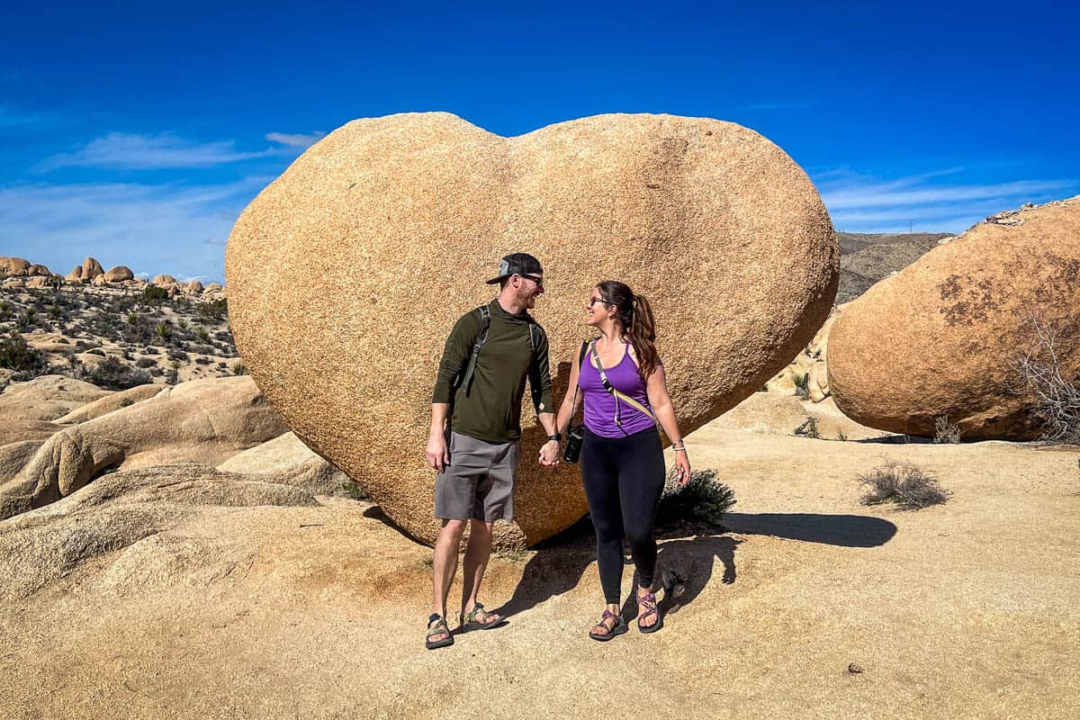
12. Heart Rock & Arch Rock via Arch Rock Trail (Joshua Tree National Park)
- Distance: 1.7 miles out and back
- Elevation gain: 100 feet
- Difficulty rating: Easy
- View the trail notes
This easy-going hike takes you to not just one, but two of Joshua Tree’s iconic rock formations.
From the paved parking lot on Pinto Basin Road, cross the road to the easy, well-marked trail. You may have to wait a bit to take pictures at Arch Rock, but when you do, don’t simply snap a few and leave. Instead, climb up on the arch itself and explore from different vantage points.
When you come down, instead of turning back toward the parking lot, head the other direction in search of Heart Rock. We say ‘in search of’ because there’s no official trail.
Luckily, since this is such a popular area, there will likely be other hikers looking for it or coming back. Don’t be afraid to ask! Start by heading northeast of Arch Rock. Heart Rock is less than one-third of a mile away, so if you don’t find it quickly, backtrack and try again.
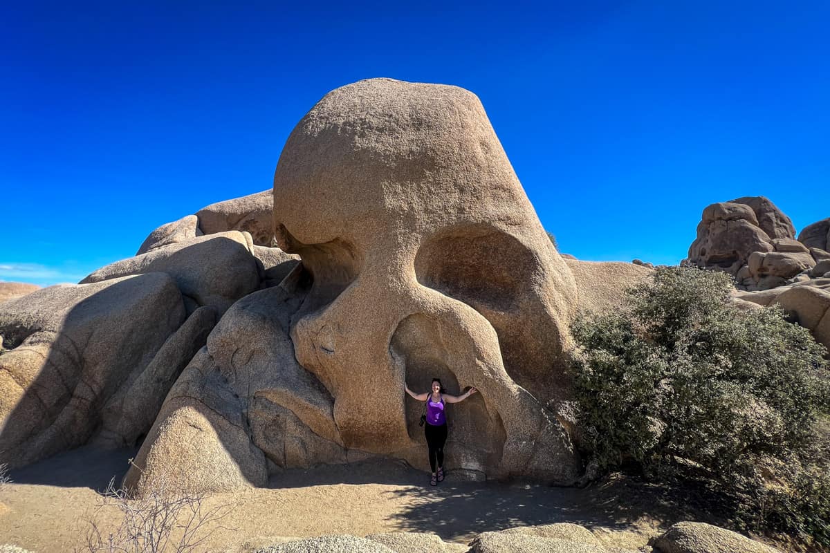
13. Skull Rock (Joshua Tree National Park)
- Distance: 1.7-mile loop
- Elevation gain: 150 feet
- Difficulty rating: Easy
- View the trail notes
Speaking of iconic formations in Joshua Tree, you can’t even mention Palm Springs hikes without hearing about Skull Rock. This bizarre rock sits right on the park’s main road and truly resembles a skull.
You can park right across from Skull Rock if all you want is a photo op, but the loop trail is perfect for a quick, family-friendly nature walk. Like many other Joshua Tree hikes, you can climb on Skull Rock and other surrounding rocks.
To do the hike, start across from Jumbo Rocks Campground, at the amphitheater in the campground, or at the Skull Rock parking lot.
14. Inspiration Peak Trail (Joshua Tree National Park)
- Distance: 1.8 miles out and back
- Elevation gain: 669 feet
- Difficulty rating: Moderate
- View the trail notes
Inspiration Peak offers spectacular panoramic views and gets you away from the crowds—a rare combination in any national park. Even more impressive, the trail starts at one of Joshua Tree’s busiest spots: Keys View.
The trail isn’t marked, but is easy to find. Look for it to your right if you’re standing in the parking lot looking up at the main viewpoint.
It’s an uphill climb almost from start to finish (which is likely what keeps crowds away!), with a slight reprieve at the halfway point. Don’t be intimidated, though; it’s manageable for even newbie hikers.
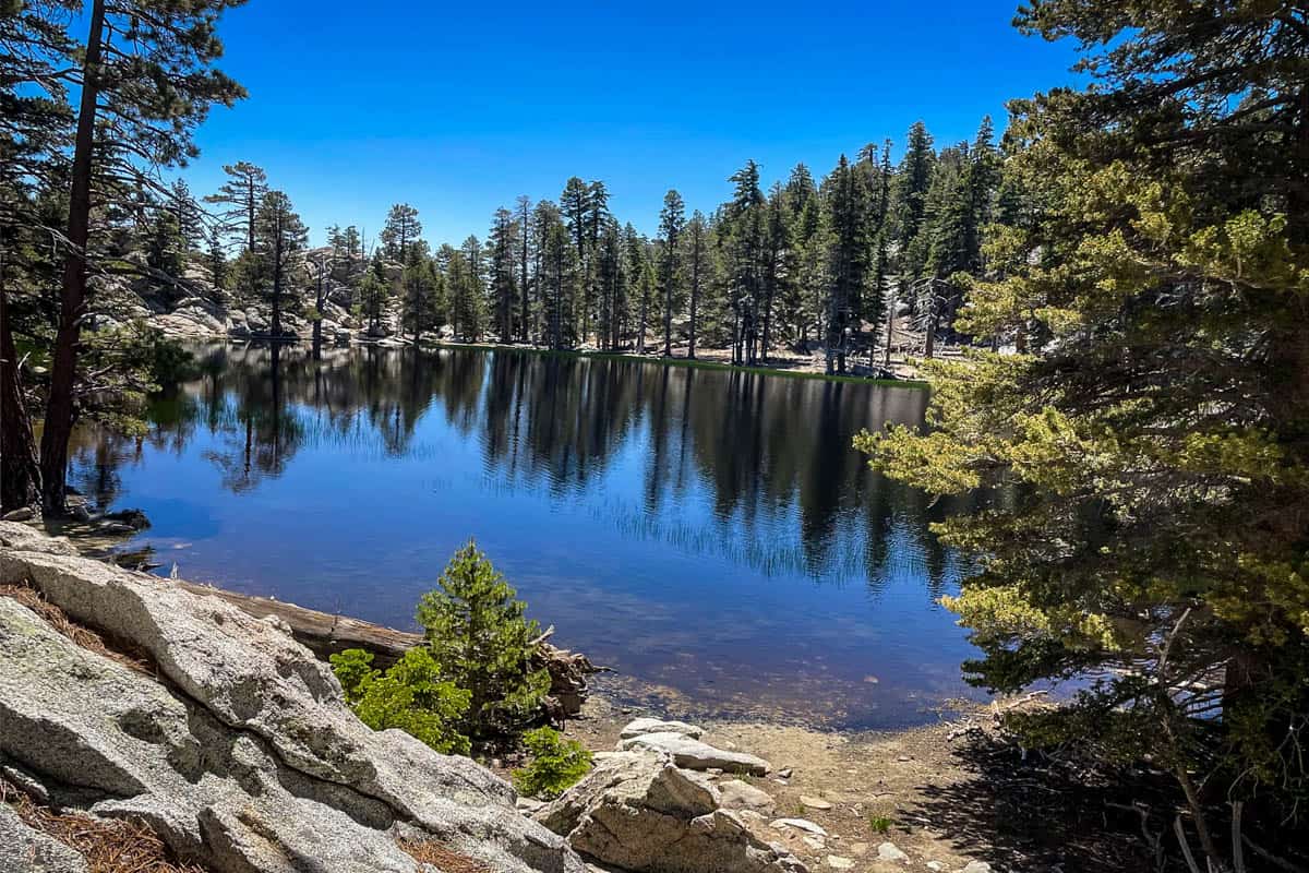
15. Willow Creek Trail to Hidden Lake
- Distance: 5-mile loop
- Elevation gain: 950 feet
- Difficulty rating: Moderate
- View the trail notes
For this impressive loop hike, take the aerial tram up to Mountain Station. Again, make sure you get a free self-issued wilderness permit at the ranger station on your way.
You can hike the loop in either direction, but most people recommend doing it counter-clockwise. From the tram station, this means starting on Round Valley Trail, then connecting to High Trail and, finally, Willow Creek Trail.
Hidden Lake is reportedly tricky to find, so we highly recommend downloading the offline AllTrails map. Like many other Palm Springs hikes, water levels are dependent on recent rainfall, so aim for late spring to see Hidden Lake in all its glory.
Best time to go hiking in Palm Springs
Palm Springs is a year-round hiking destination, but the best time is late winter through spring. Not only is the weather perfect for hiking, but this is also when local creeks and waterfalls are at their peak.
Fall is comfortable weather-wise, but don’t expect to see any water.
As far as summer, the overwhelming recommendation is to avoid hiking here. The unrelenting sun is obviously unpleasant, but it’s also legitimately dangerous, with high risk of dehydration, heat stroke, and other heat-related illness.
What to pack for hiking in Palm Springs
- Navigation*: we recommend using Alltrails+ to download the offline trail map
- Get your first week of using Alltrails+ for FREE when you sign up using our link!
- Hiking daypack
- Water bottles and/or bladder for your Camelbak
- Sun protection: sunscreen, hat, sun glasses
- Bug repellant
- Headlamp (if hiking near dawn or dusk)
- Camera/tripod (this one’s our favorite for hiking)
- Hiking layers (here is a great resource if you’re wondering what to wear hiking)
- Comfortable hiking boots or shoes
- We recommend Chacos for hiking in the desert like this as they are super versatile and you can get them wet when necessary (like for the Murray Canyon hike)
- Hiking poles (optional)
- Plenty of snacks: check out our favorite hiking snacks here!
Be sure to download our FREE hiking packing list before your next trip and never leave another essential behind again!

Roundup of the best hikes in Palm Springs and the surrounding area
Here’s a roundup of all the best Palm Springs hikes so you can see everything in one place.
- Tahquitz Canyon
- Murray Canyon Trail to Seven Falls (Indian Canyons)
- San Jacinto Peak
- Andreas Canyon (Indian Canyons)
- Desert View Trail
- Palm Springs Museum and North Lykken Trail
- Museum Trail
- Victor Loop (Indian Canyons)
- Hidden Valley Trail (Joshua Tree National Park)
- South Lykken Trail
- Cahuilla Peak via Araby Trail
- Heart Rock & Arch Rock via Arch Rock Trail (Joshua Tree National Park)
- Skull Rock (Joshua Tree National Park)
- Inspiration Peak Trail (Joshua Tree National Park)
- Willow Creek Trail to Hidden Lake
You may also like…
- Best Hikes at Joshua Tree National Park, California
- Indian Canyons: Palm Springs Hiking Guide
- Beginner Hiking Tips: Essential Info & Preparedness
- Hiking Lunch Ideas to Keep You Fed on the Trail
Save this article on Pinterest for later!

We want to hear from you!
Have you done any of the Palm Springs hikes on this list? What was your experience like? Are you planning a trip to the desert and want more advice? Comment below and let us know!