While best known as a world-class climbing destination, Smith Rock hikes are bucket list-worthy, with jaw-dropping scenery and trails spanning all lengths and difficulty levels. This guide details the best Smith Rock State Park hikes, plus other essential details!
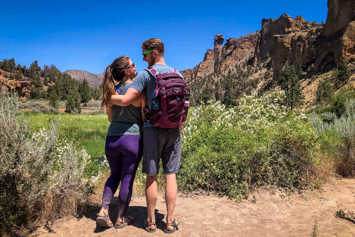
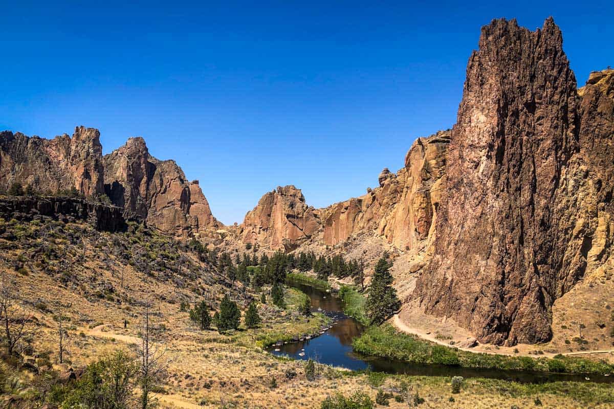
One of the 7 Wonders of Oregon, Smith Rock State Park is incredibly unique and wildly popular (understandably so!).
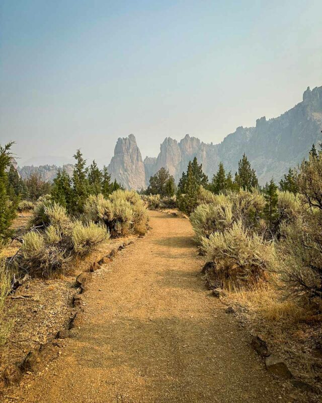
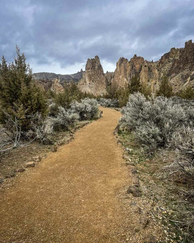
While it’s practically synonymous with rock climbing (there are literally thousands of climbs in the park!), don’t overlook Smith Rock hikes. The high desert terrain and craggy, volcanic rock formations make an excellent playground for all types of outdoor enthusiasts.
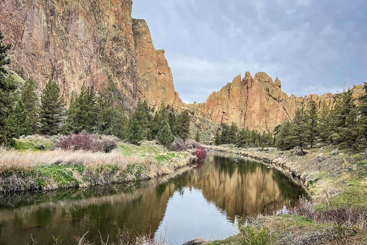
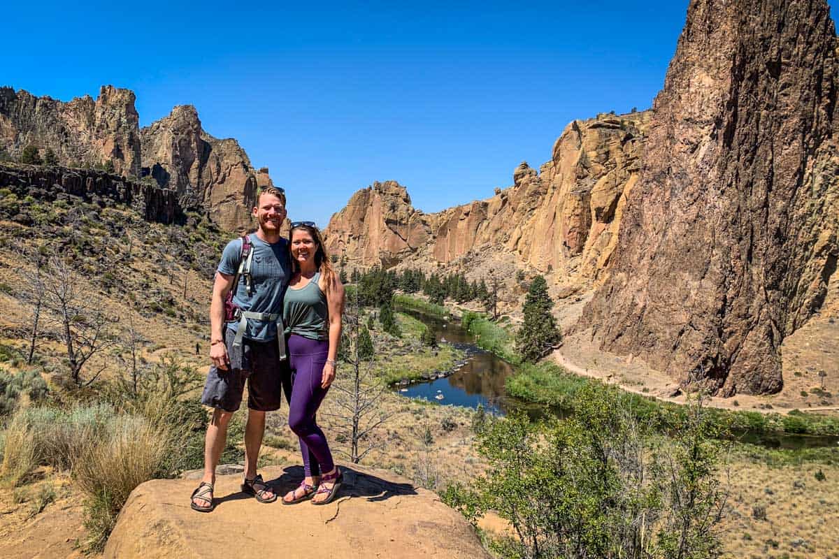
In this almost otherworldly state park, you can hike alongside the Crooked River, scramble over boulders, and come face-to-face with larger-than-life rock spires…all on a single trail.
Keep reading to learn about the park’s best trails, along with all the specifics of hiking Smith Rock.
Psst! We have a complete guide to Smith Rock State Park on our sister site to help you plan your visit!
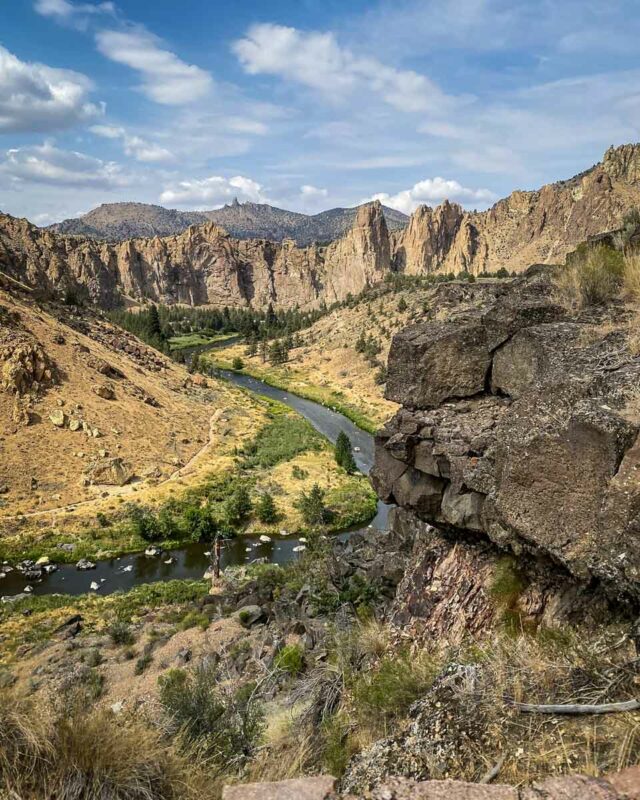
1. Misery Ridge Trail
- Distance: 2.2 miles, out and back
- Elevation: 1,115 feet
- Difficulty Rating: Moderate – Challenging
- View the trail guide
The Misery Ridge trail highlights the best of Smith Rock’s unique, dramatic features: sheer cliffs, steep climbs, river views, and the opportunity to watch rock climbers and slackliners in action.
Be prepared for serious thigh burn on this trail, even more so than other Smith Rock hikes. It climbs 1,000 feet in just over a mile (which also means coming down is just as tricky as going up!)!
It’s well worth the effort, though, for the unforgettable views across the valley to the Cascades.
Misery Ridge connects to other Smith Rock State Park hikes including the Summit Trail, so you can turn this into a much longer day.
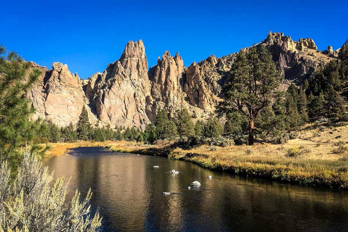
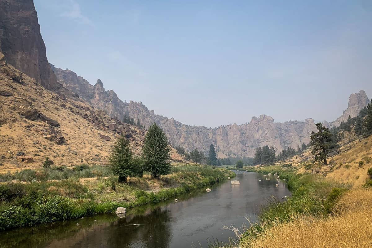
2. Crooked River Trail
- Distance: 4.5 miles, out and back
- Elevation: 321 feet
- Difficulty Rating: Easy
- View the trail notes
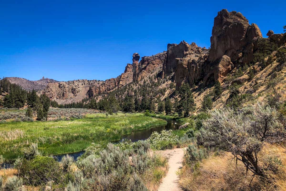
Known as one of the most mellow Smith Rock hikes, the Crooked River Trail covers a lot of ground in the park without gaining much elevation.
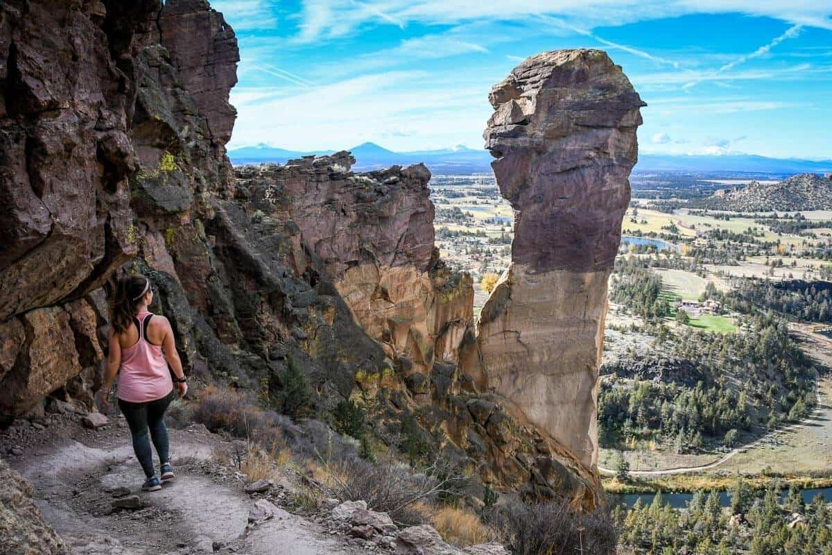
The trail follows the river, offering a perspective of the rugged landscape from down below. Keep your eyes open for Monkey Face, one of the park’s most famous formations.
To get closer to it, and also enjoy views from above, take the Misery Ridge trail back, connecting via the Mesa Verde trail. This adds just under a mile to your total distance.
3. Summit Loop
- Distance: 7-mile loop
- Elevation: 1,774 feet
- Difficulty Rating: Challenging
- View the trail notes
While Misery Ridge is the highlight of hiking Smith Rock, think of the Summit Loop as your comprehensive guide to the park.
You’ll hike on sections of five different trails, enjoying the Crooked River, Monkey Face, and the Monument along the way. The Monument is popular with rock climbers, but not so much with hikers, so this trail offers a rare opportunity to leave crowds behind.
Like many other Smith Rock hikes, you can choose between routes at several points. Who doesn’t love a good choose-your-own-adventure?
4. Rim Rock Trail
- Distance: 1 mile, out and back
- Elevation: 22 feet
- Difficulty Rating: Easy
- View the trail notes
More of a scenic walk, the Rim Rock Trail is one of the easiest, most family-friendly hikes in Smith Rock State Park. It clocks in at just a half-mile one way, yet offers gorgeous views over the Crooked River.
Like many others, this trail starts near the visitor center, then connects to the bivouac, AKA the “bivy,” the park’s only campground. The trail is wide, packed gravel, suitable for wheelchairs and strollers.
There are a few picnic tables and benches along the trail, making it a popular snack stop on the way in or out of the park. Don’t forget to look for rock climbers!
5. Wolf Tree Trail
- Distance: 2.7 miles, out and back
- Elevation: 407 feet
- Difficulty Rating: Easy
- View the trail notes
The Wolf Tree Trail starts just like the Crooked River Trail, except it veers right once you cross the bridge, instead of left. You’ll follow the river on a laid-back stroll, enjoying views of several popular climbing areas: The Monument, Picnic Lunch Wall, and Red Wall.
Many people turn around when the trail intersects with the Burma Road Trail, but you can also continue onto Student Wall. The views from the river gorge are fantastic from the top!
6. The Chute
- Distance: 0.5 miles, out and back
- Elevation: 167 feet
- Difficulty Rating: Moderate
- View the trail notes
Despite being just half a mile long, The Chute is one of the steeper Smith Rock hikes. Not-so-affectionately also known as “The Grunt,” The Chute is a popular connector trail to many of the park’s canyon and river hikes.
On several trails like Crooked River, hikers have the choice between taking The Chute or the Canyon Trail for a short distance beyond the overlook. While the Canyon Trail is more gentle, The Chute offers a quick, exciting workout.
No matter how grueling it is, remember it’s very short!
7. Canyon Trail
- Distance: 3.4 miles, out and back
- Elevation: 452 feet
- Difficulty Rating: Moderate
- View the trail notes
Speaking of the Canyon Trail, it’s another one of the best Smith Rock State Park hikes. Like The Chute, people use it as a connector trail just as often as they hike it on its own.
Canyon Trail is worthwhile, offering a ton of diverse scenery in a relatively short distance. You’ll walk along the river for awhile, see lesser-known climbing areas including Christian Brothers, and navigate around giant boulders.
Generally speaking, if you’re hiking the Canyon Trail itself, you should continue straight on the mail trail past the junction with The Chute. If you’re connecting to another trail, keep to the right to meet The Chute — several other Smith Rock hikes shoot off here.
Notably, there’s a well-maintained bathroom right near where Canyon Trail meets The Chute.
8. Homestead to North Point Loop
- Distance: 1.8 mile, loop
- Elevation: 253 feet
- Difficulty Rating: Easy
- View the trail notes
This short but sweet trail delivers in a big way, with great views and lots of different terrain.
You’ll start by descending The Chute trail or taking Canyon Trail (which adds just 500 feet), then hopping on the flat Homestead Trail to meander alongside the river for a short distance. If you’re lucky, you may see horses fording the river!
Next, there’s a decently steep ascent up some switchbacks to get to the canyon rim. Once there, the North Point Trail takes you along the rim, getting up-close and personal with the park’s iconic craggy rocks. It eventually reconnects to Homestead Trail.
While North Point is pretty flat, there are a few exposed sections to be mindful of.
Golden eagles nest right across from the North Point trailhead year-round, so keep an eye out for them. Or better yet, bring binoculars!
9. Canyon Trail & Homestead Trail Loop
- Distance: 1.5 mile, loop
- Elevation: 206 feet
- Difficulty Rating: Easy
- View the trail notes
The Homestead Trail is a rarity among Smith Rock hikes for two reasons: it sees very little foot traffic and doesn’t cross the bridge, like nearly all other trails do.
To hike this easy-going, one-mile loop trail along the river, take the Canyon Trail to a well-signed opening in the fence, just beyond the helipad.
The first half-mile is almost totally flat. Past the horse ford, there are several boulders and a network of short, unidentified trails along the river gorge. Stick to the obvious loop and you’ll rejoin the Homestead Trail.
A .25-mile stretch of the trail ascends quickly over several switchbacks, challenging even veteran hikers. The silver lining is that the higher you get, the better the views.
10. North Point Loop
- Distance: 0.4 mile, loop
- Elevation: 3 feet
- Difficulty Rating: Easy
- View the trail notes
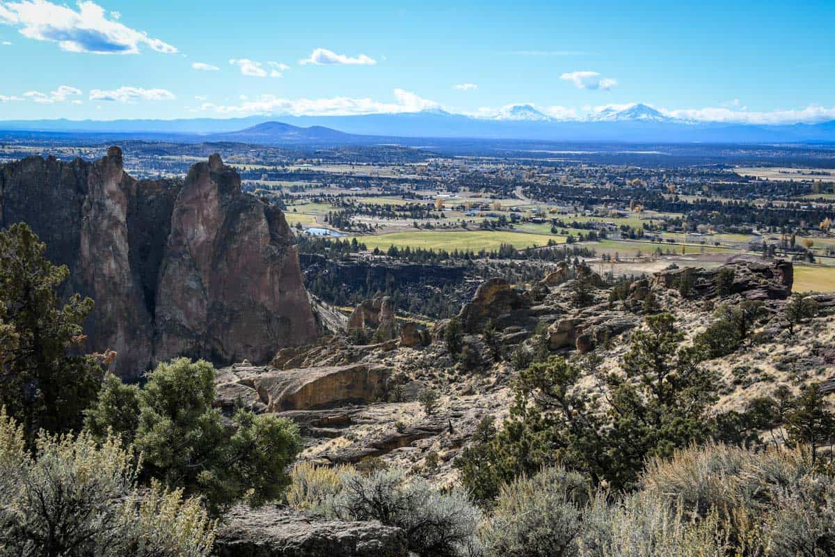
For being such an easy, short trail, North Point Loop offers outstanding views. You’ll see the river winding down below, as well as various panoramas of the park.
North Point Loop very literally follows the canyon rim, so be mindful of your footing, as well as any little ones or pets — the trail is quite exposed in several places, especially near the basalt columns.
Remember, this area is known golden eagle nesting habitat. Bring binoculars, as this is one of the highlights of hiking Smith Rock.
Note that although the trail is short, there’s absolutely no shade. Bring plenty of water and wear sunscreen protection, even if it’s not particularly hot.
What to pack for hiking at Smith Rock State Park
- Navigation: we recommend using Alltrails+ to download the offline trail map
- Get your first week of using Alltrails+ for FREE when you sign up using our link!
- Oregon State Parks Parking Permit (if you have one)
- Hiking daypack
- Water bottles and/or bladder for your Camelbak
- Bug repellant
- Sun protection: sunscreen, hat, sun glasses
- Camera/tripod (this one’s our favorite for hiking)
- Layers (here is a great resource if you’re wondering what to wear hiking)
- Comfortable hiking boots or shoes
- Microspikes (if there is any chance of snow and ice)
- Hiking poles (optional)
- Plenty of snacks: check out our favorite hiking snacks here!
Be sure to grab our ultimate hiking packing list includes our must-have gear for any hiking trail!


You may also like…
- Ultimate Guide to Smith Rock State Park
- Best Hikes Near Bend, Oregon
- How to Visit the 7 Wonders of Oregon
- Misery Ridge Trail Guide for Smith Rock
Save this article on Pinterest for later!


We want to hear from you!
Which of the Smith Rock hikes on this list has you excited to go hiking in Oregon?? Comment below and we’ll do our best to get back to you!