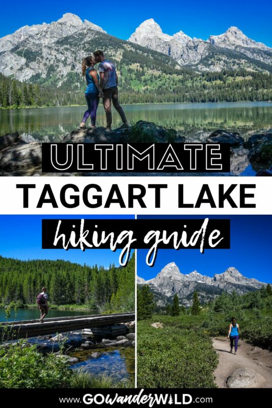
With easy access, a shimmering glacial lake, and gorgeous scenery along the way, Taggart Lake Trail in Grand Teton National Park is deservedly one of the most popular hikes in the park. In this guide, we share everything you need to know to safely hike to Taggart Lake.
Up-close mountain views and sparkling alpine lakes don’t typically belong in the same trail description as “family-friendly” or “short and sweet” (especially in Wyoming!), but Taggart Lake Trail is an exception.
On this stunner of a hike, you’ll enjoy nearly non-stop views right from the start and have the opportunity to visit not just one but two glacial lakes. Oh, and it’s a hotspot for wildlife sightings!
No wonder it’s one of the most popular hikes in Grand Teton National Park! There are other short hikes to choose from, but none highlight the iconic Tetons quite like this.
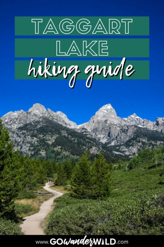
Taggart Lake Trail Guide
We’ve included some extra info for planning your Taggart Lake trail hike. Jump to the following sections (or just keep scrolling to see it all!).
- Taggart Lake trail stats
- Hike overview
- Taggart Lake trail map
- Know before you go
- The route
- Tips for hiking Lake Taggart trail
- Where to camp
- What to pack

Taggart Lake trail stats
- Location: Grand Teton National Park, Wyoming
- Distance: 3.5-6 miles, hiked as a loop or out-and-back
- Elevation gain: 420 feet
- Difficulty rating: easy to moderate
- Timing: 1.5-2 hours
- Pets: not allowed
- Permits: no special permits required
- View the trail notes
Taggart Lake trail overview
Whether you’re looking for a hike suitable for all abilities, you’re short on time, or you just want something lower impact, Taggart Lake is an excellent choice.
You definitely won’t have the trail to yourself, but the huge effort vs. reward payoff is worth the crowds.
The hike shows off outstanding views of the iconic Cathedral Group, lets you easily detour to a second alpine lake (Bradley) and put together your own route, and is accessible year-round—a rarity in the Tetons!
Taggart Lake trail map
Things to know before you go
The Taggart Lake trail is fairly straightforward and very well-traveled, but there are still several good-to-know’s before setting out.
Best time of year for the Taggart Lake hike
It’s honestly hard to define one ‘best’ time to hike the Taggart Lake trail. Unlike many other trails in Grand Teton, you can hike this one year-round (while Teton Park Road closes seasonally, the closure is just beyond the trailhead).
The most popular time is summer into early fall (July through September). This is generally the best weather, and when the trail and park roads are most likely to be clear. Adventurous hikers can also enjoy a chilly dip in Taggart Lake! However, the trail gets crowded.
Because Taggart Lake trail is accessible year-round, you can explore it on snowshoes or cross-country skis from late fall all the way through winter and spring.
The frozen lake, and the Tetons in general, is magical during these seasons, but it’s crucial to make sure you’re self-sufficient and prepared for extreme conditions. No park services are available, and very few other people will be around.
Local tip: If you’re hoping to do some leaf-peeping along the Taggart Lake trail, be aware that fall comes early and is short-lived in the Tetons. In a typical year, peak color is usually the very end of September and most trees will lose the majority of their leaves by mid-October.
How long does it take to hike the Taggart Lake trail?
Allow 1.5-2 hours to complete the Taggart Lake hike—if you’re hiking just to Taggart. Factor in another 30 minutes to one hour if you’re also hiking to Bradley Lake or doing the Beaver Creek Loop (both alternative routes detailed below).
Your individual hiking pace, as well as how much time you spend at the lake(s), may also change your timeframe slightly. Keep in mind that you’ll be hiking at an elevation of 6,700-6,950 feet. If you’re accustomed to lower elevation, you may hike a bit slower than normal.
How difficult is the Taggart Lake trail?
Most people, even with limited hiking experience, will find hiking to Taggart Lake on the easier end of moderate. The trail is well-beaten and relatively smooth, so even when it goes uphill, it’s not at all technical.
However, you are hiking at nearly 7,000 feet. The most challenging aspect of this hike is the elevation, especially for “flatlanders” (people who live at or near sea level). Fortunately, the trail doesn’t climb much, so most hikers will be just fine if they go slowly and drink plenty of water.
National Park Annual Pass
If you’re planning to visit more than one of the U.S. national parks, we’d highly encourage you to look into getting an annual park pass. At $30 per vehicle for the entrance fee, visiting Grand Teton National Park along with most other national parks in the U.S. can get expensive.
For just $80 per year, you can purchase the America the Beautiful Park Pass. This pass grants you free access to all of the national parks. Plus it also covers your entrance to over 2,000 natural, historical, and recreational sites across the United States.
→If you still need convincing, check out our article: America the Beautiful Annual Park Pass: Is it Worthwhile?
Wildlife on the trail
Lots of resident wildlife, including moose and both black and grizzly bears, make at least occasional appearances along the Taggart Lake trail. You may also see deer, elk, foxes, marmots, or beavers.
While sightings are somewhat common, close encounters with humans are not. Still, they do happen, so it’s a good idea to be ‘bear aware’ while exploring the Tetons. Try to hike in pairs or groups and make lots of noise on the trail. If you do see any wildlife, give them lots of space.
The route
We broke down the route for hiking the Taggart Lake trail into parts to give you an idea of what to expect on the route.
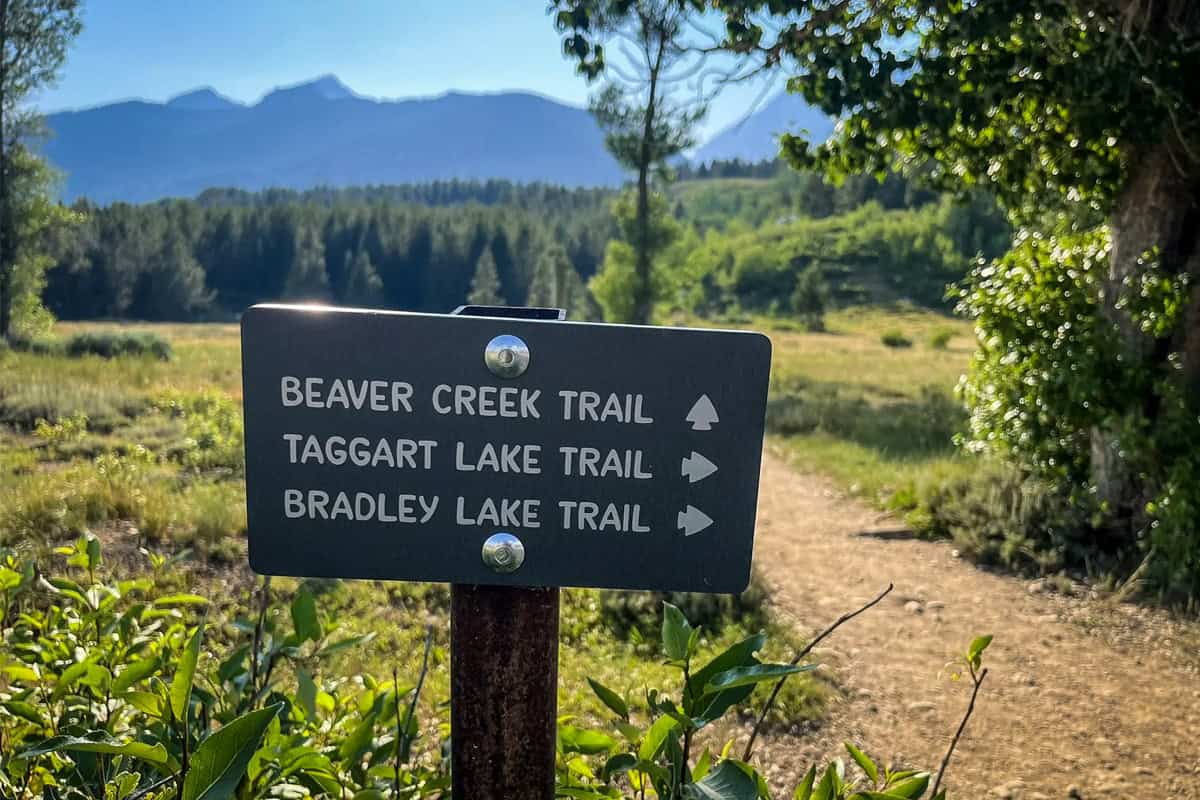
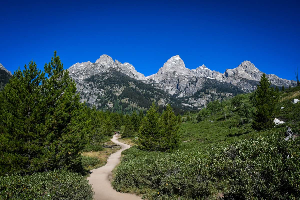
Whether you’re visiting just Taggart Lake or adding Bradley Lake, start from the Taggart Lake trailhead. Since it’s a loop, you can go either direction, but counter-clockwise (right) offers the best views, with the Teton Range in front of you most of the way.

Stay straight and slightly to the right for the first 0.2 miles. You’ll pass a trail split to Beaver Creek on the left at 1/10 of a mile, and a gated gravel road 1/10 of a mile after that.
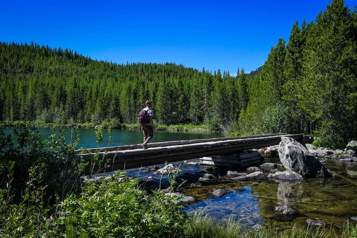
At 0.25 miles, cross a picturesque footbridge over Taggart Creek. Depending on the time of year, there may be a small waterfall.
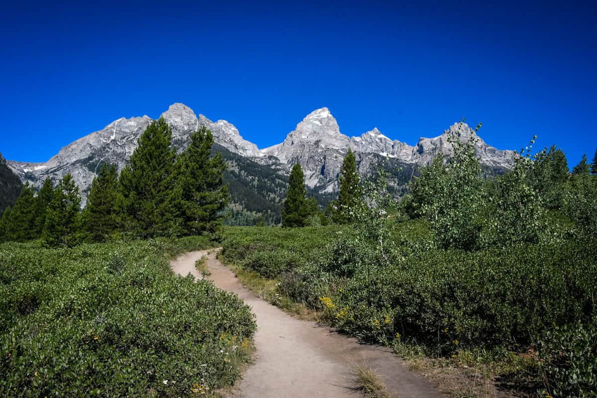
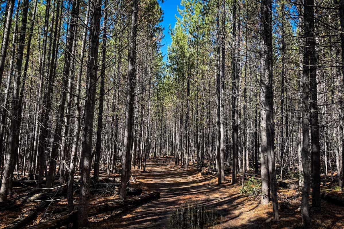
Shortly after the bridge, you’ll pass horse corrals on your right and walk through a thick aspen grove. Here, the trail starts to gain gentle elevation over a moraine, undulating up and down as it follows the creek.
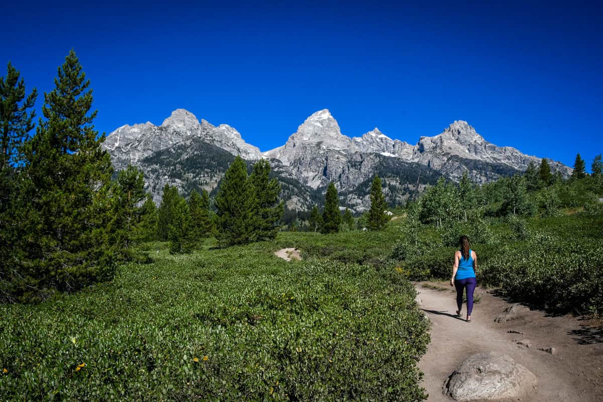
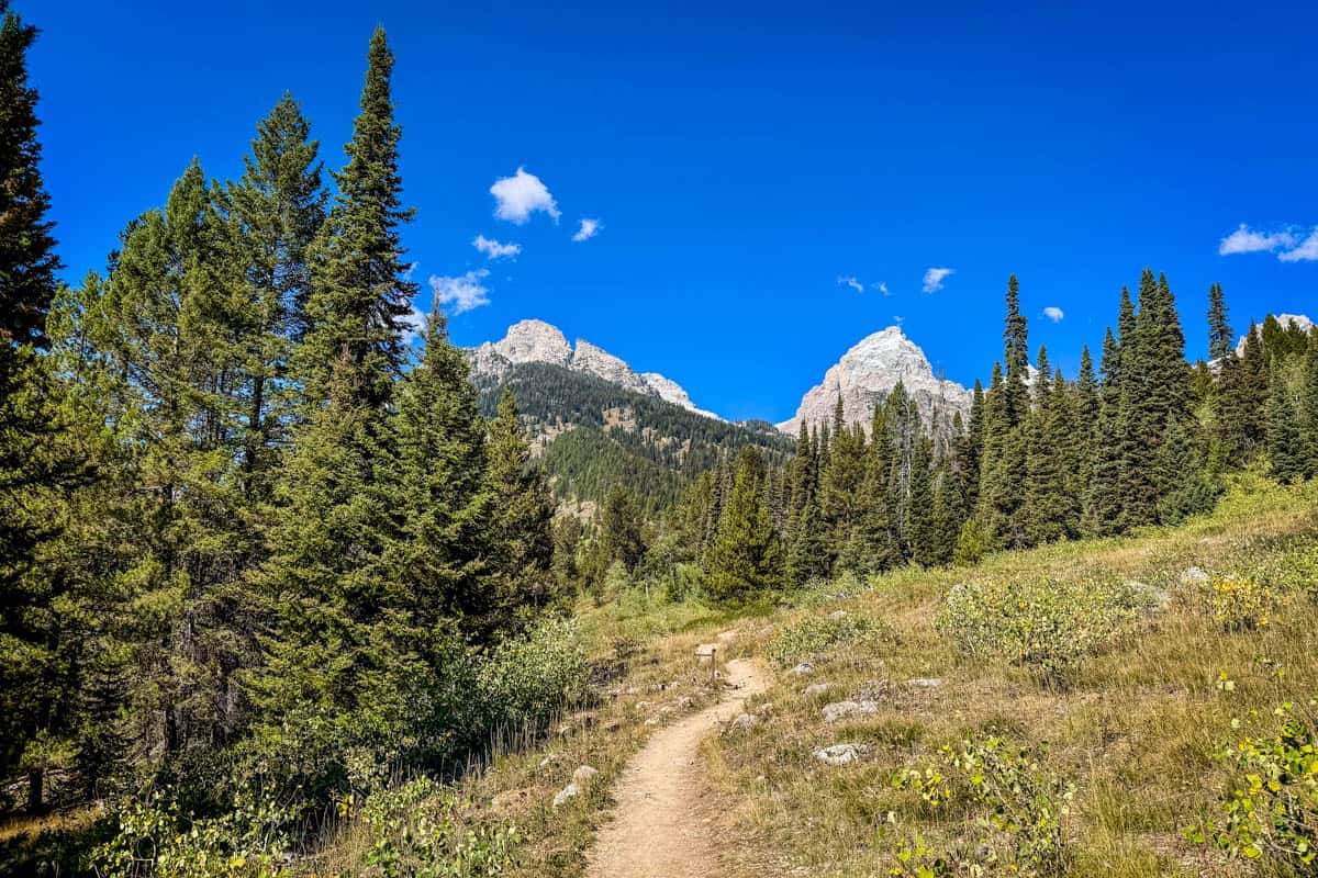
Right around the one-mile mark, the trail crosses a meadow, opening up to panoramic views of the Cathedral Group. Be on the lookout for a trail junction to Bradley Lake just over one mile in.
Taggart Lake
At the Bradley Lake trail split, it’s decision time. If you’re headed directly to Taggart Lake, go left. However, going right takes you on a loop that includes both lakes and is only slightly longer and little additional effort. We detail that route later.
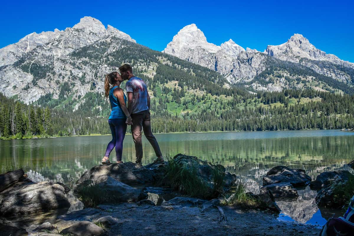
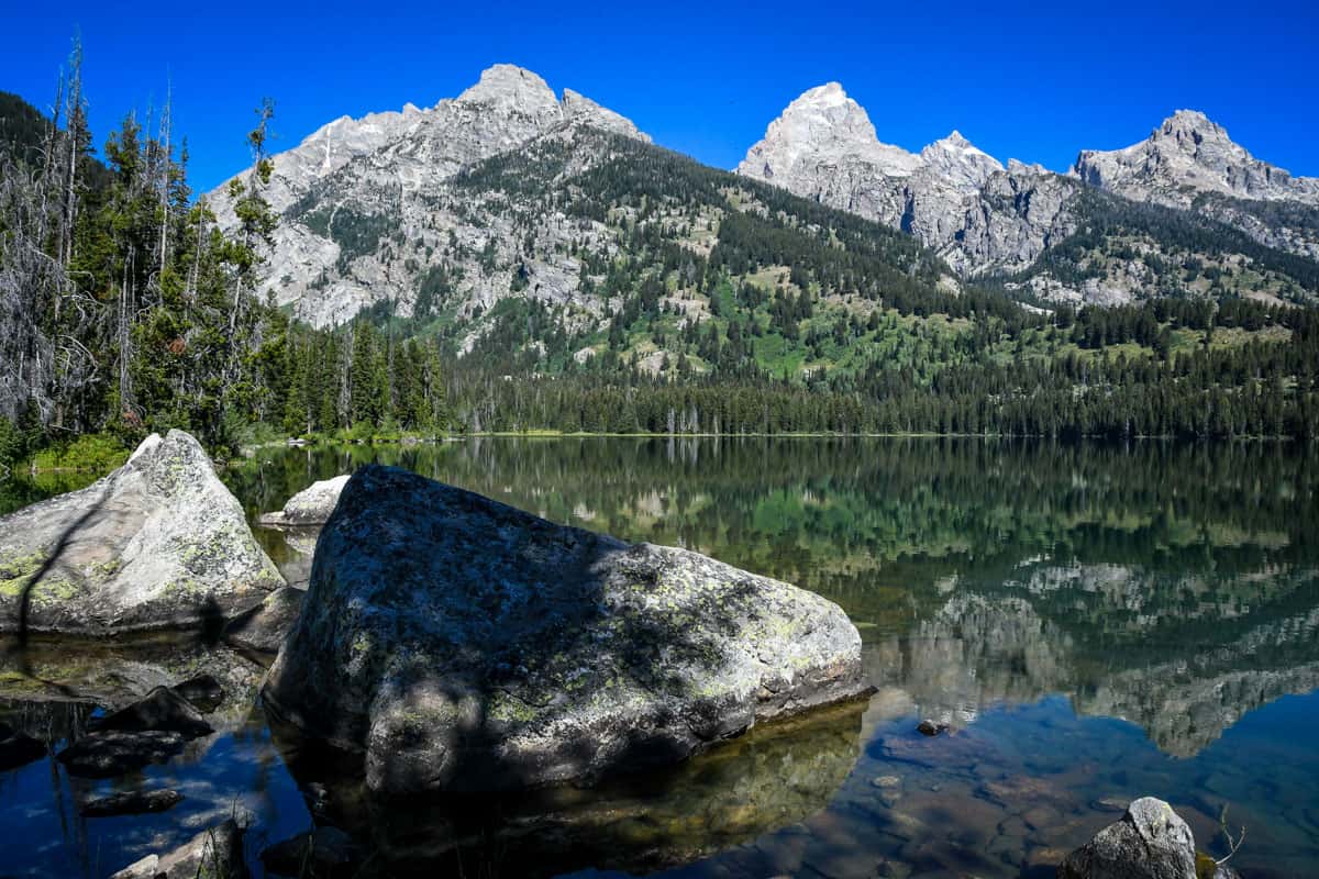
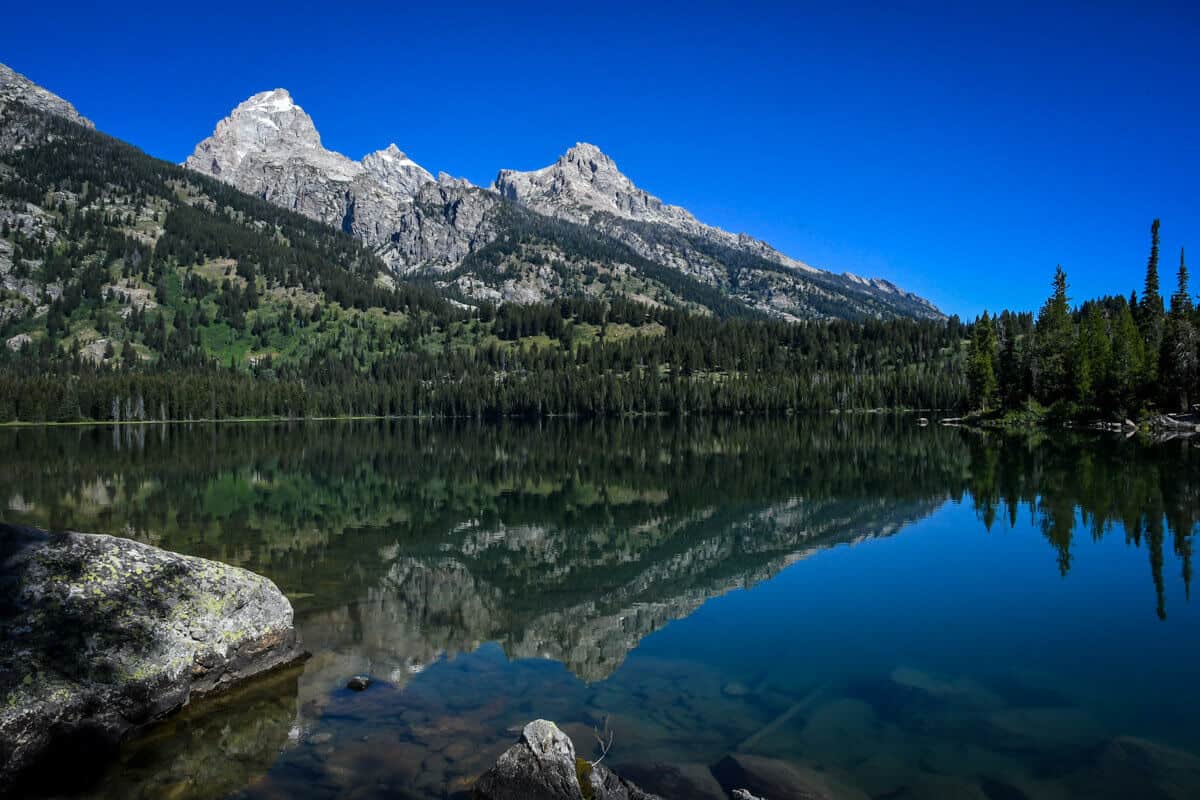
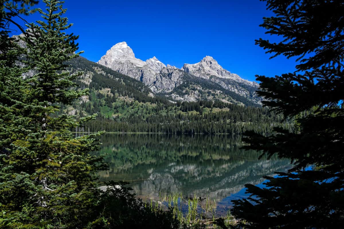
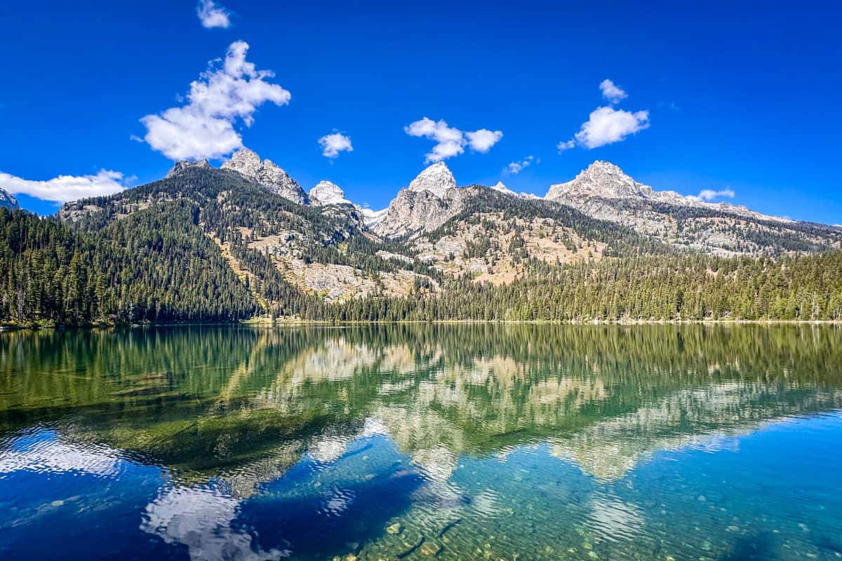
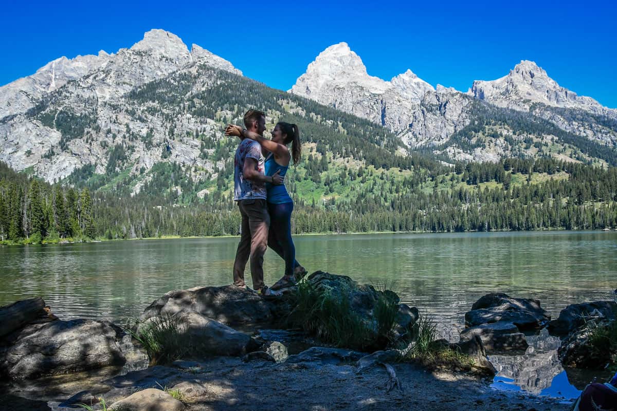
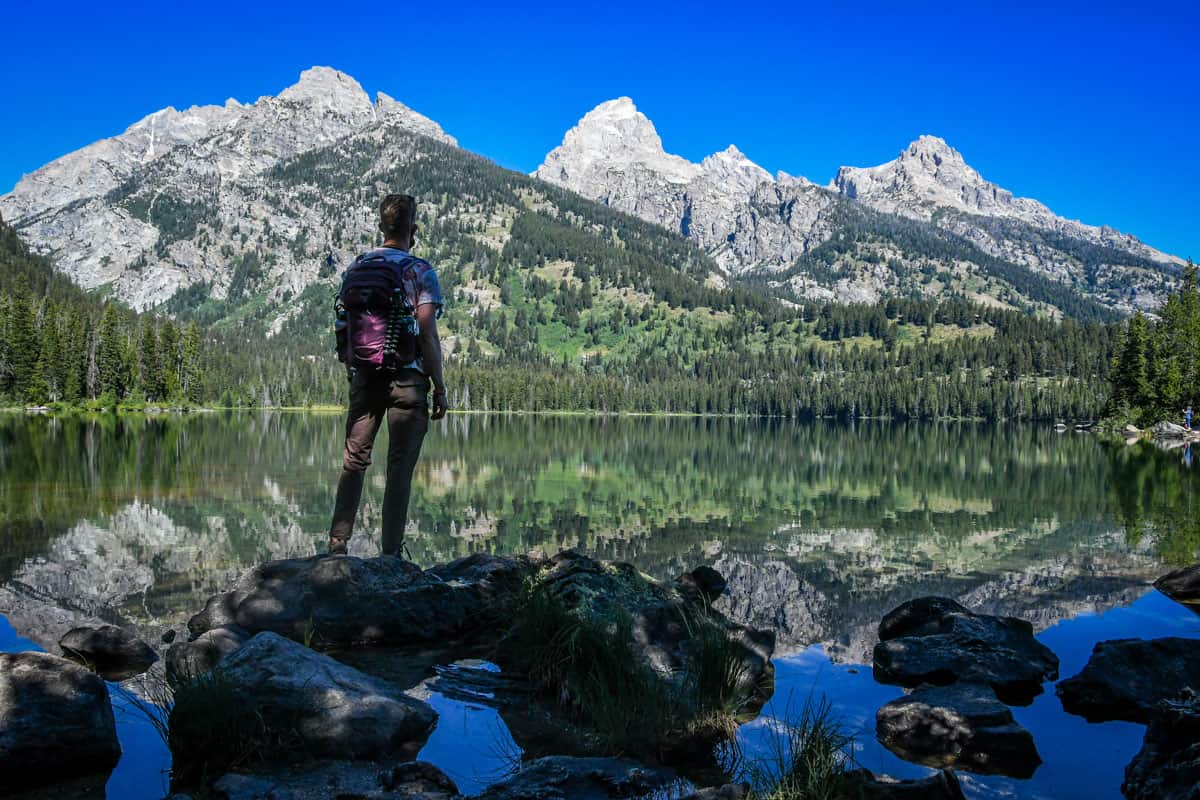
To get to Taggart Lake, pass through a short stretch of dense forest before arriving at the lakeshore in under half a mile. The forest opens up just before the edge of the lake, revealing a dramatic view with the Tetons towering above the water.
If you catch the right time of day and calm conditions, you can photograph the peaks’ reflection in the lake.
After taking in the views, get back on the trail and head back to the parking lot.
Again, you have a choice of routes: do an out-and-back lollipop loop, retracing your steps on the Taggart Lake trail, OR complete the true loop by taking the Valley Trail counter-clockwise (away from Bradley Lake).
For the full loop, cross a small bridge over the lake’s inlet with Taggart Creek in about one-tenth of a mile. Next, climb a short but slightly steep section. Other than that one ascent, this last stretch of the hike is easy and relatively flat.
Reconnect to the Taggart Lake trail just over half a mile from the lake and follow it back to the trailhead.
Taggart Lake-Bradley Lake Loop
To visit both alpine lakes without much added time or effort, and to get the best views on the entire hike, go right at the Bradley Lake trail junction (just shy of 1.1 miles in on the Taggart Lake trail).
The trail climbs some, gaining most of its elevation in the stretch between 1.5-1.9 miles. At the trail’s high point, you’ll be able to see Taggart Lake off to your left.
You’ll reach Bradley Lake after tackling two more moderate ridgelines and a handful of small switchbacks. It’s significantly smaller than Taggart Lake, but also far less crowded, so enjoy a few minutes here. Look for faint trails leading to the lake for water access.
When you’re ready, follow the signs toward Taggart Lake and finish the loop back to the parking lot as described above. The path between the lakes is winding and hilly with a short climb to a ridgeline, but not at all difficult.
A few switchbacks bring you down from the ridgeline, through thick forest and to Taggart Lake.
Taggart Lake-Beaver Creek Loop
If you prefer the path less traveled, consider heading back to your vehicle via the Beaver Creek trail. This alternate route adds less than a mile and is just as scenic, plus has the added benefit of far fewer hikers.
Get on the Valley Trail as if you’re following the more popular Taggart Lake trail back, but head in a more southerly direction. Look for the Beaver Creek trail junction and take a left to complete the loop.
For about 1.25 miles, you’ll ascend and descend, climbing a moraine and ridgeline and then coming down through an expansive bowl and meadows into the valley.
Although you can see wildlife anywhere on the trail, chances are particularly high on this stretch that runs close to the creek and meadows. Keep your eyes open for deer, elk, moose, and bears.
Toward the end of the loop, the trail leads away from the creek and the views open up again. From the high point of this section, enjoy sweeping views of Jackson Hole and the Gros Ventre Mountains in addition to the Teton Range.
When you come to a final trail junction, go right and walk a short distance back to the parking lot.
Tips for hiking to Taggart Lake
- Add Bradley Lake and/or take the Beaver Creek Trail for little additional effort. The Taggart-Bradley Loop is just over five miles total, and taking the Beaver Creek Trail back instead of the Taggart Lake loop adds 0.8 miles.
- Start VERY early or late in the day. The parking lot fills early, especially in the summer and fall. You can park along Teton Park Road, but be sure you’re not sticking out in the road or blocking anything.
- Be aware of summer afternoon storms. They’re extremely common in the Tetons, so as a general rule, it’s a good idea to avoid hiking in canyons and valleys in the middle of the day. Again, start very early or wait until sunset.
- Biting insects can be brutal in the peak of summer. Don’t forget bug spray!
- Dress in layers. Most of the trail is fully exposed, but the forested sections can be significantly cooler and year-round, the weather may chance at a moment’s notice.
- There are bathrooms in the parking lot. In the busy summer months, the park even brings in additional porta-johns. They’re heavily used, though, so bring hand wipes or sanitizer!
Where to camp nearby
Grand Teton National Park has seven campgrounds, including three within a 20-minute drive of Taggart Lake trail (Jenny Lake, Gros Ventre, and Signal Mountain).
However—campsites in the park are extremely hard to come by, especially for summer dates. ALL campsites in Grand Teton require reservations, and they become available on recreation.gov six months in advance.
Luckily for people who don’t necessarily plan trips that far out, there are several alternatives.
The best option is the vast Bridger-Teton National Forest, directly across from GTNP, which has both dispersed camping and developed sites. Unlike the park campgrounds, all camping in the national forest is first-come, first-served.
Here are some of the best and closest national forest campgrounds to Taggart Lake.
- Atherton Creek (30 minutes): Developed campground on Lower Slide Lake with a paved road and a few sites that accommodate up to 30-foot RVs
- Toppings Lake/Spread Creek (35 minutes): Dispersed camping along a forest road with a popular lower area that has a pit toilet and more private sites up the road
- Shadow Mountain (40 minutes): Popular dispersed campground with beautiful Tetons views but a notoriously rough road
You can also try your luck on Grassy Lake Road in the John D. Rockefeller, Jr. Memorial Parkway, up near Yellowstone National Park. There are 14 free primitive sites along the road, usually accessible for the season by the end of June.
What to pack for hiking the Taggart Lake trail
- Navigation: we recommend using Alltrails+ to download the offline trail map
- Get your first week of using Alltrails+ for FREE when you sign up using our link!
- Hiking daypack
- Water bottles and/or bladder for your Camelbak
- Bug repellant
- Sun protection: sunscreen, hat, sun glasses
- Headlamp
- Camera/tripod (this one’s our favorite for hiking)
- Lots of layers (here is a great resource if you’re wondering what to wear hiking)
- Comfortable hiking boots or shoes
- Hiking poles (optional)
- Plenty of snacks: check out our favorite hiking snacks here!
Be sure to download our FREE hiking packing list before your next trip and never leave another essential behind again!
You may also like…
- Grand Teton Hikes You Don’t Want to Miss!
- 4-Day Grand Teton to Yellowstone Itinerary
- Delta Lake Hike: Grand Teton National Park Trail Guide
- Beginner Hiking Tips: Essential Info & Preparedness
Save this article on Pinterest for later!
We want to hear from you!
Comment below if you have questions about the Taggart Lake trail in Grant Teton National Park and we’ll do our best to get back to you!