Central Oregon has no shortage of waterfalls, but Sahalie and Koosah Falls are standouts. Aside from being practically side-by-side and easily accessible, they’re close to several other must-see sites. This guide gives you all the details on what to expect at both falls.
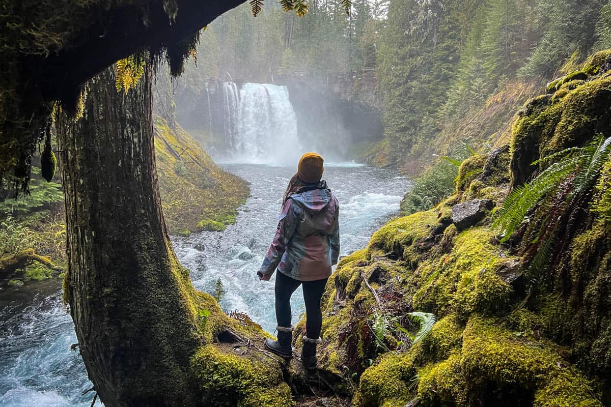
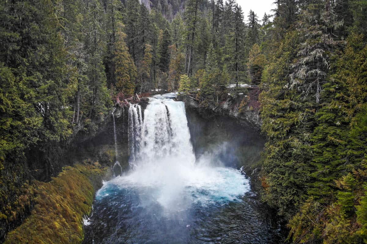
An easy-to-reach, stunning pair of cascades on the impossibly blue McKenzie River—it’s easy to see why Sahalie and Koosah Falls are some of the most popular waterfalls in Oregon.
You can reach both falls, 74 feet and 100 feet respectively, on an easy-going, family-friendly hike that starts merely steps from one of two parking lots. Choose from a gorgeous loop trail or a short out-and-back, both offering outstanding viewpoints.
To make Sahalie and Koosah Falls an even more appealing adventure, the trailhead is close to several other incredible natural attractions, including the famous Tamolitch Blue Pool and Clear Lake.
Sahalie and Koosah Falls Contents
- Sahalie and Koosah Falls trail stats
- Hike overview
- Know before you go
- The route
- Tips for hiking to Sahalie and Koosah Falls
- Where to camp nearby
- What to pack

Sahalie and Koosah Falls trail stats
- Location: Willamette National Forest, near McKenzie Bridge, Oregon
- Distance: 2.5-mile loop
- Elevation gain: 360 feet
- Difficulty rating: easy to moderate
- Timing: 1-2 hours
- Pets: leashed dogs welcome
- Permits: none required
- View the trail notes
Sahalie and Koosah Falls hike overview
In Chinook Jargon, Sahalie means ‘heaven’ and Koosah means ‘sky,’ appropriate names for these beautiful, vibrant blue waterfalls that flow year-round.
On this short and sweet loop hike right off Highway 26, you’ll have the opportunity to hike along both sides of the McKenzie River, seeing the waterfalls from multiple vantage points.
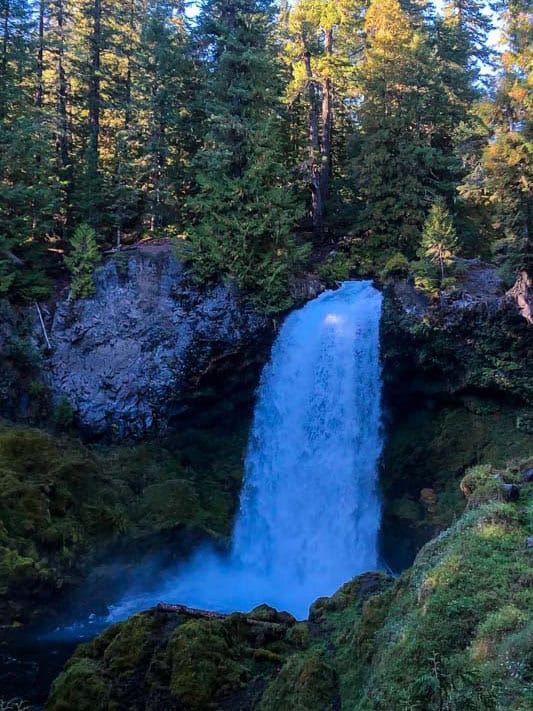
If Sahalie Falls looks familiar, well, it is. It was featured in the 1993 Disney movie Homeward Bound!
There’s a ton to explore in this area beyond Sahalie and Koosah Falls, making it the ideal weekend destination. Tamolitch Blue Pool, Clear Lake (famous for being frigid cold and having a perfectly preserved underwater forest!), and Belknap Hot Springs are all within 15 minutes!
Things to know before you go
The hike to these gorgeous waterfalls is easy and straightforward, but there are still several things to consider, including where you’ll start and whether you’ll do the loop or an out-and-back.
Best time of year to hike to Sahalie and Koosah Falls
Spring, specifically April through June, is the best time of the year to see Sahalie and Koosah Falls at their peak flow.
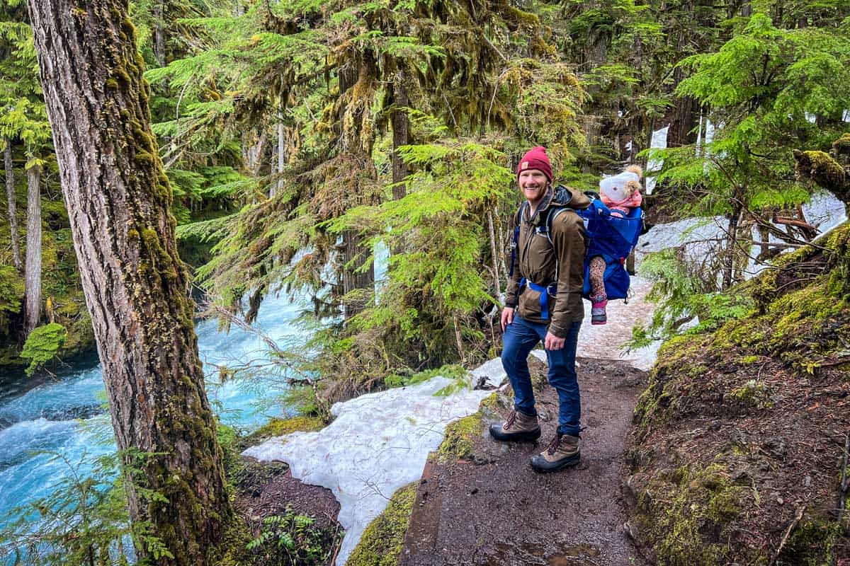
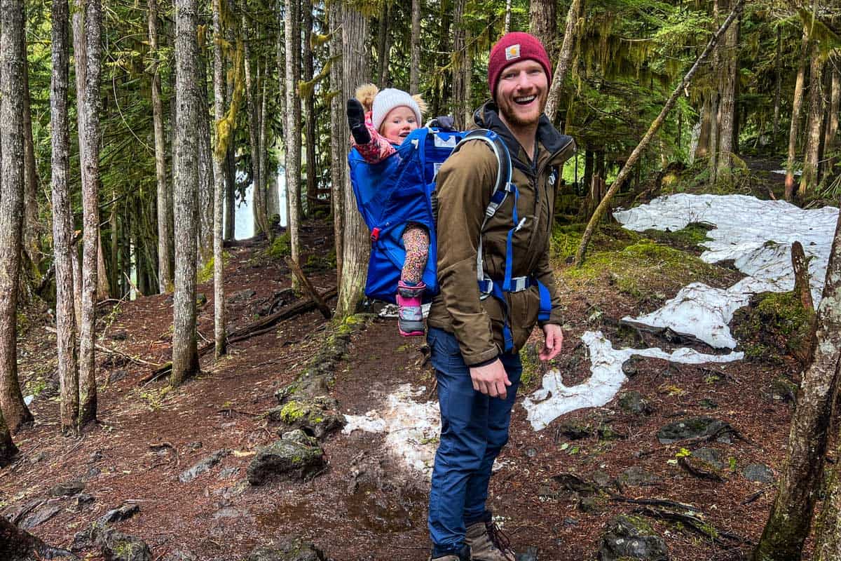
Winter is also a wonderful time to make the trip, when glistening snow blankets everything but the river and falls continue to flow. Note that the trails aren’t maintained and the parking lots aren’t accessible in winter, so you’ll have to start the hike from Ice Cap Campground.
While both waterfalls flow year-round, they’re at their lowest in late summer into fall. Summer can also bring surprisingly high temperatures, as well as crowds, to central Oregon.
And while it may rain in any season (this is the PNW, after all!), the forest canopy is thick enough along much of the trail that it provides a decent amount of shelter.
How long does it take to hike to Sahalie and Koosah Falls?
Even if you hike at a fairly slow pace or stop frequently to take pictures, you should be able to see both Sahalie and Koosah Falls in 1-1.5 hours.
How difficult is the Sahalie and Koosah Falls hike?
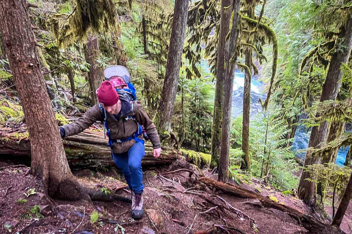
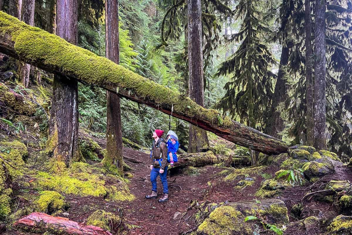
Hiking to Sahalie and Koosah Falls is on the easier end of moderate. This hike is absolutely beginner- and child-friendly, but there are some exposed tree roots and uneven ground to navigate.
Notably, the Sahalie Falls viewpoint on the east side of the river is accessible for wheelchairs and strollers. The overlook is less than 100 feet from the parking lot, on a wooden platform.
The route
We broke down the route for hiking the Sahalie and Koosah Falls trail into parts to give you an idea of what to expect on the route.
Parking
The majority of people start their hike from the Sahalie Falls parking lot, but we actually recommend you start at the lot for Koosah Falls.
They’re less than a half-mile apart, but the Koosah Falls lot sits just slightly back from the highway and doesn’t have a bathroom, so it’s consistently less busy.
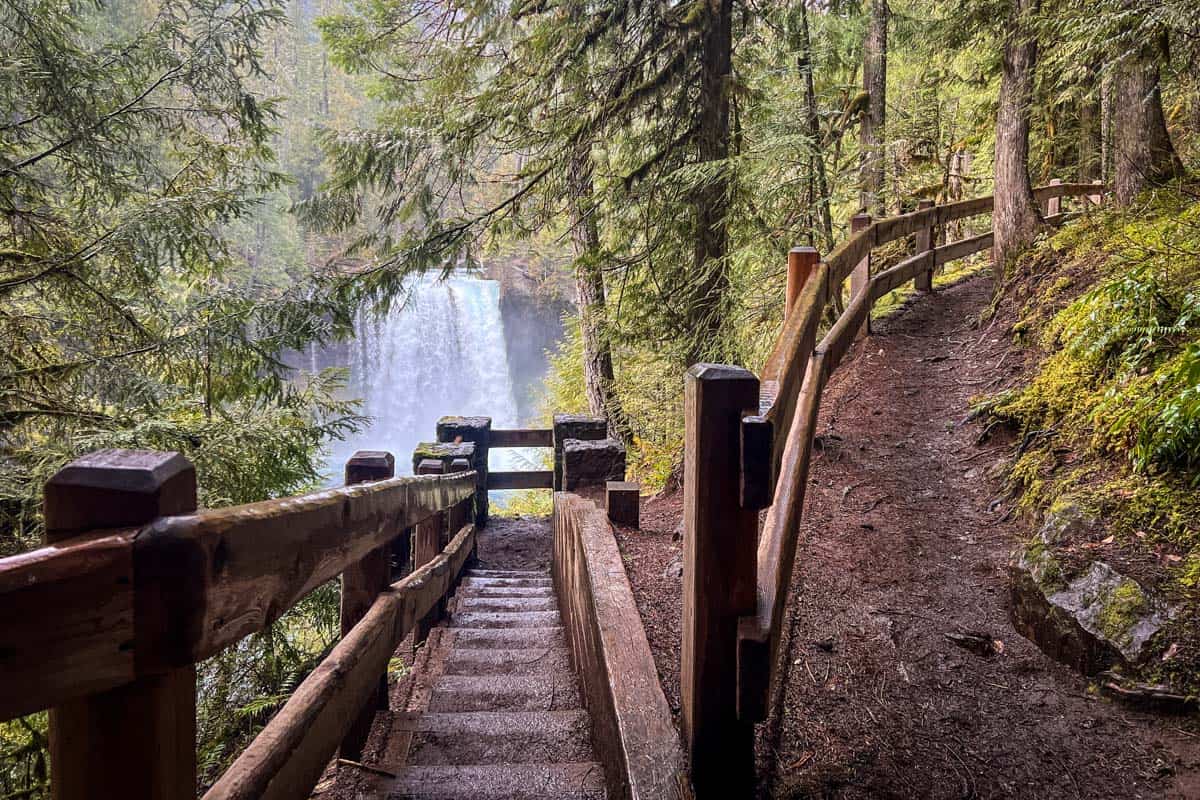
From the Koosah Falls parking lot, it’s a short distance down some stairs to the first viewing platform. Depending on the time of year, Koosah may look like a massive, wide curtain of water or two distinct, smaller streams tumbling over the rock.
The trail
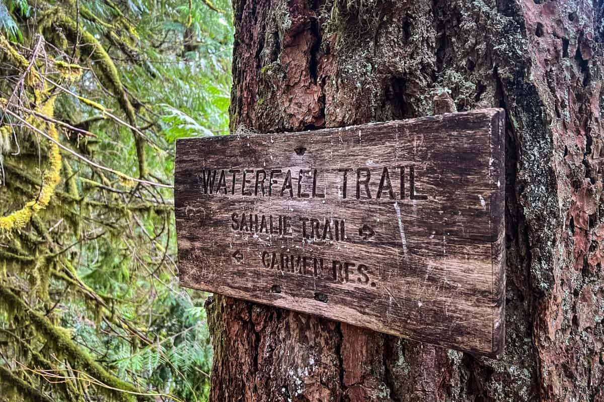
To start your hike, follow the signs for the Waterfall Loop Trail (written on some signs as “Waterfalls Trail”) to your left, walking the loop in a clockwise direction.
In just one-tenth of a mile, you’ll pass Ice Cap Campground on your left and see Carmen Reservoir straight up ahead. When you reach the reservoir, take a right and walk along the dirt Forest Road 750 for a short distance.
You’ll cross a narrow bridge over the river pretty quickly, but beware of a faint false trail heading into the woods immediately after it. It leads to nowhere, so be mindful of staying on the forest road.
Look for the McKenzie River Trail junction at the edge of the reservoir (marked by simply “Trail”), and take a right. You’ll be walking almost straight north through the forest for a few minutes, until the trail turns you sharply to the right, bringing you closer to the river again.
Koosah Falls views
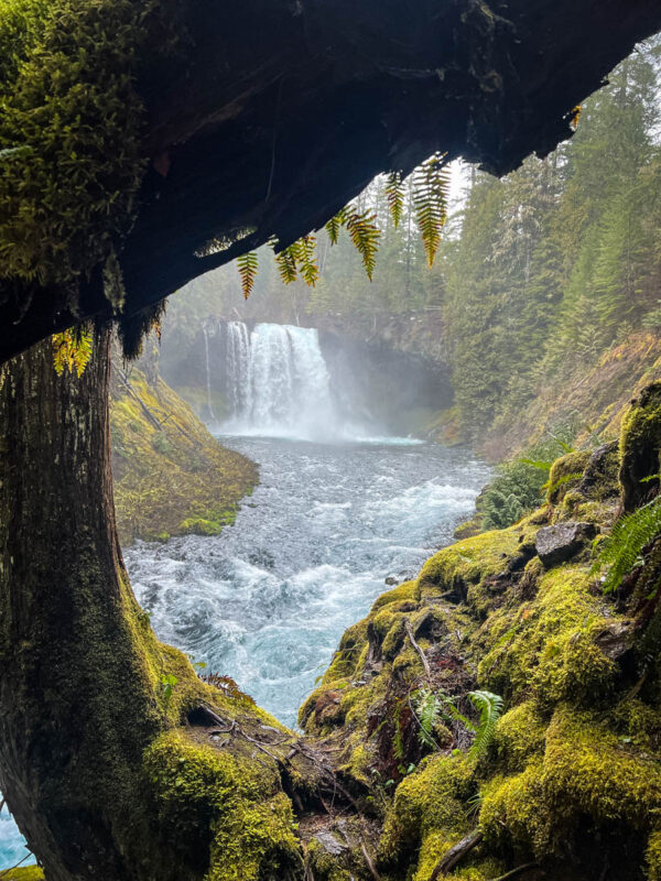
Many visitors check out Sahalie and Koosah Falls only from the viewpoints closest to the parking lots, completely skipping this entire western side of the loop. Doing the hike clockwise lets you enjoy this uncrowded section, plus offers multiple unique views of both waterfalls.
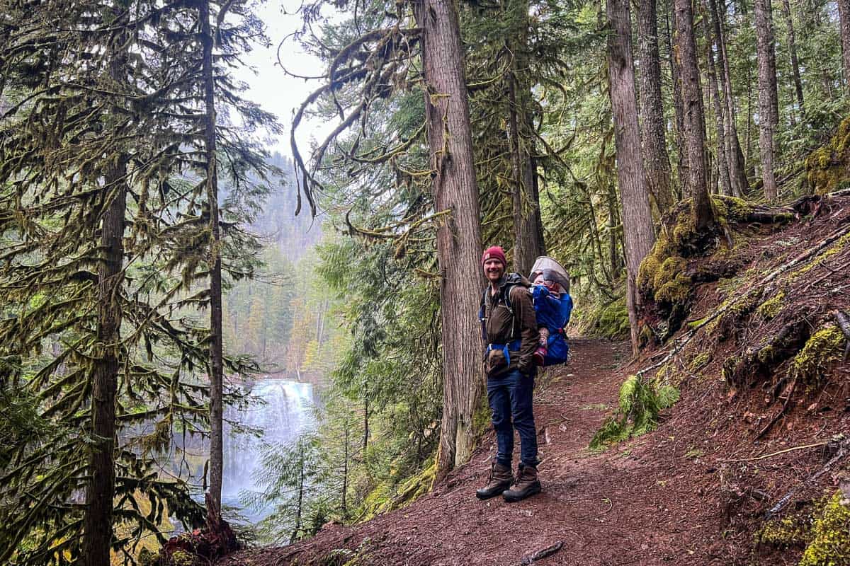
When the trail once again runs parallel to the river, you’ll be walking upstream. Along the way, be sure you stop to take in the many scenic viewpoints—not only of the two waterfalls, but the river, as well. Many people consider this 1.3-mile stretch the most scenic part of the loop.
Be aware that, on the west side of the loop, the viewpoints don’t have railings or other protective barriers. You can get surprisingly (and alarmingly!) close to the edge at some points.
Soon, you’ll come to the second viewpoint of Koosah Falls, looking at it from the west riverbank this time.
Sahalie Falls views
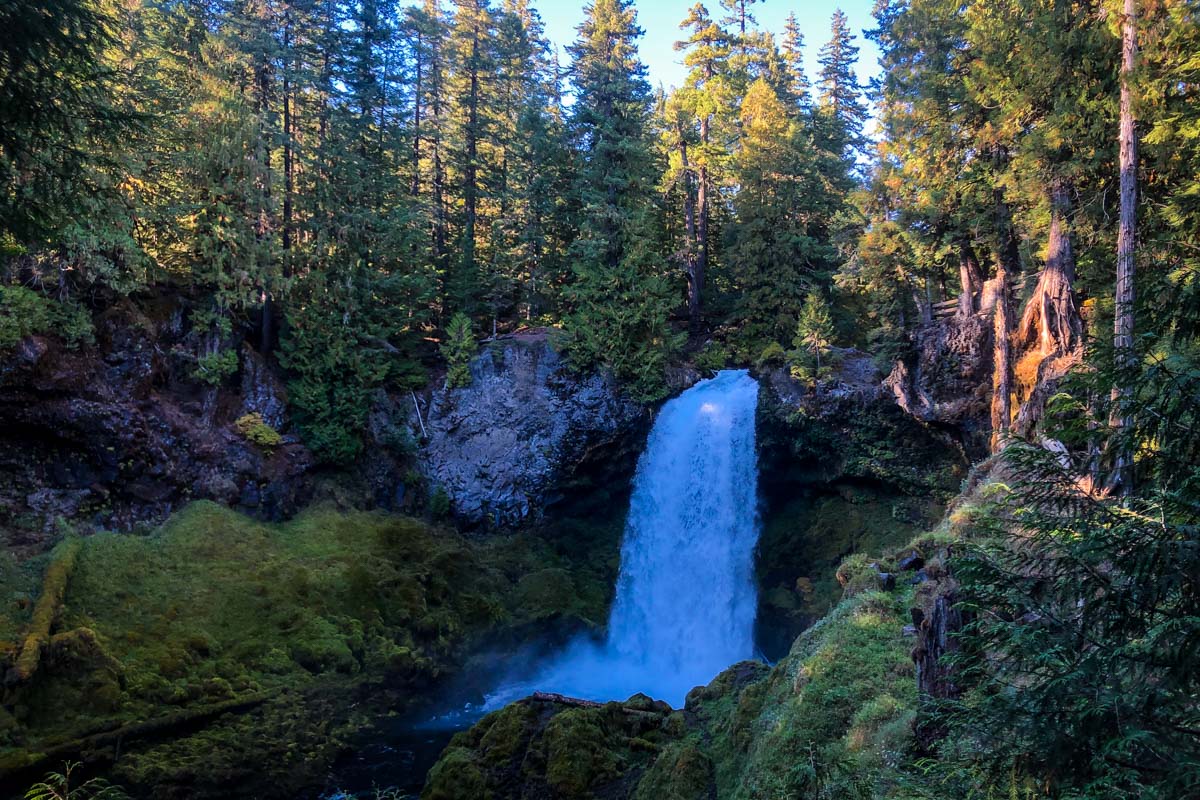
Continue upriver, and before you know it, you’ll reach the Sahalie Falls West Viewpoint. This impressive, thundering waterfall sometimes has a second cascade just to its right, emerging from another lava bowl.
The trail stretches on, meandering alongside the river, until you come to a wide, picturesque footbridge crossing it.
Watch the signs here, because the McKenzie River Trail picks up again but leads in the opposite direction, north toward Clear Lake. To get back to your vehicle, you want to reconnect with the Waterfalls Loop Trail, now heading downstream (south).
About 0.4 miles past the bridge, you’ll enter an old-growth forest just before the ‘main’ (and likely very busy) Sahalie Falls viewpoint. Emerging from the forest to see the falls revealed like this adds a layer of excitement that makes this hike momentarily feel much more secluded.
Back to the parking lot
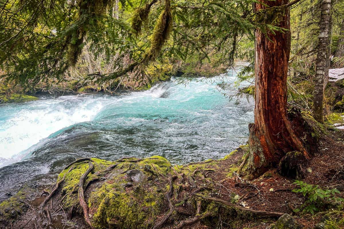
The first Koosah Falls viewpoint, where you started, is just another 0.4 miles, but this section of trail is especially scenic. Between Sahalie and Koosah Falls, the McKenzie River stair-steps in a series of unnamed but very impressive cascades.
If you need any facilities before heading back to your vehicle, the Sahalie Falls parking lot has two vault toilets and a handful of picnic tables. The parking lot is a super short walk from the overlook, less than 100 feet.
Tips for hiking to Sahalie and Koosah Falls
- Park at Koosah Falls or Ice Cap. The Sahalie Falls parking lot is perpetually busy and crowded, while these two alternatives are much quieter.
- The Sahalie Falls viewpoint is accessible for wheelchairs and strollers. It’s a wooden surface and a very short walk to the best view.
- Plan on being wet and/or muddy. The waterfalls put off a ton of moisture, even during drier periods, so there’s always mist to contend with and, usually, a muddy trail.
- Make it at least an overnight trip. There’s great camping nearby and other areas to explore, including Belknap Hot Springs, Tamolitch Blue Pool, and Clear Lake.
- Bring traction devices if you visit in winter. The trail isn’t maintained, so snowshoes and trekking poles are helpful.
Where to camp nearby
There are three developed campgrounds close to Sahalie and Koosah Falls. The third is Trail Bridge Campground, but it’s closed until the spring of 2026.
- Ice Cap Campground: Right at the Waterfalls Loop trailhead (in fact, you can park in the day use area here for your hike!) with 22 sites available May through September, over half of which are reservable in advance on Recreation.gov
- Cold Water Cove: Up at the southern end of Clear Lake, 1.3 miles from the main Sahalie Falls trailhead, 34 sites open May through October with both reservable and first-come, first-served options
Because Sahalie and Koosah Falls are in the Willamette National Forest, you can also find plenty of dispersed camping nearby—very possibly even free!
What to pack for hiking to Sahalie and Koosah Falls
- Navigation: we recommend using Alltrails+ to download the offline trail map
- Get your first week of using Alltrails+ for FREE when you sign up using our link!
- Hiking daypack
- Insulated water bottle
- Bug repellant
- Sun protection: sunscreen, hat, sun glasses
- Camera/tripod (this one’s our favorite for hiking)
- Lots of layers (here is a great resource if you’re wondering what to wear hiking)
- Comfortable hiking boots or shoes
- Microspikes (if there is any chance of snow and ice)
- Hiking poles (optional)
- Plenty of snacks: check out our favorite hiking snacks here!
Be sure to download our FREE hiking packing list before your next trip and never leave another essential behind again!
You may also like…
- How to Visit the 7 Wonders of Oregon
- Beautiful Oregon Waterfalls to Visit
- Best Hot Springs in Oregon
- Best Hikes in Oregon (for all ability levels!)
Save this article on Pinterest for later!
We want to hear from you!
Have you hiked to Sahalie and Koosah Falls? What was your experience like? Are you planning a hike to the falls and have more questions? Comment below and let us know!