When hiking in Oregon, there is something for everyone. Whether you’re a beginner or an experienced hiker, we’ve got the perfect hike listed here just for you. From the most epic views to the most unique hikes, this article has all the best hikes in Oregon to make any outdoor-lover happy!
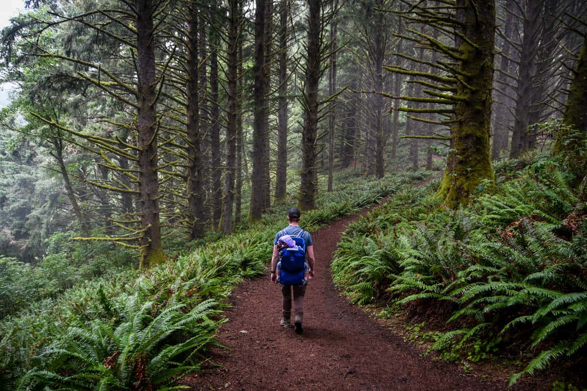
Oregon boasts some of the most scenic and dramatic hiking trails in the Pacific Northwest, so we’ve rounded up the best hikes in Oregon to help you plan your adventures around this diverse state.
From the deserts of East Oregon to the dramatic views on the Oregon Coast, use this list of the best Oregon hikes to make the most out of your Oregon itinerary.
Oregon Hikes Guide
- Our favorite hikes in Oregon
- Best easy hikes in Oregon
- Best moderate Oregon hikes
- Best challenging Oregon hikes
- Best multi-day hikes in Oregon

Our favorite Oregon hikes
These are some of the best hikes in Oregon that pack a serious punch when it comes to scenery and views and our personal favorite Oregon trails.
1. Haystack Rock Trail
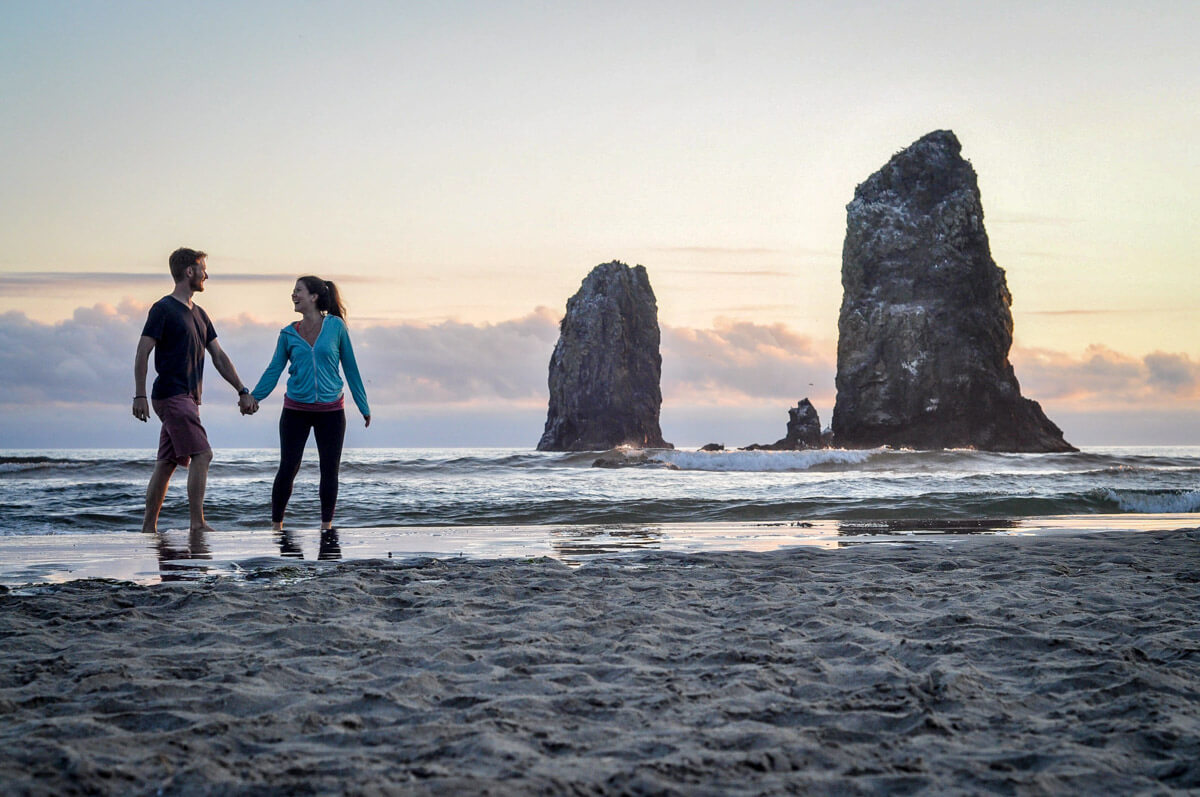
- Location: Cannon Beach, Oregon Coast
- Distance: 4.3 miles, out-and-back
- Elevation gain: 16 feet
- Difficulty rating: Easy
- Trail notes on Alltrails
One of the best hikes in Oregon for a colorful sunset on the beach is the Haystack Rock Trail on Cannon Beach. Hike as far in as you’d like to see seabirds, massive rock formations, and picturesque scenery for photos. Consider hiking this Oregon trail during low tide to explore the tidepools near Haystack Rock.
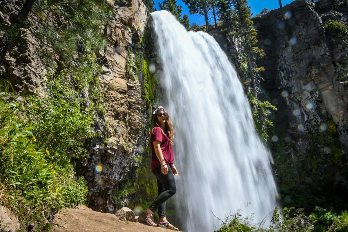
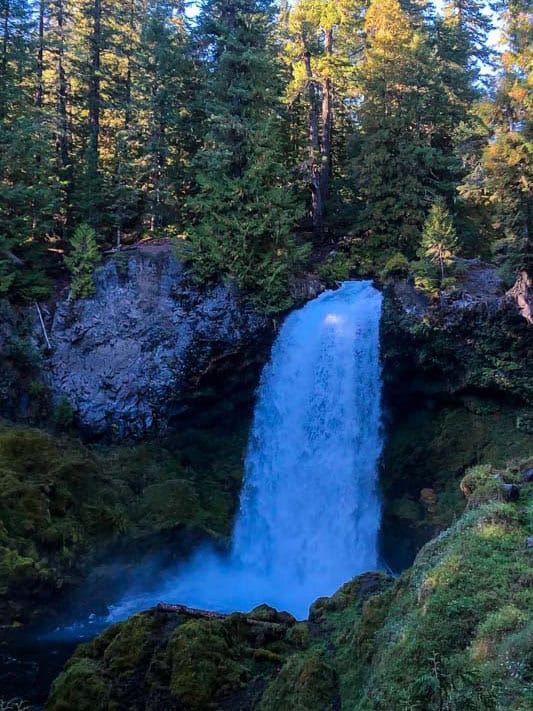
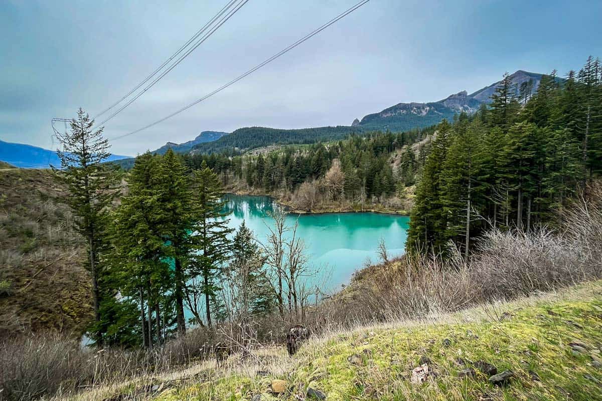
2. Tamolitch Blue Pool via the McKenzie River Trail
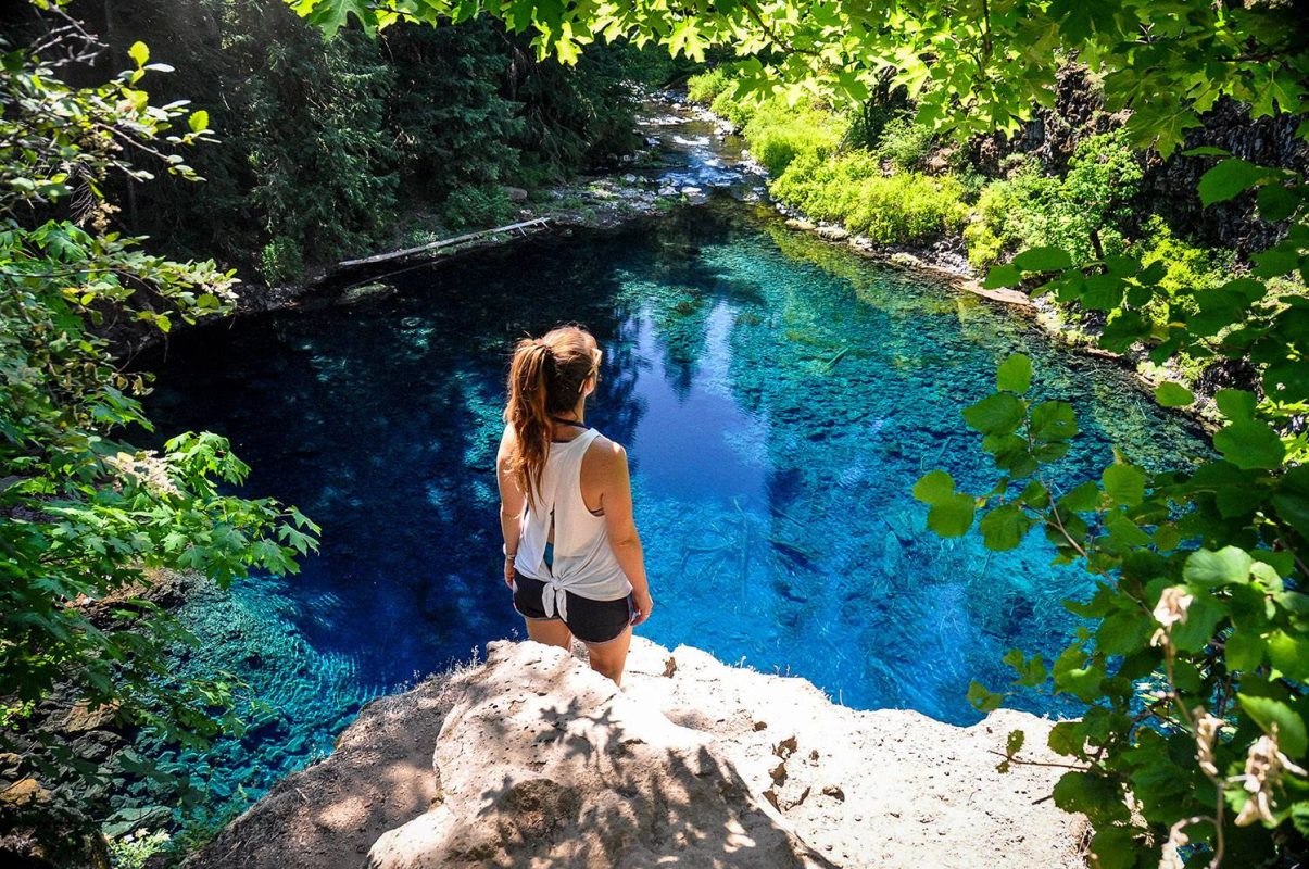
- Location: Willamette National Forest
- Distance: 3.7 miles, out and back
- Elevation gain: 305 ft
- Difficulty rating: Moderate
- Trail notes on Alltrails
This short section of the McKenzie River Trail brings you to the stunning turquoise Tamolitch Pool (also known simply as the Blue Pool). There are no filters used on this photo – the water really is that blue!
You’ll begin your hike walking through an old growth Douglass fir forest. The hike is relatively flat, but be careful for tree roots and slippery rocks. We have all the directions and information you need in our guide to visiting the Tamolitch Blue Pool.
3. Proxy Falls Loop Trail
- Location: Willamette National Forest
- Distance: 1.6 miles, loop
- Elevation gain: 147 feet
- Difficulty rating: Easy
- Trail notes on Alltrails
Hike through lava fields and dense forests to see two beautiful waterfalls near Bend. This Oregon waterfall trail is perfect for day hikers and families and is best hiked from March through November.
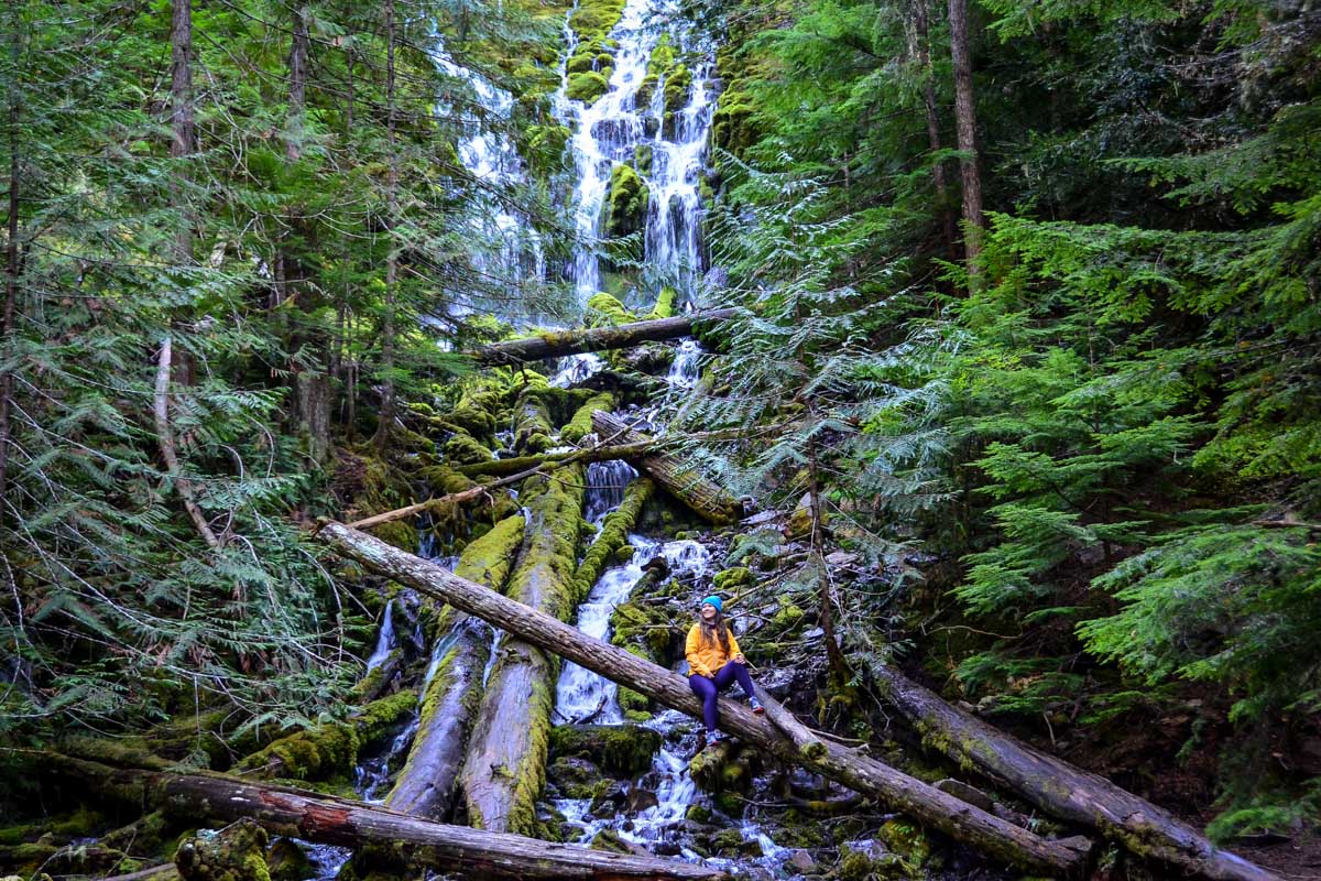
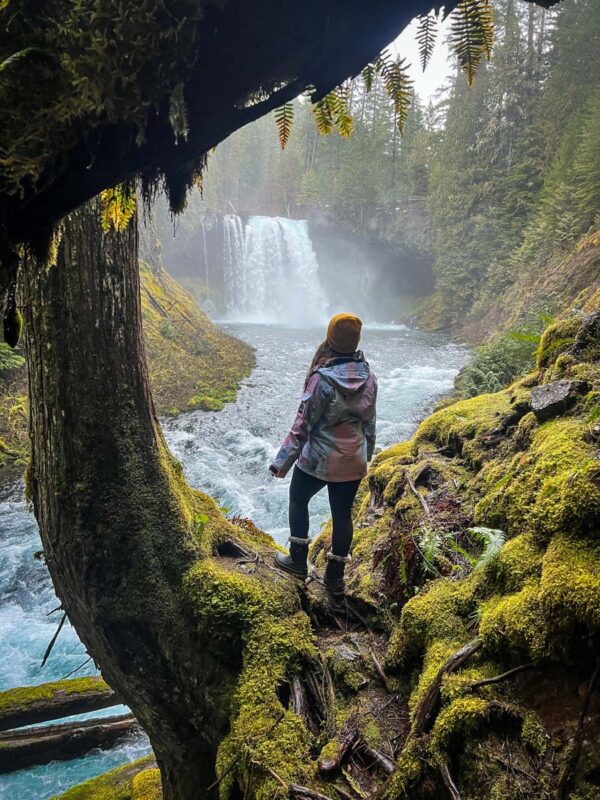
4. Tumalo Falls Trail
- Location: Deschutes National Forest
- Distance: 6.5 miles, out-and-back
- Elevation gain: 583 feet
- Difficulty rating: Moderate
- Trail notes on Alltrails
Start the Tumalo Falls Trail early to beat the crowds and enjoy this 90-foot falls pouring over a basalt ledge. Depending on how far you go, you’ll be able to spot over seven different waterfalls on this route. This trail is popular for day hikers and mountain bikers.
We put together a detailed guide to the Tumalo Falls hike so you’ll know exactly how to get there and what to expect.
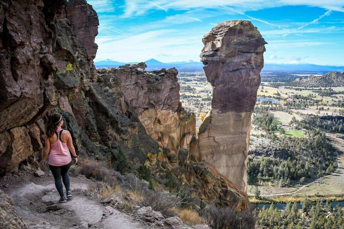
5. Misery Ridge Trail
- Location: Smith Rock State Park
- Distance: 3.5 miles, loop
- Elevation gain: 948 feet
- Difficulty rating: Challenging
- Trail notes on Alltrails
Explore the Misery Ridge Trail in the spring or fall to enjoy views of the Crooked River winding through Smith Rock State Park. At the viewpoint, look for remnants of Oregon’s largest volcanic eruption, almost 29.5 million years ago within a collapsed caldera.
Psst! Check out our guide to visiting Smith Rock State Park on our sister site for all the information you need to plan your visit.
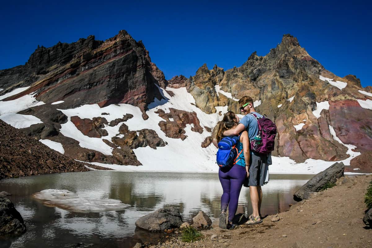
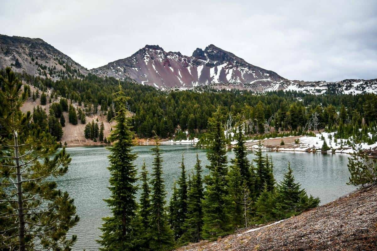
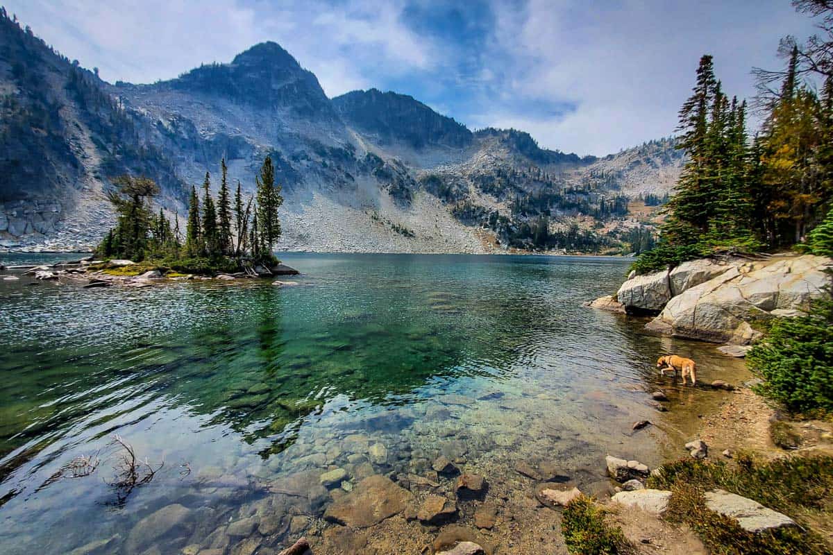
6. Broken Top Mountain to No Name Lake
- Location: Deschutes National Forest
- Distance: 5.5 miles, out-and-back
- Elevation gain: 1,420 feet
- Difficulty rating: Moderate
- Trail notes on Alltrails
Take the challenge to hike up Broken Top Mountain, a stratovolcano whose last activity was over 100,000 years ago. At the top, see No Name Lake sitting in the crater that was formed from glaciers carving the volcano over thousands of years.
We put together a detailed guide to hiking Broken Top so you’ll know exactly how to get there and what to expect.
Easy hikes In Oregon
From coastal trails with ocean views to tranquil forest paths and easy lakeside walks, these shorter trails are some of the best hikes in Oregon to do with kids or when you just don’t feel like lacing up your hiking boots.
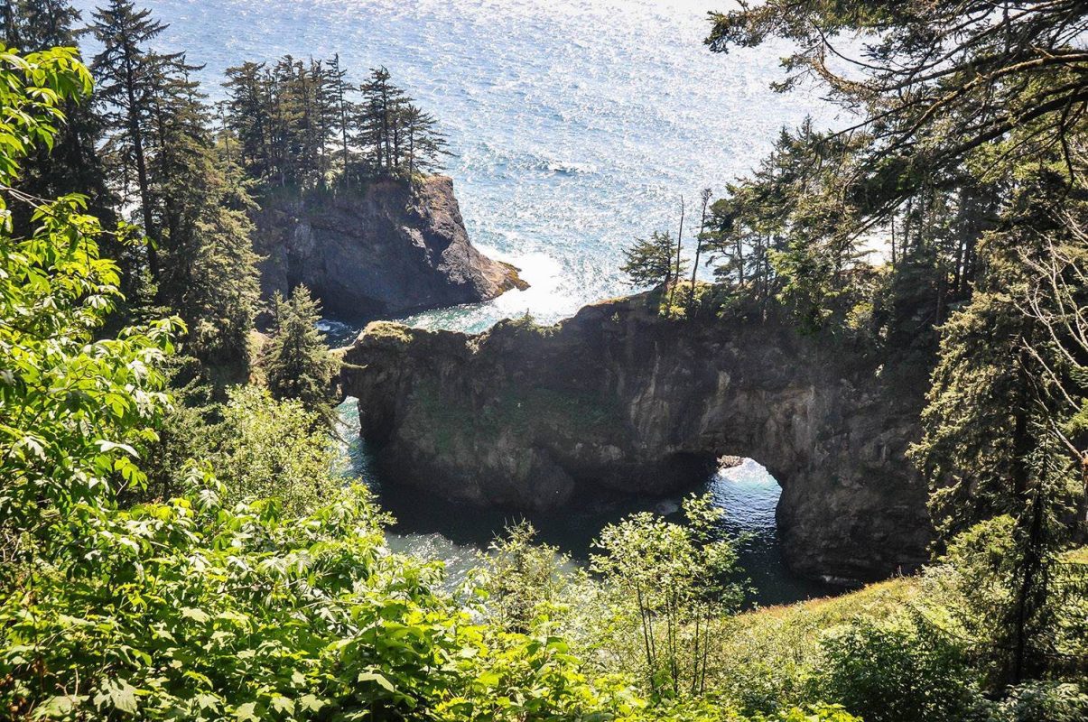
7. Natural Bridges Viewpoint Trail
- Location: Samuel H. Boardman State Scenic Corridor, Oregon Coast
- Distance: 0.7 miles, out-and-back
- Elevation gain: 62 feet
- Difficulty rating: Easy
- Trail notes on Alltrails
The Natural Bridges viewpoint is one of the most photographed locations in Oregon for its stunning rock formations right on the Oregon Coast. To get to the most beautiful viewpoint, go right at the parking lot, rather than left since that will take you along the coastal trail.
8. Abiqua Falls Trail
- Location: Santiam National Forest
- Distance: 0.7 miles, out-and-back
- Elevation gain: 249 feet
- Difficulty rating: Challening
- Trail notes on Alltrails
Abiqua Falls is a stunning waterfall surrounded by chiseled basalt columns. It’s formed the same as the waterfalls in Silver Falls State Park, but this boasts a little bit more solitude.
9. Pilot Butte
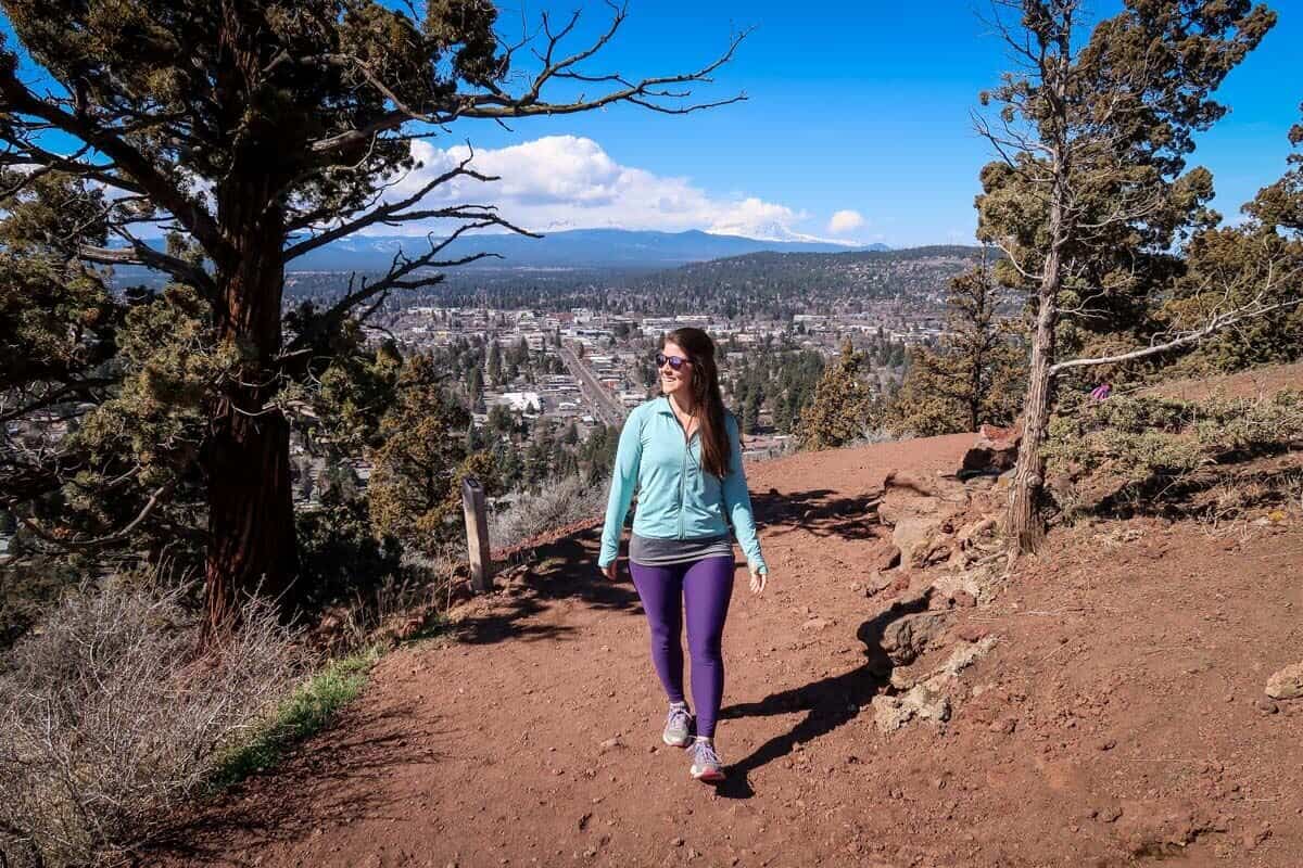
- Location: Bend, Oregon
- Distance: 1.8 miles, out and back
- Elevation gain: 456 ft
- Difficulty rating: Easy
- Trail notes on Alltrails
The unassuming hill protruding sticking up next to Bend, Oregon, is actually a nearly 500-foot lava dome that was formed by an extinct volcano. This, my friends, is Pilot Butte.
The state park is a popular place where locals like to get some exercise. There are two options for hiking to the top: You can hike the paved 1-mile road (shared with cars during the summer months), or hike the steeper but more peaceful gravel nature trail. The heavily-trafficked 1.8-mile out and back trek will offer panoramic views over town with nine snow-capped peaks looming in the distance.
10. Wahclella Falls
- Location: Columbia River Gorge
- Distance: 1.9 miles out and back
- Elevation gain: 300 feet
- Difficulty rating: easy to moderate
- Trail notes on Alltrails
An easy, fun interactive trail leads to Wahclella Falls, considered by many to be one of the most impressive Columbia River Gorge waterfalls.
You’ll go through a slot canyon, pass enormous boulders, cross bridges, and see a small dam and several smaller cascades on the trail.
The 2017 Eagle Creek Fire was especially devastating in this area, so there’s an increased risk of landslides and flash flooding. Avoid it during rain and for 1-2 days after big storms.
Note that you’ll need to either pay a $5 day use fee to park, or have a Northwest Forest Pass.
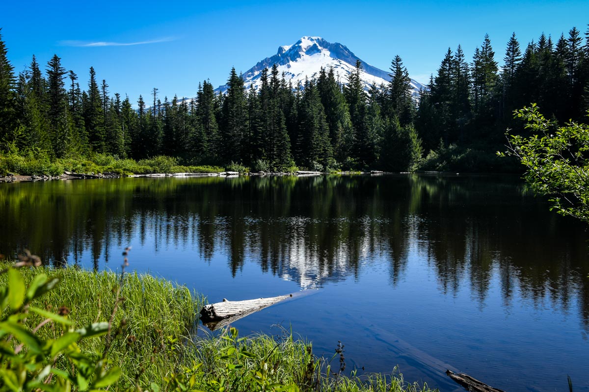
11. Trillium Lake Loop
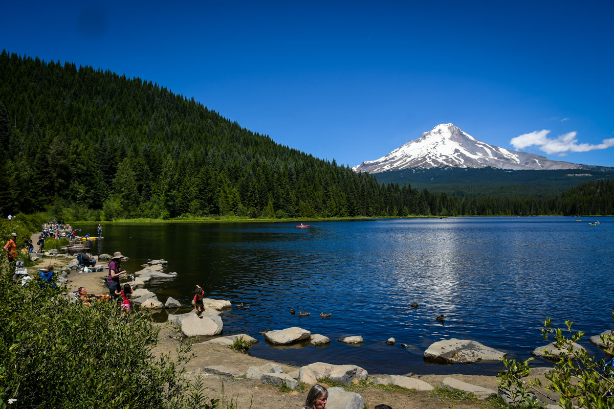
- Location: Mount Hood National Forest
- Distance: 1.9 miles, loop
- Elevation gain: 26 feet
- Difficulty rating: Easy
- Trail notes on Alltrails
The Trillium Lake Trail is one of the most popular Oregon hikes near Mount Hood. It’s an, easy scenic day hike that features a snowcapped Mount Hood as the backdrop of a still alpine lake. Since this trail is postcard worthy, you’ll share it with other day hikers, kayakers, swimmers, windsurfers, and more on a nice day.
Along the trail, hike over scenic boardwalks, through spruce-filled woods, and in the summer months, dozens of wildflower pockets among the forest floor. Since this trail is so trafficked, aim to arrive here early before the crowds.
12. Rowena Plateau trail
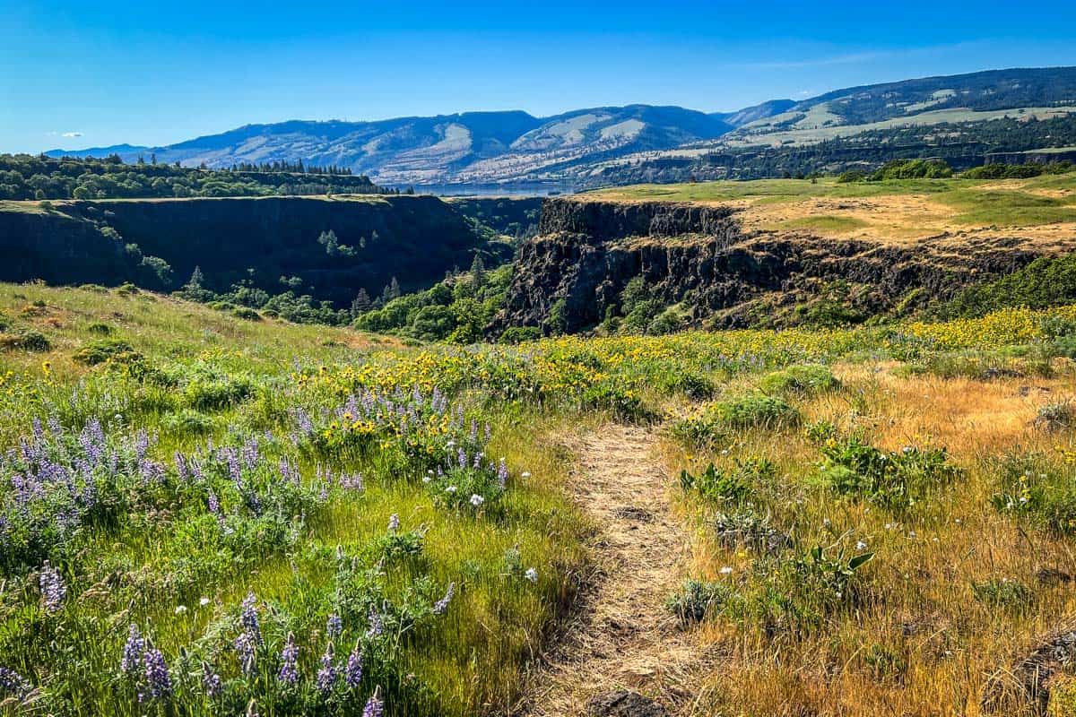
- Location: Columbia River Gorge
- Distance: 2.1 miles, loop
- Elevation gain: 259 feet
- Difficulty rating: easy
- Trail notes on Alltrails
This picturesque trail offers stunning panoramic views of the Columbia River and the surrounding gorge. Located within the Tom McCall Nature Preserve, the hike features diverse wildflower meadows, sweeping grasslands, and unique geological formations.
Hikers can enjoy seasonal blooms, especially in spring, making it a popular destination for wildflower lovers. The trail’s relatively gentle terrain and breathtaking vistas make it accessible to hikers of all ability levels.
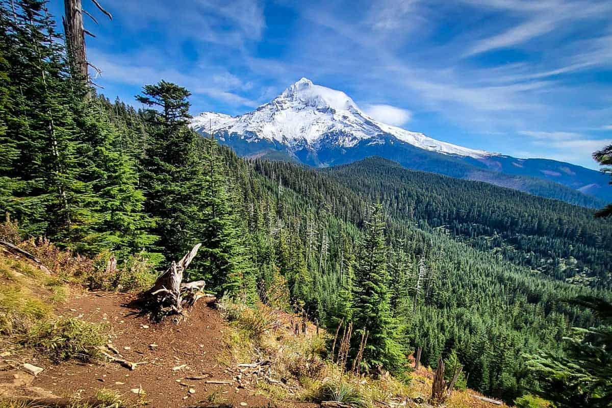
13. Lookout Mountain Trail
- Location: Mount Hood National Forest
- Distance: 2.6 miles, out-and-back
- Elevation gain: 551 feet
- Difficulty rating: Easy
- Trail notes on Alltrails
Lookout Mountain is the perfect trail for those that want to see incredible views but with little effort. This is one of the best hikes in Oregon for its view of Mount Hood and the Cascade Mountain Range.
14. Lost Lake Loop
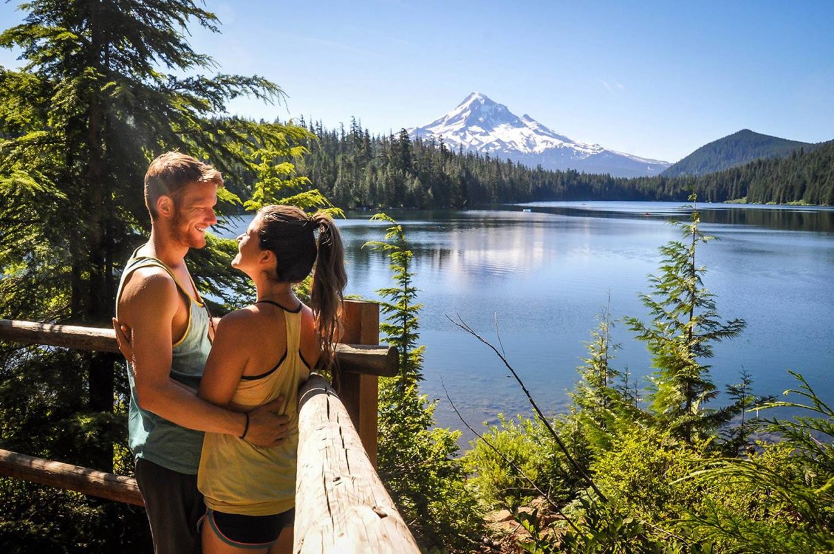
- Location: Mount Hood National Forest
- Distance: 3.1 miles, loop
- Elevation gain: 177 feet
- Difficulty rating: Easy
- Trail notes on Alltrails
The Lost Lake Loop is another picturesque day hike that, as you could have guessed, offers Mount Hood as a magnificent backdrop to your adventurous hiking trip in this National Forest. One of the last miles of this trail features a popular photo spot and one of the best views of the mountain top.
This is one of the best hikes in Mount Hood for families and little ones since it’s relatively flat throughout and offers small spurs with lake access to explore. Please note: you cannot access the lake from Late November into the Late Spring.
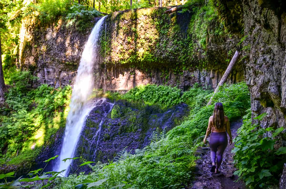
15. Multnomah Falls to Wahkeena Falls Loop
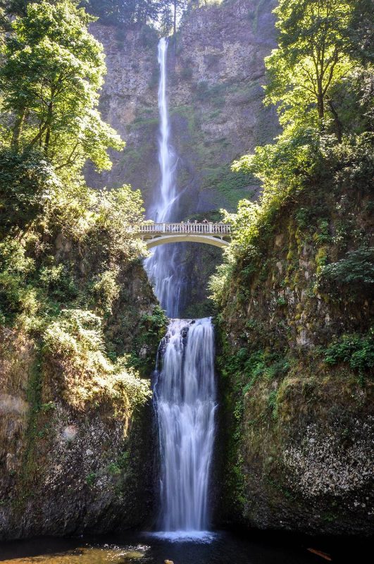
- Location: Columbia River Gorge
- Distance: 2.3 miles, out and back
- Elevation gain: 803 feet
- Difficulty rating: Moderate
- Trail Notes on Alltrails
Multnomah Falls is one of the most beautiful waterfalls in the state, making it rank easily as one of the best hikes in Oregon. On this loop trail, enjoy six different falls and cascades among rich green tones of forest. This is a popular spot for day hikers, photographers, trail runners, and families.
Moderate Oregon hikes
These are the best hikes in Oregon for hikers with a moderate level of fitness and trail knowledge.
16. The Watchman Peak Trail
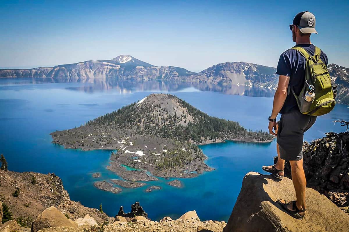
- Location: Crater Lake National Park
- Distance: 1.7 miles, out-and-back
- Elevation gain: 400 feet
- Difficulty rating: Moderate
- Trail notes on Alltrails
Anyone up to cross a National Park off your bucket list? The Watchman Peak Trail is one of the best hikes in Crater Lake National Park and boasts stunning views of Wizard Island, and wildflowers in the summer months. Arrive here early to enjoy the most unobstructed views over Crater Lake.
Psst! If you’re planning to head to this National Park, check out the America the Beautiful Annual Pass to save money on entrance fees!
17. Gold Butte Fire Lookout Trail

- Location: Willamette National Forest
- Distance: 2.5 miles, out-and-back
- Elevation gain: 734 feet
- Difficulty rating: Moderate
- Trail notes on Alltrails
This short and sweet trail takes you to a historic fire lookout looking out at the Oregon Cascades. This trail is best hiked in the spring and summer months, but can be enjoyed year round. The Gold Butte Fire Lookout can be rented online, so be mindful if there are others staying here when you pay it a visit.
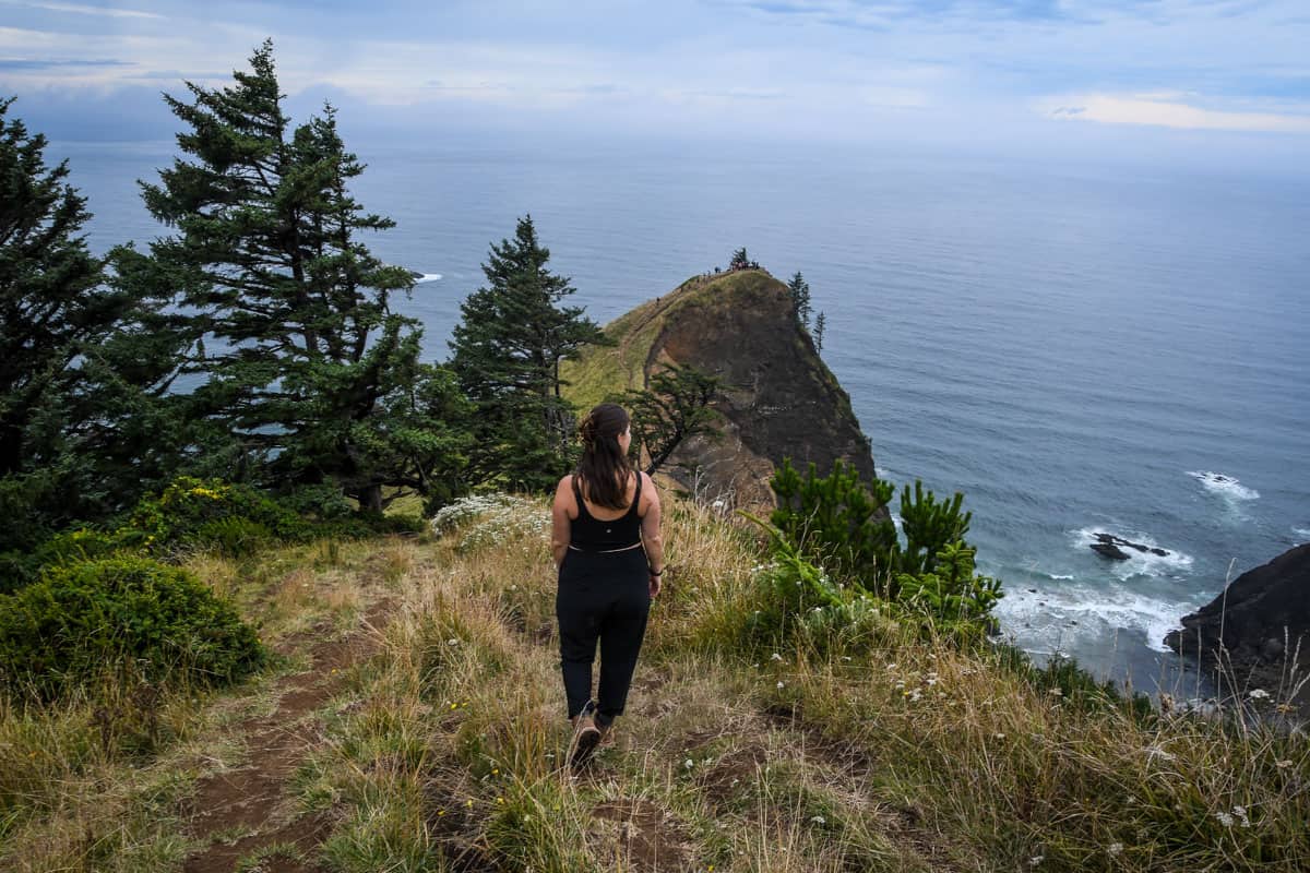
18. Clatsop Loop Trail from Indian Beach
- Location: Ecola State Park, Oregon Coast
- Distance: 2.8 miles, out-and-back
- Elevation gain: 784 feet
- Difficulty rating: Moderate
- Trail notes on Alltrails
The Clatsop Loop Trail takes you to the scenic coast in Ecola State Park by walking under vibrant canopies of trees that open up to moody coastal views. Once you arrive at the beach, try and spot the lighthouse and surfers catching the first morning swells.
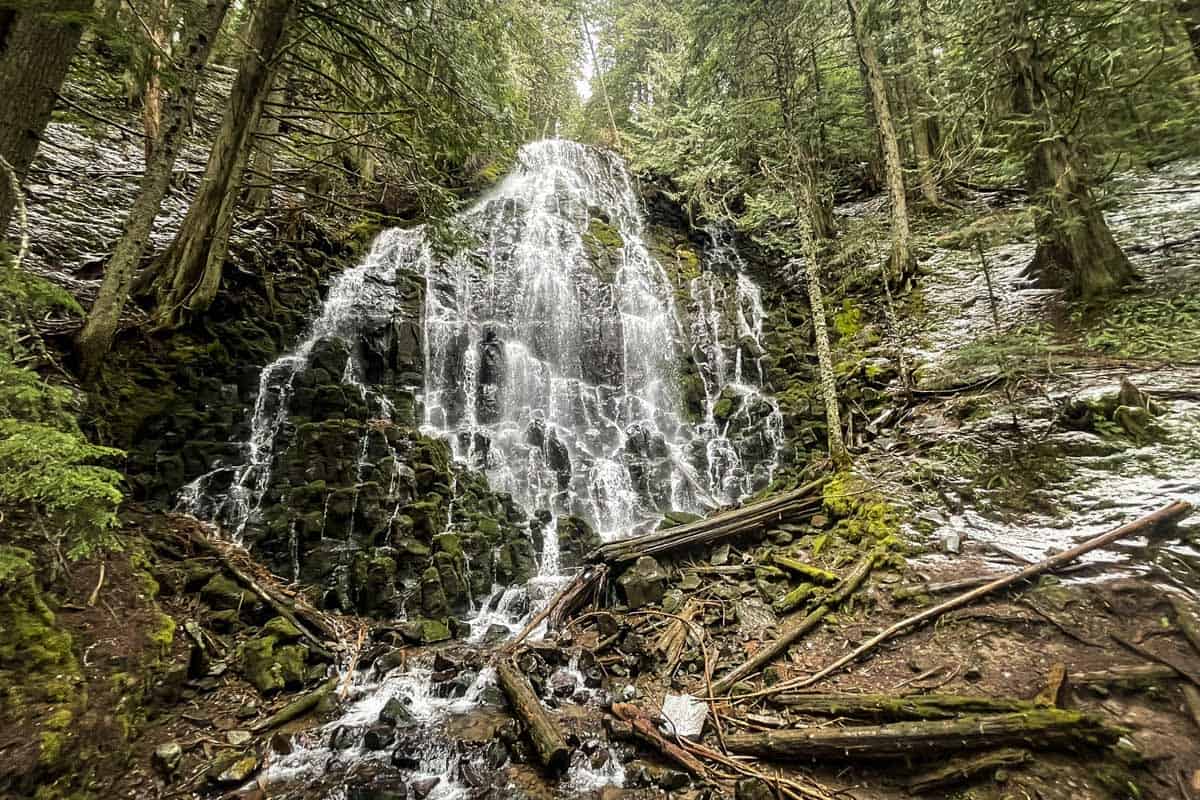
19. Tamanawas Falls Trail
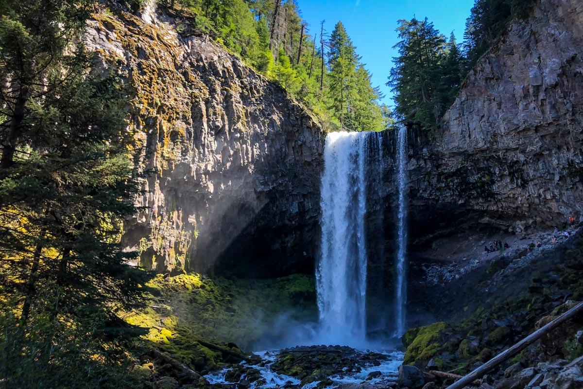
- Location: Mount Hood National Forest
- Distance: 3.4 miles, out-and-back
- Elevation gain: 580 feet
- Difficulty rating: Moderate
- Trail notes on Alltrails
Tamanawas Falls is where Cold Spring Creek pours over a 110-foot cliff at the base of Mount Hood. It can be accessed any time of year with the right gear and is perfect for fall foliage or a snowshoe.
Check out our other favorite Mount Hood hikes if you’re in the area!
20. Sahalie & Koosah Falls
- Location: Willamette National Forest
- Distance: 2.6 miles
- Elevation gain: 360 feet
- Difficulty rating: Easy
- Trail notes on Alltrails
With two picturesque, ultra-blue cascades and a leisurely, family-friendly trail, this is one of the best waterfall hikes in Oregon. You’ll likely hear Sahalie Falls from the parking lot (it’s probably only 100 yards away!). It connects to Koosah Falls via an easy loop trail along the river, with several photo ops and picnic spots along the way.
21. Oneonta Gorge Trail
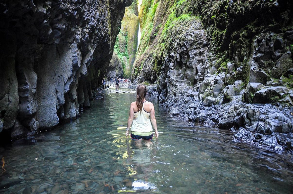
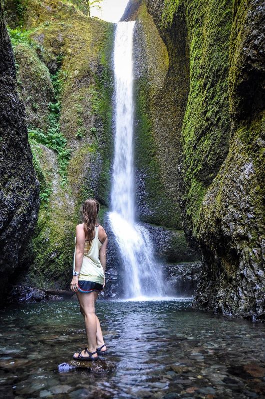
- Location: Columbia River Gorge
- Distance: 5.6 miles, out-and-back
- Elevation gain: 1,633 feet
- Difficulty rating: Moderate
- Trail notes on Alltrails
Walk through a gorge bursting at the seams with vibrant green hues and through waist to chest deep water to discover the prize at the end of this jaw-dropping trail, Lower Oneonta Falls. This trail is best hiked in the summer months on a week day to avoid crowds and for favorable water temperature in the gorge. Check for an updated trail status here.
Psst! Looking for even more adventure? Check out our list of the best hot springs in Oregon and where to find them.
22. Mirror Lake Loop Trail
- Location: Mount Hood National Forest
- Distance: 4.2 miles, loop
- Elevation gain: 672 feet
- Difficulty rating: Moderate
- Trail notes on Alltrails
Mirror Lake in the Mount Hood National Forest is the perfect place for a picnic or lake day for avid hikers and families. Cross bridged streams and pockets of wildflowers in the spring months or consider snowshoeing this loop in the winter months.
23. Marion Falls and Gatch Falls Trail

- Location: Mount Jefferson Wilderness
- Distance: 4.3 miles, out-and-back
- Elevation gain: 921 feet
- Difficulty rating: Moderate
- Trail notes on Alltrails
Marion Falls and Gatch Falls Trail is one of the best waterfall hikes in Oregon. Best hiked April through September, walk along Marion Creek and through vibrant pines to these beautiful cascades in the Mount Jefferson Wilderness. Don’t forget your day pass!
24. God’s Thumb via the Knoll
- Location: Oregon Coast
- Distance: 4.3 miles, out-and-back
- Elevation gain: 1,131 feet
- Difficulty rating: Moderate
- Trail notes on Alltrails
Hike through a vibrant forest that opens up to a large green rock formation with steep cliff sides. Take in the sweeping views of the Oregon Coast and Pacific Ocean at the top of the God’s Thumb Trail.
Note: As of 2024, you are no longer allowed to hike all the way out to “the thumb,” but we still saw a lot of people doing it. When there are restrictions on trails, please respect them. (It’s usually for your safety or to keep the wildlife or environment protected.)
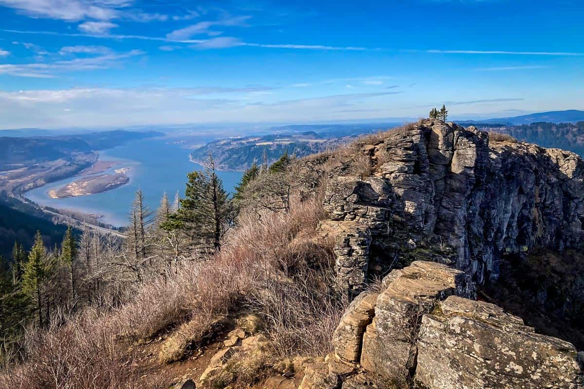
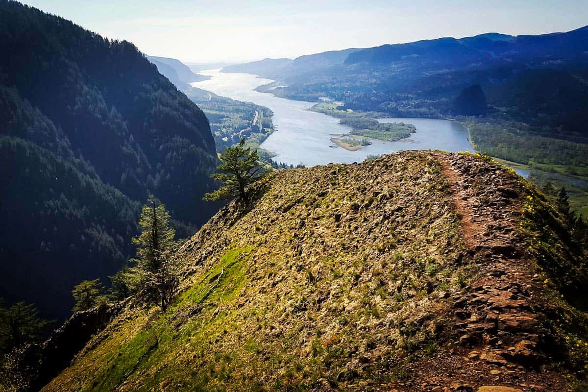
25. Angel’s Rest Trail
- Location: Columbia River Gorge
- Distance: 4.5 miles, out-and-back
- Elevation gain: 1,476 feet
- Difficulty rating: Moderate
- Trail notes on Alltrails
Explore the west end of the Columbia River Gorge on the Angel’s Rest Trail. Hike over million year old lava flows from Larch Mountain and witness it open up to views of the gorge, Beacon Rock, and Silver Star Mountain.
Psst! This is also one of the best hikes near Portland!
26. Munra Point Trail via George Trail
- Location: Columbia River Gorge
- Distance: 4.5 miles, out-and-back
- Elevation gain: 2,076 feet
- Difficulty rating: Moderate
- Trail notes on Alltrails
This is one of the best Oregon hikes since it is one of the most scenic views of the entire Columbia River Gorge. Hike over a shark fin ridge to the exposed basalt knob and take in the views of the gorge. This hike is best experienced in dry weather, from April to November.
27. John Dellenback Dunes Trail
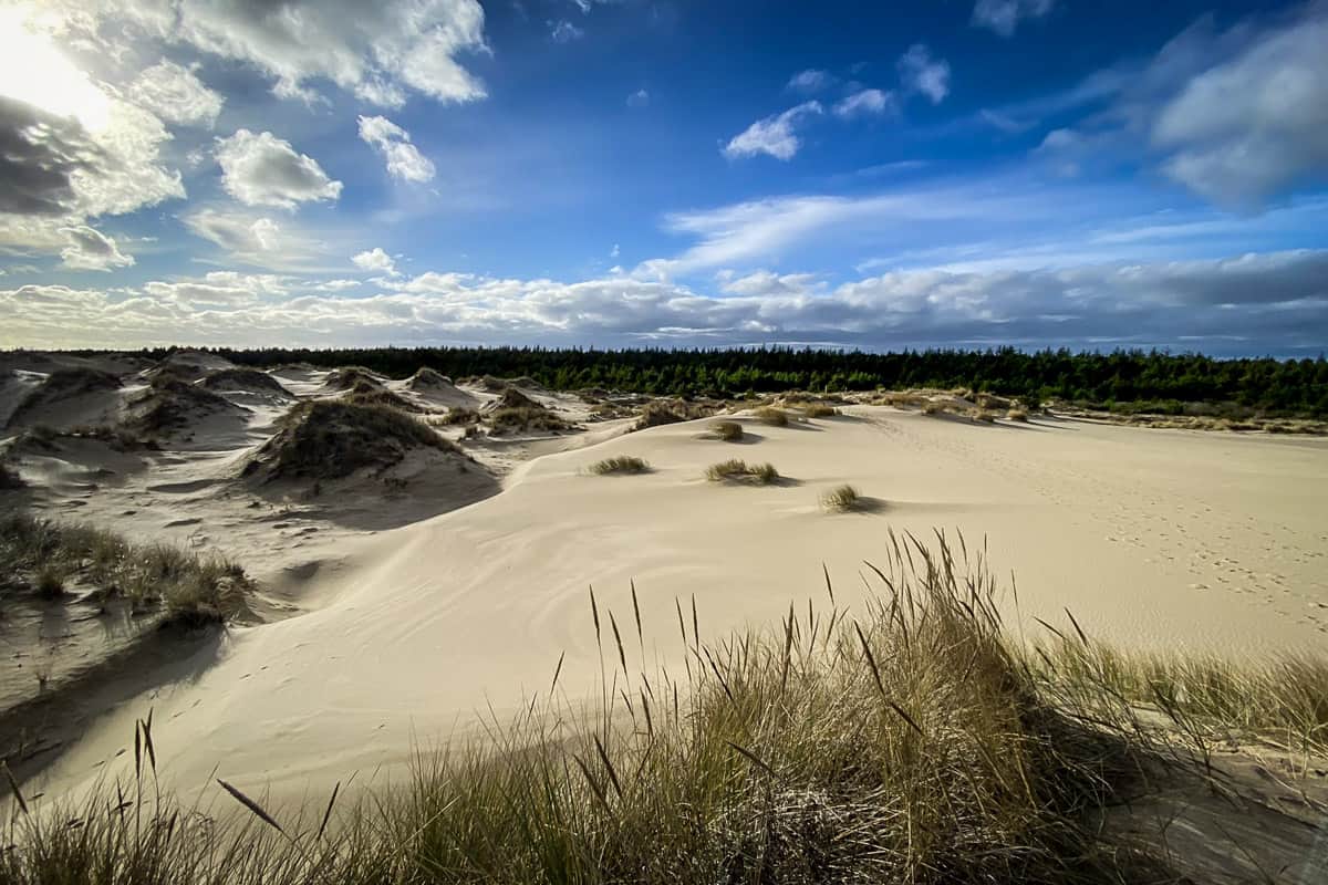
- Location: Oregon Coast
- Distance: 5.5 miles, out-and-back
- Elevation gain: 308 feet
- Difficulty rating: Moderate
- Trail notes on Alltrails
Hike over expansive, 200 foot sand dunes to a quiet, secluded beach. The John Dellenback Dunes Trail features a variety of different landscapes in one small push: ocean, sand, and forest. Watch for a variety of birds, plants, and wildlife on this scenic trail.
28. Silver Falls Canyon Trail
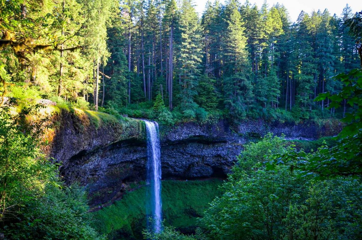
- Location: Silver Falls State Park
- Distance: 5.6 miles, out-and-back
- Elevation gain: 1,000 feet
- Difficulty rating: Moderate
- Trail notes on Alltrails
Silver Falls is the second highest waterfall in the state making it one of the best Oregon waterfall hikes. Along this route you’ll find a variety of different waterfalls along this historic trail that was transformed from a pack trail to a wagon road 1901, and eventually changed to a hiking only trail.
29. Battle Ax Mountain Loop Trail
- Location: Bull of the Woods Wilderness, 117 miles east of Salem
- Distance: 5.8 miles, out-and-back
- Elevation gain: 1,751 feet
- Difficulty rating: Moderate
- Trail notes on Alltrails
Battle Ax Mountain is one of the most scenic hikes in the Bull of the Woods Wilderness. Endure the slow, rocky, and potholed drive up to Elk Lake to get to the trailhead and begin your loop to see incredible views of the Three Sisters and Mount Rainier. Battle Ax is best hiked in the summer and fall months.
30. Strawberry Lake and Little Strawberry Lake Trail
- Location: Strawberry Mountain Wilderness, 107 miles southwest of Baker City
- Distance: 6.9 miles, out-and-back
- Elevation gain: 1,368 feet
- Difficulty rating: Moderate
- Trail notes on Alltrails
Pristine meadows, fields of wildflowers, and two stunning lakes make the Strawberry Lake and Little Strawberry Lake Trail one of the best hikes in Oregon. While you enjoy the lakes and Strawberry Falls, look around for wildlife like mountain goats and deer. Mosquito repellant is essential for this hike since they can get brutal in the summer.
31. Bald Mountain via Lolo Pass Trail
- Location: Mount Hood National Forest
- Distance: 6.7 miles, out-and-back
- Elevation gain: 1,489 feet
- Difficulty rating: Moderate
- Trail notes on Alltrails
This is a quiet section of the Pacific Crest Trail that links onto the Timberline Trail and to a lookout trail to the summit of Bald Mountain. Enjoy the magnificent view of Mount Hood and keep an eye out for the remains of an old fire lookout that last stood in the 1940s.
32. Ramona Falls Trail
- Location: Mount Hood National Forest
- Distance: 7.1 miles, out-and-back
- Elevation gain: 1,066 feet
- Difficulty rating: Moderate
- Trail notes on Alltrails
Ramona Falls could be considered the centerpiece of the Mount Hood Wilderness. This cascading waterfall is one of the best waterfall hikes in Oregon and is a junction for the Pacific Crest Trail and Timberline Trail, so you can expect to see day hikers and backpackers taking in its beauty.
33. Trail of Ten Falls
- Location: Silver Falls State Park, 24 miles east of Salem
- Distance: 7.4 miles, out-and-back or loop
- Elevation gain: 1,151 feet
- Difficulty rating: Moderate
- Trail notes on Alltrails
The Trail of Ten Falls is one of the most popular trails in Silver Falls State Park and the best trail in Oregon for waterfalls. You won’t be disappointed on this Oregon trail since every waterfall is jaw-dropping and picturesque, ranging from 27 feet to 178 feet high.
You can use our guide to Silver Falls State Park to help plan your trip!
Psst! Is chasing waterfalls kinda your thing? Are you also an avid hiker? Check out these incredible Oregon waterfall hikes and see which ones you need to add to your bucket list.
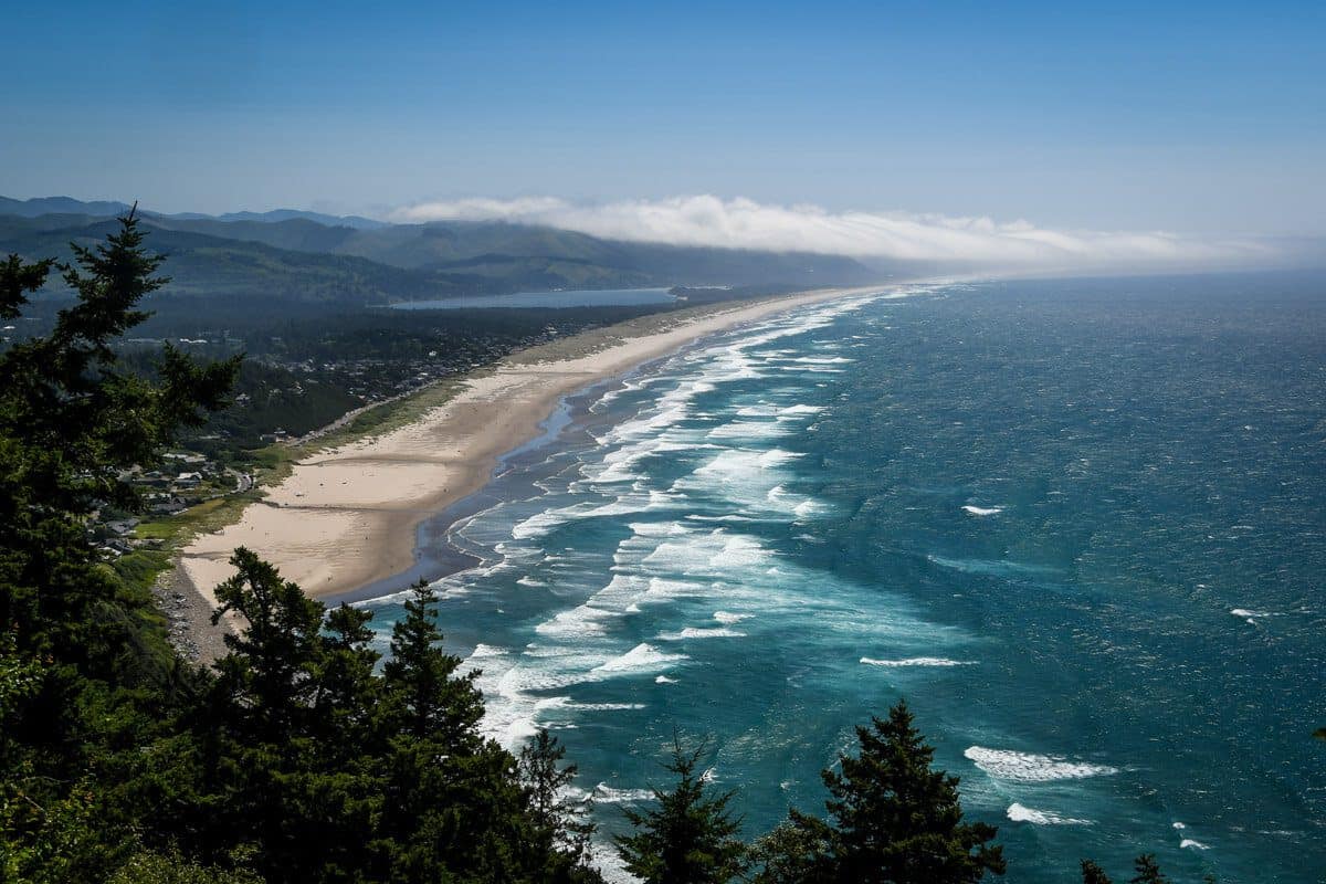
34. Neahkahnie Mountain Trail via Pacific Crest Trail
- Location: Ecola State Park, Oregon Coast
- Distance: 3.4-mile loop
- Elevation gain: 1,066 feet
- Difficulty rating: Moderate
- Trail notes on Alltrails
Witness one of the most dramatic and panoramic views of the Oregon Coast on the Neahkahnie Mountain Trail. This trail is best hiked during the spring months, when the trail is dotted with coastal fawn lilies, salals, and other colorful wildflowers.
This trail is one of our favorite hikes near Cannon Beach.
35. Green Lakes Trail
- Location: Deschutes National Forest
- Distance: 9.1 miles, out-and-back
- Elevation gain: 1,187 feet
- Difficulty rating: Moderate – Challenging
- Trail notes on Alltrails
Follow Fall Creek on the Green Lakes Trail up to picturesque lakes at the base of the South Sister. This trail is best hiked June through September and is perfect for day hikers, backpackers, and fisherman.
It’s known as one of the best hikes near Bend!
Challenging Oregon hikes
These Oregon hikes will take some serious endurance to complete, but the journey will be totally worth it when you arrive at the summit to see the views!
36. Maxwell Lake Trail
- Location: Eagle Cap Wilderness (northeast Oregon)
- Distance: 8 miles, out-and-back
- Elevation gain: 2,450 feet
- Difficulty rating: Moderate-Challenging
- Trail notes on Alltrails
From June to August, pick fresh huckleberries as you climb past high peaks and pristine views to the glittering Maxwell Lake. Be mindful of the water levels at Maxwell Creek in the early spring or after it rains, since you’ll be crossing this river on your way up.
37. Saddle Mountain Trail
- Location: Saddle Mountain State Natural Area (northwest Oregon)
- Distance: 4.5 miles, out-and-back
- Elevation gain: 1,791 feet
- Difficulty rating: Challenging
- Trail notes on Alltrails
Hike to the highest point in Northwest Oregon to see views over the end of the Columbia River Gorge, Astoria, Mount St. Helens, Mount Rainier, and Mount Hood. Explore the Saddle Mountain Trail during wildflower season to walk through vibrant meadows of flowers.
38. Paulina Peak Trail
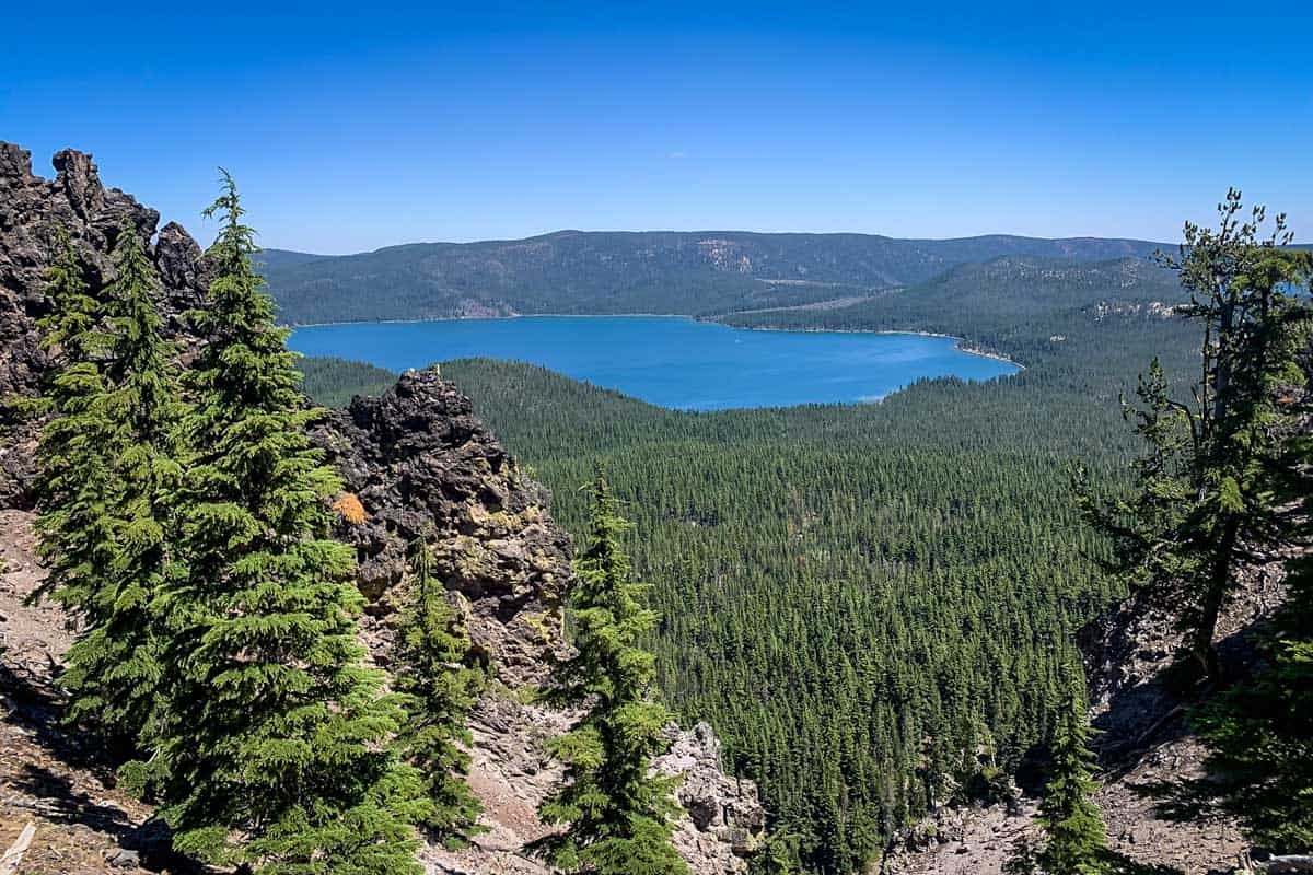
- Location: Fremont National Forest
- Distance: 6.1 miles, out-and-back
- Elevation gain: 1,607 feet
- Difficulty rating: Challenging
- Trail notes on Alltrails
The Paulina Peak Trail begins on the shores of Paulina Lake and goes through magical coniferous forest to one of the most expansive views in Oregon. On a clear day, spot Mount Adams in the Cascade Range all the way to Mount Shasta in California on top of the largest shielded volcano in North America.
39. Tom Dick and Harry Mountain Trail
- Location: Mount Hood National Forest
- Distance: 9 miles, out-and-back
- Elevation gain: 1,709 feet
- Difficulty rating: Challenging
- Trail notes on Alltrails
The Tom, Dick, and Harry Mountain Trail is one of the best hikes in Oregon since the trail is well-kept and has amazing views of Mount Hood and Mirror Lake as you hike through the vibrant forests of the Salmon-Huckleberry Wilderness. This is an excellent hike for the summer or fall hiking season.
We put together a detailed guide to hiking Tom Dick and Harry Mountain so you’ll know exactly how to prepare and what to expect.
40. Painted Canyon Loop Trail
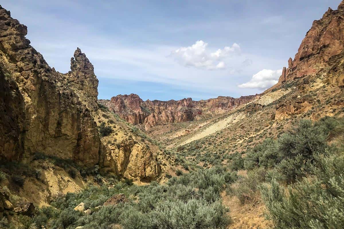
- Location: Northern Owyhee Canyonlands
- Distance: 9 miles, loop
- Elevation gain: 1,200 feet
- Difficulty rating: Challenging
- Trail notes on Alltrails
The Painted Canyon Loop Trail is one of the best day hikes in Owyhee Country. Best hiked during the springtime, watch out for the Owyhee Clovers and other wildflowers as you hike through Carlton Canyon, Honeycombed battlements, and the Painted Canyon.
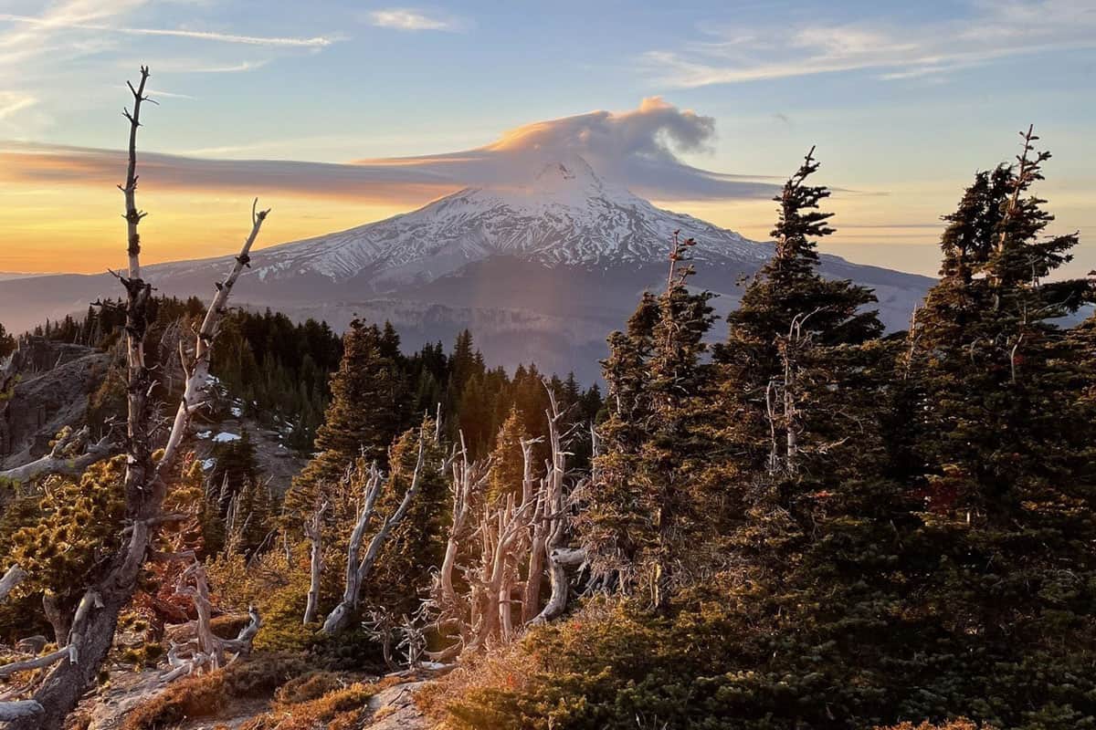
41. South Sister Summit

- Location: Three Sisters Wilderness, 27.7 miles east of Bend
- Distance: 11.6 miles, out-and-back
- Elevation gain: 4,986 feet
- Difficulty rating: Challenging
- Trail notes on Alltrails
The South Sister summit is a bucket list hike of many Oregon natives. At the summit, experience one of best 360-degree views in central Oregon. The South Sister Summit doesn’t require any technical gear or climbing knowledge making it popular for its short summer hiking season.
We have all the directions and information you need in our trail guide for the South Sister Hike.
42. Cooper Spur Trail
- Location: Mount Hood National Forest
- Distance: 12.2 miles, out-and-back
- Elevation gain: 5,055 feet
- Difficulty rating: Challenging
- Trail notes on Alltrails
The Cooper Spur Trail takes you to the highest point on Mount Hood via a formal trail. At the top, watch ice fall from Elliot Glacier in the North, see Oregon’s desert country in the East, and the Hood River Valley in the Northeast.
43. Paradise Park Trail via the Timberline Trail
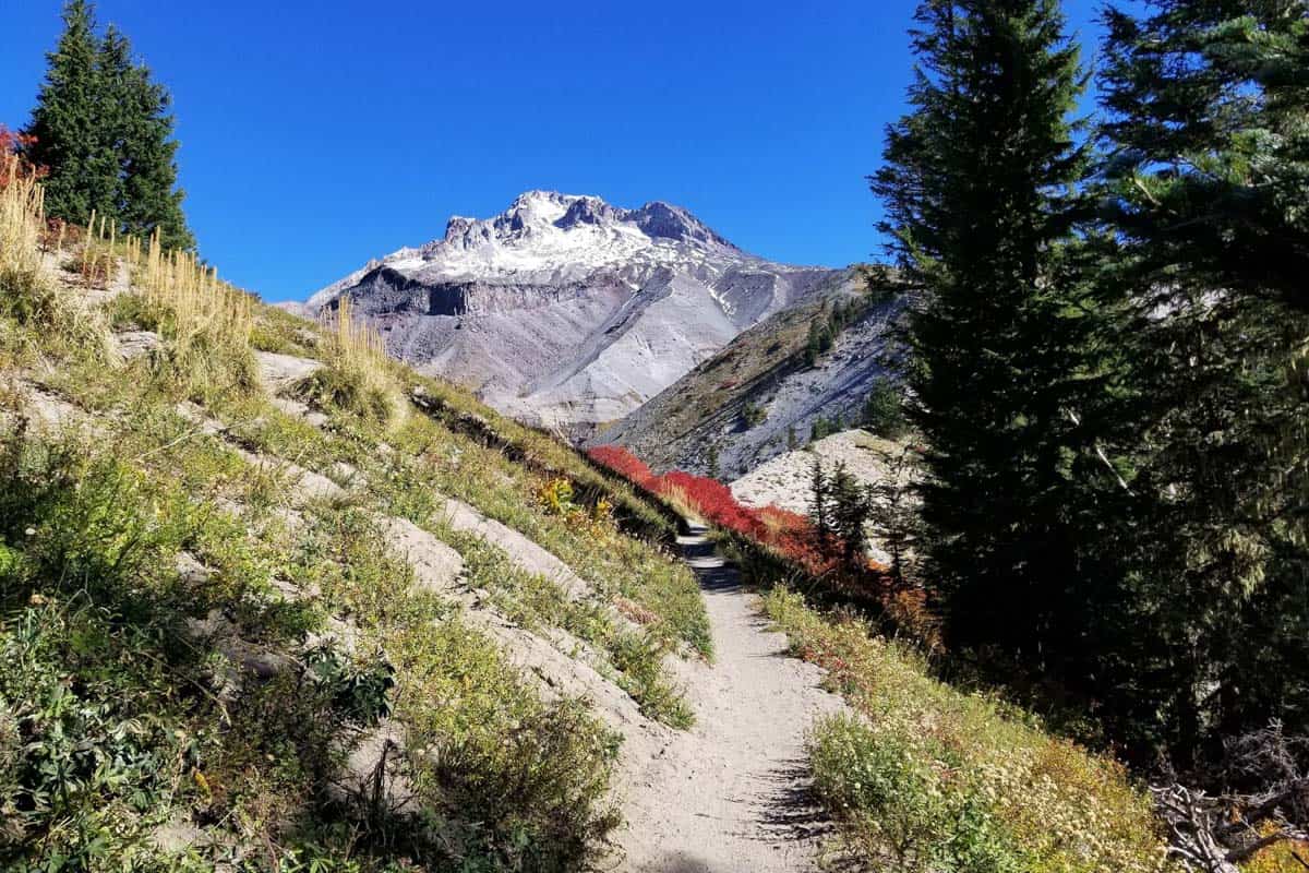
- Location: Mount Hood Wilderness
- Distance: 15.7 miles, out-and-back
- Elevation gain: 3,428 feet
- Difficulty rating: Challenging
- Trail notes on Alltrails
Paradise Park is one of the most beautiful alpine areas on Mount Hood. Tackle this as a day hike, or a multi-day hike and snag a campsite at the North Fork of Lost Creek that boasts the best views. This is a perfect hike to see fields of colorful wildflower meadows!
44. Table Mountain Trail via Pacific Crest Trail
- Location: Columbia River Gorge Scenic Area, 52 miles east of Portland
- Distance: 16.4 miles, out-and-back
- Elevation gain: 4,311 feet
- Difficulty rating: Challenging
- Trail notes on Alltrails
While the Bonneville Trailhead for this hike is located in Washington, this is still one of the best hikes in Oregon. This trail is sweat-inducing and will challenge even experienced hikers. Those that take on the challenge and arrive at the Table Mountain Summit enjoy staggering views of Mount Hood, and the Columbia River Gorge Wilderness.
Multi-day hikes in Oregon
Lace up your hiking boots and strap on your pack to tackle these multi-day backpacking hikes in Oregon.
Psst! If you are a newbie to backpacking and not sure where to start. We have a guide to backpacking for beginners that has everything you need to know to feel comfortable hitting the trails!
45. Timberline Trail
- Location: Mount Hood National Forest
- Distance: 41.4 miles, loop
- Elevation gain: 10,341 feet
- Difficulty rating: Challenging
- Trail notes on Alltrails
Enjoy views as you walk around the base of the tallest mountain in Oregon, Mount Hood. This is one of the best Oregon hikes for its spectacular views of Mount St. Helens, Mount Rainier, Mount Adams, Three Sisters, the Oregon Coast, and Portland. Truly the journey of a lifetime.
46. Eagle Cap Wilderness Loop Trail
- Location: Eagle Cap Wilderness
- Distance: 37.2 miles, loop
- Elevation gain: 8,264 feet
- Difficulty rating: Challenging
- Trail notes on Alltrails
Circumnavigate Eagle Cap Mountain in the Eagle Cap Wilderness Area. Hike over challenging mountain passes, up and down glacial valleys, and take in the views at the glittering lakes.
47. Three Sisters Loop Trail
- Location: Three Sisters Wilderness
- Distance: 47.5 miles, loop
- Elevation gain: 7,034 ft
- Difficulty rating: Challenging
- Trail notes on Alltrails
Hike the Three Sisters Loop Trail to witness three of the most well-known mountains in Oregon: South Sister, Middle Sister, and North Sister. Walk among lava fields, dense forests, open alpine meadows, and scenic lake views around these three famous peaks.
48. Big Indian Gorge Trail to Little Blitzen Loop
- Location: Steens Mountain Wilderness, 76.9 miles south of Burns
- Distance: 25.2-mile loop
- Elevation gain: 4,603 ft
- Difficulty Rating: Challenging
- Trail notes on Alltrails
Tour the scenic Steen Mountains that tower over a sagebrush desert in East Oregon. Hunt for 19th century graffiti on this rugged journey in one of Oregon’s greatest geological wonders.
49. Oregon Coast Trail
- Location: Oregon Coast
- Distance: 416.3 miles, point-to-point
- Elevation gain: 26,138 ft
- Difficulty Rating: Challenging
- Trail notes on Alltrails
Hike one of the most scenic Oregon hikes to witness the dramatic coastal headlands, moody beaches, and the colorful coastal towns. Witness the diversity of Oregon’s terrain on a long-distance thru hike or as a day hiker in any of the ten trail segments on the Oregon Coast Trail.
50. Pacific Crest Trail
- Location: Mexico, California, Oregon, Washington State, and Canada
- Distance: 2,591 miles, point-to-point
- Elevation gain: 429,478 ft
- Difficulty Rating: Challenging
- Trail notes on Alltrails
The Pacific Crest Trail is one of the best hikes in Oregon, and one of the most rigorous and scenic in the United States as it passes through many notable National Parks and mountain ranges up the entire West Coast. It takes hikers five months to complete this life-changing journey from Mexico to Canada.
What to pack for hiking in Oregon
Although the best hikes in Oregon vary in length and difficulty, you’ll still want to have some key items in your pack no matter which hike you choose to do.
- Navigation: we recommend using Alltrails+ to download the offline trail map
- Get your first week of using Alltrails+ for FREE when you sign up using our link!
- Hiking daypack
- Water bottles and/or bladder for your Camelbak
- Bug repellant (we prefer the natural stuff)
- Sun protection: sunscreen, hat, sun glasses
- Camera/tripod (this one’s our favorite for hiking)
- Lots of layers (here is a great resource if you’re wondering what to wear hiking)
- Rain jacket
- Comfortable hiking boots or shoes (or Chacos if you prefer)
- Swimwear (if you’re visiting in the summer and plan to take a dip!)
- Plenty of snacks: check out our favorite hiking snacks here!
Be sure to grab our ultimate hiking packing list includes our must-have gear for any hiking trail!

You may also like…
- What to Wear Hiking in Every Season
- 15 Beautiful Oregon Waterfalls to Visit
- The 10 Best Hot Springs in Oregon
- Silver Falls State Park: What to Expect + Best Hikes
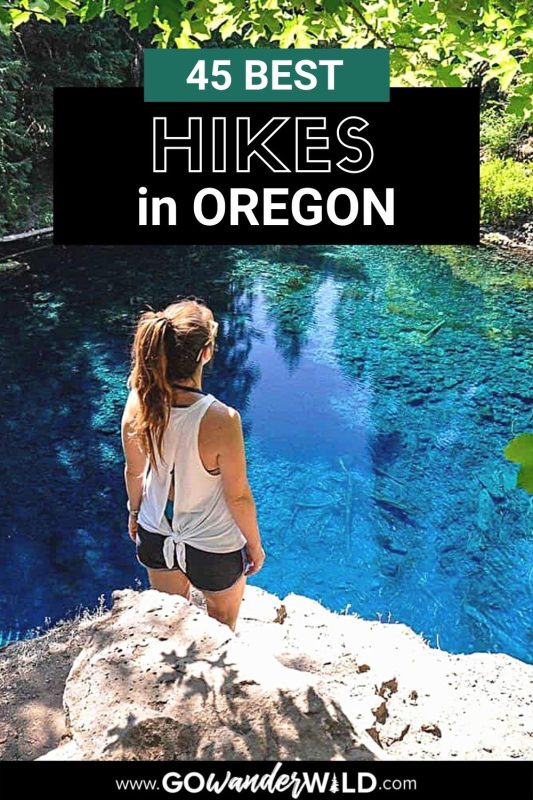
Save this article on Pinterest for later!

We want to hear from you!
Have you done any of the best hikes in Oregon from this list? What was your experience like? Are you planning a trip to go hiking in Oregon and want more advice? Comment below and let us know!